University of Wisconsin
Noting Notable Features for Rain Gardens
Eight groups in your class are each responsible for a different aspect of surveying the campus for a suitable rain garden location. Features to consider include water flow, topography, sun/shade patterns, land surface, vegetation,...
Curated OER
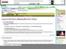
Lesson 2 Activity 2: Mapping Mount St. Helens
Learners use topographic map skills to interpret impact of the May 18, 1980 eruption of Mount St. Helens on the volcano's topography, and draw profile views of Mount St. Helens before and after the May 18, 1980, eruption.
Curated OER
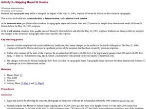
Mapping Mount St. Helens
Learners study topographic maps and contour lines and construct a simple three-dimensional model of Mount St. Helens before the May 18, 1980, eruption. They use topographic map skills to interpret the impact of the May 18, 1980, eruption...
Space Awareness
Valleys Deep and Mountains High
Sometimes the best view is from the farthest distance. Satellite imaging makes it possible to create altitude maps from far above the earth. A three-part activity has your young scientists play the role of the satellite and then use...
Curated OER
Faking It
Middle school earth scientists describe the behavior of the Coriolis force. They compare and contrast conditions under which the Coriolis force has a significant impact with conditions under which it has very little. They model the...
Polar Trec
What Can We Learn from Sediments?
Varve: a deposit of cyclical sediments that help scientists determine historical climates. Individuals analyze the topography of a region and then study varve datasets from the same area. Using this information, they determine the...
NOAA
Currents
A deep ocean current circles the globe at a force that is greater than 16 times all the world's rivers combined. Groups analyze the effects of submarine topography on deep ocean current speed. They then determine how this speed affects...
Curated OER
African Safari
Sixth graders gain an appreciation for the different cultures that inhabit the Earth by focusing on the people of Africa
Curated OER
Earthquakes on the Surface
Students view topographic or relief maps of Southern California and discuss what they see. They make predictions based on the topography of the region.
Curated OER
What is a Karst
Students investigate landforms by holding a class experiment. In this topography lesson, students define the word "karst" and discover why sinkholes are created on the surface of the Earth by completing worksheets. Students create a...
Curated OER
MAPPING THE TOPOGRAPHY OF UNKNOWN SURFACES
Students describe in words and graphic displays the elevation or depression profile of sections of Mars' Olympus Mons and/or Valles Marineris. They explain how orbiting spacecraft build up global maps one data slice at a time.
Curated OER
Climate and Topography, What Is the Connection?
Fourth graders study Neumann's world continent map and explore topography and climate.
Curated OER
Karst Topography
Students observe a movie about karst topography over the Internet and note nonpoint source pollution. They discuss ways to manage pollution and their experiences with any polltion sources.
Curated OER
Fossil Fuels (Part II), The Geology of Oil
More of a mini-unit than a lesson, these activities lead inquisitors through a survey of oil deposits. In the first part, they read about and view diagrams of sedimentary rock layers that trap oil. Next, they test porosity and...
Curated OER
Tissue Paper Geography
Learners explore geographic features of the desert and apply their understanding of the topography of the desert by creating a tissue paper painting.
Curated OER
The Rain Forest of Costa Rica
Fifth graders examine and discuss the topography, climate, natural resources and artwork of Costa Rica. They develop a diagram of the layers of the rain forest, and design a tourist brochure or advertisement promoting Costa Rica's...
Curated OER
Our Country's Environment
In this environment worksheet, students complete a crossword puzzle using the word bank and definitions for terms about the land and its water.
Curated OER
Cross Section and Slope
Students draw cross sections of given contour maps. In this math instructional activity, students interpret the different symbols used in the map. They determine slope and steepness through direct measurement.
Curated OER
Gilligan's Island
Students investigate topographical maps and match actual landforms to them. In this topographical maps lesson students create "Gilligan's Island" to scale then answer questions about it such as what the highest elevations is and what...
Montana State University
Ice in Action
Make your own bite-size glacier! A resource teaches about the formation and melting of ice. Activities include videos, a hands-on activity where your pupils build glaciers, and a photographic analysis to teach individuals the chilling...
Curated OER
Oceanography
Fifth graders study the topography of the ocean floor. They determine its ever changing nature as they examine currents and trade winds. They write paragraph describing how the winds might affect land formations after the discussion of...
Curated OER
Global Warming – More or Less
Eighth graders identify the factors that contribute to global warming. In this earth science lesson plan, 8th graders evaluate the impact of global warming on the planet. They discuss their views within the group.
Curated OER
Sonar Simulation
Students compare and contrast side-scan sonar to other methods used to find objects underwater. In this underwater search lesson, students describe side-scan sonar and make inferences about the topography of an unknown landscape. This...
Curated OER
No Escape
Via four student handouts, marine biology learners examine the topography and circulation cell of the Fieberilng guyot. Then they examine the number of individual hydroids counted at each depth. Pupils use the information to relate water...


