Curated OER
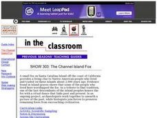
SHOW 303: The Channel Island Fox
Pupils explore how archaeologists and other scientists use different clues to piece together a picture of the past. Students perform activities that allow them to conduct three types of scientific research. They discuss their...
Curated OER
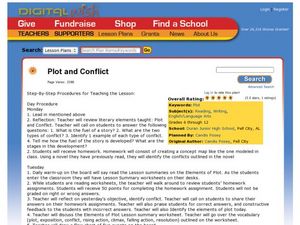
Plot and Conflict
Students review the literary elements of plot and conflict. In this plot and conflict instructional activity, students read a story and answer questions about the plot and conflict within. Students create a concept map for the novel to...
Curated OER
Alternative Energy
Young scholars identify the five major alternative energy sources. For this physical science lesson, students assess the advantages and disadvantages for each type of energy. They complete a concept map using information they researched.
Curated OER
Can You Dig It?
Young scholars investigate a fossil site and diagram a site map. They role play as paleontologists.
Curated OER
Latin America: Places and Regions
Seventh graders create a Latin American portfolio in the form of a country presentation using PowerPoint software. They use their knowledge of geographic concepts to interpret maps, globes, charts, diagrams, and timelines.
Curated OER
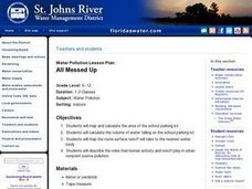
All Messed Up
Students begin the experiment by mapping and calculating their school parking lot. They calculate the volume of water falling on the lot and map the route the water runoff takes. They discuss the roles that humans play in affecting water...
Curated OER
Hazard Alert
Pupils examine data regarding the occurrence of natural hazards as they occur in the United States. They record data on a classroom chart, map the areas affected by the hazards, and analyze and discuss conclusions drawn from the...
Curated OER
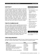
Testing the Waters
Students explore water in depth through discussion, research, and experiment. Students apply map skills to locating particular regions of the world as they relate to water. Students predict water quality based on information researched...
Curated OER
Our Little Town
Students draw a map of their local community using a drawing program. Using the internet, they locate various landmarks and identify famous people living or coming from their town. They participate in interviews with the community...
Curated OER
Exploring Our Community
Students identify nonprofit and profit organizations in their community. They discuss why it is important to have both types of organizations. They create a land use map of their community.
Curated OER
Paws in Jobland: Lesson Plan 25 - People in our School
Students brainstorm a list of jobs that exist in their own school and its surrounding environment. In this lesson on careers, students create a map of the school and locate on the map where each job takes place. Next, the class divides...
Curated OER
Hatching Chicks to Agriculture - Where does the feed come from?
Second graders examine the types of grain that goes into feed for chickens. They study other grain crops grown in Kansas and the foods that are made from them.
Curated OER
Writing: Lesson 7
Teacher reads aloud to the students the material that is printed in boldface type inside the boxes. Information in regular type inside the boxes and all
information outside the boxes should not be read to the students. Possible
student...
Curated OER
Discovering the Oasis
Students focus on the types of vegetation and animal life living around local water sources. This lesson can be adapted to any local water source, whether it be a lake, a river, stream or ocean. It has a particular focus on the bird...
Curated OER
Farming Idaho
Students use a digital atlas to explore areas in the Western United States that depend heavily upon water. They explore the type of soil and the farming that is compatible with the soil. As a class, students explore Idaho's economic...
Curated OER
Groups Coming to America
Fifth graders use text or other references to locate different types of information about the Mayflower and pilgrims. They create a presentation for lower elementary classes about the Pilgrims.
Curated OER
Trace Your Waste*
Students examine waste disposal programs in the area and record the information on a map along with ideas on where garbage should go.
Curated OER
Animals of Rainforest and Temperate Forest
Students research an animal from each type of forest, and compare/contrast them on a concept map. They write a letter from one animal to the other, using information from their research.
Curated OER
Researching the World's Oceans
Students research and compare important features of the oceans based on current data. They examine the globe or map, determine the major oceans of the world, and record their names on the data sheet.
Curated OER
Where Did It Come From?
Pupils research island formation, plot locations on a map and make an analysis of why some islands are formed where they are.
Curated OER
Allegheny Portage Railroad National Historic Site
Students use drawings, maps, readings, paintings and photos to consider how the topography of Pennsylvania led to the construction of the Allegheny Portage Railroad. They also investigate their own community's transportation history.
Curated OER
Try to See It My Way
Students participate in a game to identify with other people's points of view. They complete a worksheet about minefields and locate them on a map. They work together in groups to identify why the landmines were placed where they were.
Curated OER
Tracking the Storm
Students discuss the different types of storms that can hit land. They locate specific coordinates on a plane grid. They discuss lonsgitude and latitude to plot the coordinates of a tropical storm. They practice finding coordinates...
Curated OER
"Across Oregon On The 45th N Parallel" A Transect of Oregon
Students explore the physical geography of Oregon. In groups, students collect weather and elevation information on Oregon. They organize the data and create maps and graphs of the information. Afterward, students compare the...
Other popular searches
- Different Types of Maps
- Reviewing Types of Maps
- Types of Maps Grids
- Types of Maps Worksheets
- 10 Types of Maps
- Three Types of Maps
- 2 Types of Maps
- Types of Maps Australia
- Types of Maps "Australia
- Types of Maps "Australia"
- Maps Types Key Symbols
