It's About Time
Volcanic History of Your Community
Did you know there are 20 volcanoes erupting at any given time? Pupils look at various igneous rocks, read local geologic maps, and determine if their area has a history of volcanic activity. A reading passage and analysis questions...
Indian Land Tenure Foundation
More Tribal Homelands
Here is a very fun idea that introduces young learners to how geographical location affects cultural development. They are introduced to four areas where Native Americans have lived in the past by reading stories and examining images....
Oregon State
World Map of Plate Boundaries
Young geologists piece together the puzzle of plate tectonics in an earth science lesson. Given a physical map of the world, they search for land formations that indicate the location of different types of plate boundaries.
Curated OER
East Asia Country Project
Get your young historians thinking about East Asian culture and history during this partner research project, in which they analyze a variety of East Asian aspects to prepare for a presentation. After an initial "what do we already know"...
Curated OER
Symmetries of a Quadrilateral I
Learners examine the properties of quadrilaterals from the point of view of rigid motion. Different types of quadrilaterals are characterized by their symmetries, so learners explore the symmetries of a described quadrilateral to...
Carnegie Mellon University
Renewables Workshop
Youngsters examine resource maps to find out which states are using solar and wind power and discuss as a class various other renewable energy sources. They use a provided data table to record pros and cons to each technology, build and...
Science Matters
A Model of Plate Faults
The San Andreas fault is one of the longest fault zones in the world. In a series of 20 lessons, the fourth lesson has pupils use a paper model to recreate various types of plate faults. Each is held in position then drawn...
Curated OER
Gotham Equinox
By looking at the direction of the parallel streets of New York and figuring which days the setting sun is directly visible along those lines, your class can calculate the degree and angle of the sun. A really nice lesson, giving a...
Alabama Learning Exchange
Triangle Congruence with Rigid Motion
Combine transformations and triangle congruence in a single lesson. Scholars learn to view congruent triangles as a rigid transformation. Using triangle congruence criteria, learners identify congruent triangles and the rigid...
Curated OER
Earth's Water
If the majority of our planet is covered with water, why do we need to bother conserving it? With a thorough and varied investigation into the location and types of water on the earth, learners will gain an understanding of why this...
EngageNY
Synthesizing Information: Living Things in the Rainforest
How is a map a type of informational text? Class members view a world map of major rainforests, discussing its text features with a partner. Next, they take notes on key details from multiple texts about rainforests and write an...
Workforce Solutions
Workforce Solutions 2-3 Lessons
Four lessons and an at-home connection examine 12 jobs. Beginning with an interactive map, scholars view and discuss each one within their small group. Groups focus on the products provided and on their scarcity. Finally, pupils look...
Smithsonian Institution
Borders and Community: Early 20th Century Chicago Neighborhoods and Ethnic Enclaves
Chicago is one city, four neighborhoods, and countless nationalities. The instructional activity explores the ethnic division of Chicago in the early twentieth century. Academics read primary sources, analyze maps, and tour an online...
Curated OER
The Earth is an Orange
Students examine and identify the various types of maps. Using two types of maps, they compare the data that can be gathered from each one. They also identify and locate the continents and the oceans. They review the purposes of each...
Curated OER
Are We There Yet?
Students discover how to use maps and why they are important when using a map. They calculate distance using a map scale and time using travel speed and a map scale.
Curated OER
Shizuko's Daughter: Concept of Definition Word Map
Help your class use critical thinking when it comes to unfamiliar words. With vocabulary from Kyoko Mori's Shizuko's Daughter, kids write the word in the center of a graphic organizer, and find its category, comparisons,...
Curated OER
Regents High School Examination: Physical Setting Earth Science 2010
Every topic under the sun is covered in this New York State Regents High School Examination. With the focus of earth science, participants answer 85 quesitons about the solar system, geologic time, rocks and minerals, landforms, and...
Curated OER
Regents High School Examination: Physical Setting Earth Science 2006
Test your class on earth science with this extensive resource. This test, created by The University of the State of New York Regents, is made up of 50 multiple choice questions and 32 short answer questions that cover the branches of...
EngageNY
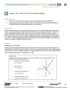
Vectors and Translation Maps
Discover the connection between vectors and translations. Through the lesson, learners see the strong relationship between vectors, matrices, and translations. Their inquiries begin in the two-dimensional plane and then progress to the...
EngageNY
A Rainforest Folktale: Determining the Message of “The Wings of the Butterfly,” a Tukuna People Tale
Did you the message? Scholars listen to a read aloud of The Wings of the Butterfly to summarize and determine the message of the text. They discuss the folktale and vocabulary in groups, then use a double bubble map to compare the story...
Port Jefferson School District
Hurricane Katrina
Young scientists track Hurricane Katrina across the Atlantic Ocean as they learn about these destructive forces of nature. Provided with a table of data tracking the location and conditions of Katrina over a one week span, students...
EngageNY
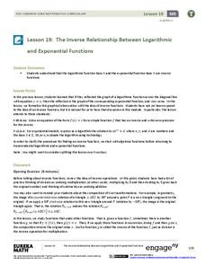
The Inverse Relationship Between Logarithmic and Exponential Functions
Introducing inverse functions! The 20th installment of a 35-part lesson encourages scholars to learn the definition of inverse functions and how to find them. The lesson considers all types of functions, not just exponential and...
EngageNY
Getting a Handle on New Transformations 2
Use 2x2 matrices to move along a line. The second day of a two-day instructional activity is the 28th installment in a 32-part unit. Pupils work together to create and solve systems of equations that will map a transformation...
National Wildlife Federation
Bats: Maligned or Malicious?
Most people couldn't name the positive qualities of bats. Learners discover how bats benefit the environment and then create a concept map to summarize the information. After their reading, they identify misconceptions people have about...
Other popular searches
- Different Types of Maps
- Reviewing Types of Maps
- Types of Maps Grids
- Types of Maps Worksheets
- 10 Types of Maps
- Three Types of Maps
- 2 Types of Maps
- Types of Maps Australia
- Types of Maps "Australia
- Types of Maps "Australia"
- Maps Types Key Symbols

