Curated OER
Mountain Creation: A Drama Exploration
Students explore mountain formation. In this cross curriculum earth science and legend writing lesson, students listen to the poem "The Way to make Perfect Mountains" by Byrd Baylor and identify examples of vivid language used. Students...
Curated OER
Mountain Man Clothing
Students examine what mountain men wore, and what the clothing looked like. They determine what the special features and purposes had to been included in the clothing. They examine the shirts, breeches, hats, and gloves that were...
Curated OER
Exploring Hawaiian Mountain Zones
Fourth graders watch a video that describes the climate and vegetation zones of Hawaii. They describe the different physical conditions that create vegetation zones from the sea to the mountains. In groups, they create an illustrated...
Curated OER
I Love the Mountains
First graders discuss and define different landforms. They read the book "Our Land", sing a landform song and perform it with motions and then complete a worksheet.
Curated OER
Changing Landforms
Students investigate different types of landforms. In this landforms lesson, students explore landforms by participating in a WebQuest. Students research the reasons behind landforms changing and create a picture using KidPix.
K5 Learning
Landforms
Valleys, mountains, and plateaus are just a few geographic landforms on our Earth. Read about these types and more in a brief landform passage. After reading, learners respond to six short answer comprehension questions.
Curated OER
Across the Landscape
Students create a unique, stunning display of the Earth's landforms. They discuss the many different types of the Earth's landforms such as deserts, mountains, oceans, plateaus, coastlines, and marshlands. Students discuss what...
Curated OER
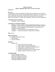
Climb a Mountain, Raft a River on Your Own Land
Students are introduced to the characteristics of a map. As a class, they discuss the uses of public lands in their community and develop symbols for each feature. They use the symbols to create a map showing the recreational uses of...
US Institute of Peace
Observing Conflict
Identifying conflict is important, but how do you handle conflict when it comes? Students use a plot mountain to graph two role-play scenarios about interpersonal conflicts.
Curated OER
Landform Tag
Third graders explore various landforms. They play landform tag while exploring the various types of landforms that are found within the United States. Students locate landforms as they are called by the teacher.
Curated OER
Major Types of Farming Operations in Antebellum Arkansas
Students read a handout about the types of farms in Antebellum Arkansas and respond on the worksheet. They answer an essay question on the topic.
Curated OER
I Can Find that Where? - A Study of Landforms
First graders make landform maps of the United States. In this landform lessons, 1st graders participate in a discussion of local landforms and make a landform map of the United States. They follow the teacher's directions to add plains,...
Curated OER
How Mountains Shape Climate
Students use raw data to make a climatograph; they explain the process of orographic precipitation and the concept of a rain shadow.
Curated OER
Neither Wind Nor Rain
Here is another in the interesting series of lessons that use the special State Quarters as a learning tool. This one uses the North Dakota State Quarter. During this lesson, your class learns about the different patterns of erosion, and...
Curated OER
Create a Country
Students work in small groups to list features and elements found on a variety of grade- appropriate maps. They develop a class list of map features and elements to draw from as they create a map of an imaginary country.
Curated OER
The Gifts of the Nile
Get your class thinking about the geography that shaped the Egyptian landscape and culture. They compare ancient climate zones and geogrpahical fetures, locate evidence of plate tectonics, take and quiz, and write a short essay. The...
Curated OER
Conejito
Third graders read the story "Conejito" and write a descriptive story about the rainforest in Panama. They answer story comprehension questions, complete worksheet questions about a map of Panama, and rewrite a paragraph changing the...
Curated OER
How Volcanoes Grow
Students create models of the three major types of volcanoes and determine how a volcano's shape is related to the type of material erupted. They then observe a demonstration that simulates the nature of two volcanic materials: lava and...
Curated OER
The Biggest Plates on Earth
The best part about teaching guides is all the great information you can use to inform your class. They infer what type of boundary exists between two tectonic plates. Then, using given information on earthquakes and volcanism they'll...
Curated OER
Living in the Greenhouse
Students discuss the different types of climate zones found throughout the world. They participate in activities which relate to real events. They make observations and the consequences of their actions on the environment.
Compton Unified School District
How Can We Locate Places?
How can we locate places? Maps, of course! Expose second graders to the tools available in maps and discuss how these tools can help people find locations. Students also look at communities, including what makes a community and the...
Curated OER
Introduction to Maps
Learners develop their map skills. In this geography lesson, students participate in an activity that requires them to survey their social studies book in order to find different types of maps and purposes for their uses.
Curated OER
China's Geographical Features Word Search
In this China's Geographical Features word search, learners identify types of land formations located in China. A list of mountains, hills, rivers and uplands is provided. An answer key is available for the 20 items.
Curated OER
Water Forms - Eight Types Matching
In this water forms worksheet, learners match the water forms to their definitions. Students complete 8 matches on this worksheet.


