Curated OER
U.S. and Canada: How are We the Same? How are We Different?
Get high school geographers to compare and contrast Canada and the United States. They begin by drawing a freehand map of North America, then complete readings to gain insight into Canada. The text is not provided; however, another text...
Curated OER
A Tough Nut to Crack
Sixth graders explore agriculture by examining world geography. In this pecan cultivation lesson, 6th graders identify the history of the famous nut and the impact it has on the U.S. economy, diet and human body. Students define...
Curated OER
As Simple as Beans: Canada's Population
Students gather facts about Canada from various maps. In this Canada activity, students use beans to relate the populations of the U.S. and Canada. Students create population distribution maps based on the placement of the beans.
Curated OER
Capitals, Oceans, And Border States
Students investigate geography by completing games with classmates. For this United States of America lesson, students examine a map of North America and identify the borders of Mexico and Canada as well as the Pacific and Atlantic....
Curated OER
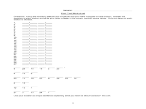
Canada Eh? Pre/Post Tests on Canada Using GPS
Students participate in a GPS activity and answer questions about Canada. In this Canada lesson, students identify location by using a GPS Unit and latitude and longitude. Students find an Inuksuk (station) and a complete worksheet.
Curated OER
Geography: Intro to Canada
Students investigate the geography of Canada by analyzing a map of the country. In this North American geography lesson, students identify the 13 provinces of Canada and their locations by examining a Canadian map. Students...
Curated OER
Canadian Symbols
Students discover the ideals of Canada by analyzing its symbols. In this Canadian culture lesson, students identify the symbols that established the U.S. as its own nation and compare them to important Canadian symbols....
Curated OER
United States & Canada: How Are We The Same? How Are We Different?
Learners compare and contrast similarities and differences between Canada and the US. In this geography lesson, students read various articles and identify similarities and differences in economies, cultures, geography, climate,...
Curated OER
Alaska the Elephant
Students explore an Internet website, locating and matching the shape of an elephant's head to a state in the U.S. They complete an Alaska worksheet, identifying other geographical locations surrounding Alaska.
Curated OER
Corn Exports Visually
Students study imports and exports and the countries that import the most corn from the U.S. They construct mini paper corn plants and label a map with these plants to represent the amount of corn the U.S. exports to countries around the...
Curated OER
Hafta Do NAFTA?
Students examine the benefits and problems of U.S. participation in the North American Free Trade Agreement. In two groups, students represent the campaign team for a presidential candidate, one for and one against NAFTA, and research...
Curated OER
Monarch Migration
In this science and geography worksheet, students read a short passage about the migration pattern of the monarch butterfly. Students trace a path on the U.S. map showing the winter and spring migration.
Curated OER
Physical Location; How a Border Town Might Develop
Young scholars speculate how a location can develop into a large town. They investigate the physical resources and how populations can grow. There are guiding questions to help students through the research and class discussion. Young...
Curated OER
National And International
Students participate in a series of geography lessons in which they identify the meaning of national and international. They discover the regions of the US after identifying the planet on which they live, the continents, the oceans and...
Curated OER
Migrating Across Borders
Students research and map the migratory patterns of the golden-winged warbler. They develop a strategy to protect this species and, in teams representing different countries, negotiate treaties with each other to protect the bird.
Curated OER
Winter Olympics History Year by Year
Investigate the history of the Winter Olympic Games. After researching this event and compiling necessary statistics, pupils use a graphic organizer to chart their findings. A template for a chart is included in this resource. Have your...
Curated OER
Where in the World Do Those Cookies Come From?
Young scholars discuss exports and imports by discovering where the ingredients come from for making chocolate chip cookies. They take a survey of their favorite cookies and create a bar graph to represent the information.
Curated OER
Searching the States (or Provinces) Scavenger Hunt
Students examine information on a particular state or province. Groups of students use the internet to locate facts about an assigned state. They research information such as capital, state song, and major crops. students report their...
Curated OER
Boundaries and People
Young scholars map watersheds to find their boundaries. In this watershed activity students map and then give their "watershed address." Young scholars show the trail from stream, larger stream to oceans. Students...
Curated OER
Sense of Place Through the Eyes of an Inuit Children's Author
Students read books by Michael Arvaaluck Kusugak to explore life in the Artic Circle. After reading the books, students compare and contrast life in the Artic Circle to life in the United States. They write and illustrate a story about...
Curated OER
The First North Americans
Students identify and interpret the different North American Indian groups, by region, and the type and impact of their interaction with Europeans.
Then they complete an overview of one main Native American group during the age of...
Curated OER
The School Travel Agency
Pupils, in groups, produce a travel brochure outlining the uniqueness of a given state or province. They consider what makes an effective travel brochure, research their state and design, edit and present their brochure to the class.
Curated OER
Water Pollution Hot-Spots
Students complete internet research in small groups to identify types of water pollution, spotlight water pollution hot-spots, and design a plan for water prevention.


