Curated OER
Where Should We Land?
Students discuss the difference between major landforms as a class. In groups, they rate the landforms based on the needs of the community that wish to settle there. They also discuss the push and pull factors of the colonists that made...
Curated OER
Where in the World is Utah Wheat?
Students examine the role of climate and landforms in the use of Utah's land. In this geography lesson, students analyze the relationship between geography and agriculture in the state as they examine data regarding wheat production in...
Curated OER
Rain Shadows and Sea Breezes
Students plot the average rainfall for a variety of cities in the United States. Using the map, they work together to determine patterns on which toxicants are transported through the air. They determine the impacts of various weather...
Curated OER
Layer By Layer
Have your class learn about the formation of the Grand Canyon using this lesson. After listening to a variety of stories about the Grand Canyon and erosion, learners complete worksheets related to the geology of this area. What a...
Curated OER
Oregon Trail Landforms
Fourth graders explore landforms located along the Oregon Trail. They discuss the significance of the Oregon Trail, identify visual landforms, and explain the definition of each one. Students complete worksheets, color, and label maps.
Curated OER
Cookie Topography
Students construct a cross section diagram showing elevation changes on a "cookie island." Using a chocolate chip cookie for an island, they locate the highest point in centimeters on the cookie and create a scale in feet. After tracing...
Curated OER
War of 1812
Eighth graders locate the major land forms and bodies of water on a map of Louisiana. In groups, they discuss the role of the Mississippi River in the Battle of New Orleans and how land and water affect the outcome of battles. To end...
Curated OER
Point Me to Puerto Rico
Students research the physical features and geography of Puerto Rico as well as locate it on a world map and identify its major characteristics. Pictures and postcards are shown to each class for a visual connection to Puerto Rico as...
Curated OER
Natural Resources
Learners explore Iowa geography and topographic maps. In this geography and topographic maps lesson, student investigate maps, newspapers, Iowa flora and fauna. Students gain an understanding of how different landforms can be identified...
Curated OER
What is the connection between rice and estimation?
Sixth graders investigate estimating. In this estimating instructional activity, 6th graders estimate how much rice is eaten around the world. Students estimate the percentages of rice eaten by other countries. Students compare rice...
Curated OER
Where, Oh Where
Students use maps to explore several traditional regions of Native Americans. They research information on the regions' climate, resources, landforms, flora and fauna.
Curated OER
Advertise With Geography...it's Free And It's Easy!!
Learners establish awareness of how landforms/landmarks produce a visual image of a region and demonstrate how advertisers use the "positive geographical image" to sell their product by creating their own advertisements.
Curated OER
Crater Creation
Students examine the Oregon state quarter and discuss how Crater Lake was formed-geologically and according to Native American legend. They practice making predictions and identifying the beginning, middle, and end of a story.
Curated OER
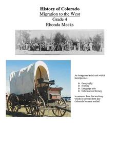
History of Colorado-Migration to the West
Fourth graders identify reasons for people moving to the Colorado Territory and examine how moving in the 1800's is different than moving today. They also practice reading maps and gathering information from maps, as well as, describe...
Curated OER
Mississippi Gulf Coast Islands
Fourth graders complete a variety of exercises as they study the creation, history, and geography of the Mississippi coastal islands. They discover the natuaral forces that act on the islands and how these forces affect the habitats and...
Curated OER
Decision Making, Take a Seat or Get off the Bus
Fifth graders explore the positive and negative consequences of choosing to fight against discrimination. They read the story of Rosa Parks. Students discuss the movement against segregation. Students read other books about...
Curated OER
Crater Creation
After looking at the back of a quarter featuring Oregon terrain, learners distinguish between fiction and non-fiction and identify the beginning, middle and end of a story. First, they listen to legends that describe the creation of...
Curated OER
The Silk Road, An Ancient Internet
Pupils examine how goods and ideas moved along an ancient trade route between China and Europe. They make charts of items, ideas, etc. that were transported along the Silk Route.
Curated OER
Canada: A Land Rich in Beauty and Culture
Third graders in groups research the different regions of Canada. They create a timeline to put the major events of Canada's history in order.
Curated OER
Building Bridges for Young Learners- School
Students examine the purpose of education. For this schooling lesson, students read a letter from a child in Uzbekistan. Students compare and contrast their schooling to children around the world.
Curated OER
Diary of a Worm Secret Agents
Second graders explore the geography of Washington D.C. and President Bush's hometown of Crawford, Texas. They read the book, Diary of a Worm, determine the best route to go to Texas from Washington D.C., and throw a birthday party for...
Curated OER
Australia: the Land Down Under
Young scholars give a solid history and geographic explanation of the country of Australia and explain why it is important. They use some creativity in designing their own island, by using the physical features of this particular country.
Curated OER
Climate Systems - Which Location Is Best For Me?
Students study the difference between weather and climate. In this climate systems lesson plan students search the Internet for the parts of the Earth's system, gather climate data and complete a challenge scenario.
Curated OER
European Explorers of North and South America
Sixth graders explore the connection between the geography of America and the migration of the Native Americans to the American continents to the future conquering of the continents by the Europeans. They discuss the causes and effects...


