Chicago Botanic Garden
Unit 2 Pre-test, Grades 7– 9
This pre-assessment launches a unit on climate change and weather. 15 questions, both short answer and multiple choice, asses the classes' knowledge about these concepts.
Curated OER
What State Are You In?
Students identify the major U.S. cities. In this U.S. geography lesson, students work in pairs and use game cards to name various cities in the United States.
Curated OER
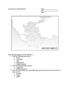
Ancient Greece Map Worksheet
Since the beginning of time, geography has shaped the development of human civilization, and ancient Greece is no exception. This worksheet supports young historians with exploring this relationship as they first identify key land...
Advocates for Human Rights
Refugees and Asylum Seekers
To gain a deeper understanding of the plight of refugees and asylum seekers, class members read stories written from the point of view of an emigrant, map the individual's journey, and note the human rights affected by each stage of the...
Ms. Catsos
Ancient Rome Map Worksheet
It wasn't just the great leaders of ancient Rome that shaped their civilization—the geography of the region played a major role as well. After first identifying major land masses, bodies of water, and city states on a map of Europe,...
Smithsonian Institution
Lexington and Concord: Historical Interpretation
Learners view and analyze three different images related to the Battle of Lexington and Concord. They also answer a variety of questions in a graphic organizer to help keep the information straight.
Curated OER
Maps Can Help Us
First graders explore the geography of Montana by analyzing geographic maps of the area. In this Native American reservation lesson, 1st graders discuss the similarities and differences between reservations in the state of Montana....
National Museum of the American Indian
The A:Shiwi (Zuni) People: A Study in Environment, Adaptation, and Agricultural Practices
Discover the connection of native peoples to their natural world, including cultural and agricultural practices, by studying the Zuni people of the American Southwest. This lesson includes examining a poster's photographs, reading...
Curated OER
Mapping Electricity
Students complete Internet research and use their map reading skills to learn about how the United States creates and uses electricity in different states. In this energy sources activity, students study the mini map of energy usage...
Curated OER
Immigration to the United States
Students examine the reasons why people immigrated to the United States. Using maps and charts, they analyze population movements and religious affiliations. They discover how the United States became a lesser Protestant country.
Curated OER
Mapping Population Changes In The United States
Students create a choropleth map to illustrate the population growth rate of the United States. They explore how to construct a choropleth map, and discuss the impact of population changes for the future.
Curated OER
Grid Frame Mapping
Students map and describe small area of the schoolyard and discuss habitats.
Curated OER
Nonfiction Genre Mini-Unit: Persuasive Writing
Should primary graders have their own computers? Should animals be kept in captivity? Young writers learn how to develop and support a claim in this short unit on persuasive writing.
Curated OER
Mystery State #42
In this mystery state worksheet, students are given five clues which they try to answer to identify the state in question. Then, they locate the state on a map.
Curated OER
Mystery State #21
In this mystery state instructional activity, students answer five clues to identify the state in question. They then locate that state on a map.
Curated OER
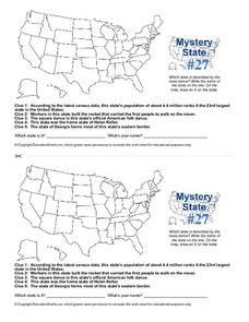
Mystery State #27
In this mystery state activity, students answer five clues to identify the state in question. They then locate that state on a map.
ProCon
Sanctuary Cities
Should sanctuary cities receive federal funding, or do they defy federal laws? That is precisely the question scholars attempt to answer as they prepare for a class discussion or debate. After reading some brief background information,...
Alabama Department of Archives and History
Conflict in Alabama in the 1830s: Native Americans, Settlers, and Government
To better understand the Indian Removal Act of 1830, class members examine primary source documents including letters written by Alabama governors and the Cherokee chiefs. The lesson is part of a unit on the expansion of the United...
Delegation of the European Union to the United States
Cultural Identity
How does cultural diversity impact political identity? That is the question researchers face as they continue their examination of the European Union and the programs it has developed in its attempt to achieve unity in diversity. To gain...
Curated OER
Lesson 1: Map Data and the Census
Young scholars learn about the history of the census. In this U. S. Census lesson plan, students develop an understanding about how the United States Constitution grants and distributes power and discover how the spatial organization of...
Curated OER
The Louisiana Purchase: Worksheet
Celebrate the anniversary of one of the United States' most important land acquisitions with a fun activity. The class answers five matching questions related to those involved with the Louisiana Purchase and then think about what life...
Curated OER
A Place of My Own: A Study of Maps
Students investigate maps. They demonstrate their knowledge about maps and place landforms in the proper place as they create salt dough maps. They create a geography folder as well.
Curated OER
The Nifty Fifty- Facts and Figures
Students explore an assigned state. In this United States geography lesson, students identify facts and figures related to a particular state. Students use the Internet for research and create a PowerPoint presentation displaying these...
Curated OER
China is Unique
Sixth graders study the culture of China by comparing it to that of the United States. They write all questions and notes in a journal. The students access the internet to obtain the information and internet sites are suggested in the...


