Curated OER
The Fifty States
Students become familiar with the states. They study capitols, mottos, nicknames, and other various details. They create group projects that be presented to the class.
Curated OER
State Facts
In this state fact chart worksheet, students are provided with a chart showing all 50 states, their abbreviations, state bird, flower, animal, and the year of statehood. There are also basic facts about each state. The worksheet...
Curated OER
Mystery State # 28
Using clues is a great way to increase deductive and logical reasoning skills. Boost thinking skills while quizzing kids about us geography. They use five clues to determine which state is in question.
Curated OER
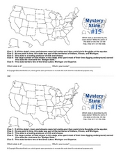
Mystery State #15
Do you know the name of the Badger State? Using five fantastic clues, your super sleuths will determine the name of mystery state number 15. A wonderful way to warm up the class!
Curated OER
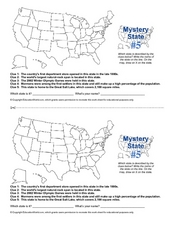
Mystery State # 5
Mystery state number five is none other than Utah! Quiz your kids on state knowledge while building deductive reasoning skills. They use each of the five clues to determine the name of the mystery state. A great warm up when studying...
Curated OER
Mystery State #2
Which is the mystery state for today? Using five super clues, your class will work to uncover which state is being described. They'll have no problem remembering facts about Nevada after this fun warm-up activity.
Curated OER
United States Map Quiz
In this online interactive geography quiz worksheet, students respond to 50 identification questions about the shapes of countries shown. Students have 5 minutes to complete the quiz.
Curated OER
Max Knows Mexicao, United States and Canada
Students utilize their map skills to explore the regions of North America. They explore the physical characteristics and climates of the regions. Students label their map and prepare a presentation of their findings.
Curated OER
United States of America Map
For this United States of America map worksheet, students examine boundaries of each of the 50 states in the nation. This map not is labeled.
Curated OER
Iowa State Map
For this Iowa state map worksheet, students color and label the important cities and physical features. Students also study the background map that shows the location of Iowa in the United States.
Curated OER
Washington State Map
For this Washington map worksheet, students color and label the major cities and important physical features on the map. Students also study a second map that shows the location of Washington in the United States.
Curated OER
California State Map
In this geography of California instructional activity, students color the map and label major cities and physical features. Students also study a second map showing the location of the state of California in the United States.
Curated OER
State Map Locations
In this four state map locations learning exercise, students match up the following four state names to their actual locations on a United States map: Vermont, Tennessee, Kentucky and Rhode Island.
Curated OER
People Change the Landscape
Students examine ways in which humans have brought change to the natural environment. In this ecology and literacy instructional activity, students listen to the book Island Boy by Barbara Cooney. Students observe and define map-reading...
Curated OER
50 States: New England States
Students discover where certain states are located and what the look like. They look for their information on a web site. Each student is assigned a state which they must research then present to the entire class.
National Geographic
Mapping the Americas
Celebrate the geography of the Americas and develop map skills through a series of activities focused on the Western Hemisphere. Learners study everything from earthquakes and volcanoes of the Americas and the relationship...
Curated OER
Race and Ethnicity in the United States
Students explore race and ethnicity as it is defined by the U. S. Census Bureau. They compare data from 1900, 1950, and 2000 and identify settlement patterns and changes in population. In groups, they map these changes and discuss...
Curated OER
Puerto Rico: The 51st State?
Students explore Puerto Rico. For this Puerto Rico current events lesson, students conduct a Webquest to answer questions about Puerto Rico's culture. Students discuss whether Puerto Rico is a country or a state, and defend...
Curated OER
War of 1812: Map and Label
Map test! Hand out this map of the East Coast of the United States and let learners mark each of the nine sites listed. They'll be making a map that shows the battle sites and areas involved in the War of 1812. Great as a test or as a...
Curated OER
The 50 States and its Holidays
Though the format of this ELL lesson is confusing (the standards listed are for plate tectonics, yet the objectives are for American geography and holidays), a teacher could glean some ideas from the main idea. Here, pupils complete a...
Reporters Without Borders
2017 World Press Freedom Index
Freedom of the press was seen as a right so important that the Founding Fathers listed it as part of the first amendment to the United States Constitution. Americans pride themselves on this freedom, but just how free are American...
Curated OER
Our 50 States
Students identify the location of the 50 states using an interactive map. They practice geography skills by playing a fun game. Pupils become familiar with the state abbreviations for the US states. Students become familiar with the...
Curated OER
U.S. Political Map
For this political map worksheet, students use the map of the United States and the 7 cities to measure the straight-line distance between the cities. Students add the total number of miles traveled and write their answers in the spaces.
Curated OER
USA: Average Precipitation and Temperature Map
In this United States map worksheet, learners make note of the average precipitation and temperature in regions of the country.
Other popular searches
- United States Maps Regions
- Northeast United States Maps
- 50 United States Maps
- Create United States Maps
- Western United States Maps
- Custom United States Maps
- Outline Maps United States
- Blank United States Maps
- Maps, United States Rivers
- Maps United States Capitals
- Maps of the United States
- Maps United States


