Curated OER
Oh, the Regions
Focus on the geography of Oklahoma. In this activity, learners compare different geographic regions in Oklahoma, create a collage to share their results, and identify important landforms throughout the United States, such as the...
Curated OER
How the Great Salt Lake Relates To Us
Third graders name at least three resources that come for the Great Salt Lake. They describe at least one product that is made from each resource. They name and locate on a map at least five different geographic regions where Great...
Curated OER
Crowley's Ridge: An Upland in the Lowlands
This clever lesson combines elements of geography, art, literature, and storytelling. Pupils take a close look at the six geographical regions of Arkansas, and pay close attention to Crowley's Ridge - which is one of the six. In groups,...
Curated OER
Earth, the Universe, and Culture
Students view segment of documentary, Swift: Eyes Through Time, explore famous scientists, their theories, places of origin, and culture, document scientific viewpoints of famous scientists throughout history, and discuss geographical...
Artisan Global
QuakeFeed Earthquake Map, Alerts and News
Amateur seismologists explore Earth's earthquakes in real time using a variety of map styles and parameter selections.
Polar Trec
The Amazing Antarctic Trek
This resource provides two ways to engage learners in using latitude, longitude, and research skills. In pairs, or on their own, learners will locate several Antarctic regions on a map. They will write the name of the place and a few key...
Curated OER
Biomimicry, Nature: Architecture of the Future
Students explore the relationship between nature and architecture. For this cross curriculum history, culture, and architecture lesson, students observe and discuss structures visible in nature. Students view websites in which Native...
Curated OER
Adventure Writing: Oregon's Landscape as a Setting
Students identify geographical features of different regions encountered by migrants on the Oregon trail. Students research how the Oregon landscape may have affected life and 19th century westward migration. Students write a narrative...
Curated OER
Nine Lives, One Habitat
Students explore reintroduction of endangered species into new habitats. They research and promote possible sites for reintroducing populations of Florida panthers outside of their current habitat in the Big Cypress Swamp region of...
Colorado State University
Why Does the Wind Blow?
Without wind, the weather man wouldn't have much to talk about! Blow away your junior meteorologists with a creative demonstration of how wind works. The activity uses an empty soda bottle and compressible Styrofoam peanuts to illustrate...
Curated OER
Wisconsin Snapshots
Fourth graders study Wisconsin's culture and heritage. They research the state's symbols and identify leaves common to the Wisconsin area. They create a leaf booklet and visit the state park. They visit local farms and create nature maps...
Curated OER
Animal Adaption to Environment
Students explore the concept of adaptation as a means of surviving in varied environments. They discuss human adaptations and then view slideshows and video that present animal adaptations in the following environments: cold regions,...
Curated OER
Historical and Physical Georgia: Change
Students explore the geographical features of Georgia. In this geology lesson, students explore the physical regions of Georgia and make observations regarding their changes through the years.
Curated OER
Establishing a Lawn
The techniques for preparing soil before laying, or seeding, a lawn is covered in this set of slides. Ideal pH, fertilizer, and drainage is described. Details of the best seed type for different conditions are also...
Curated OER
Exploring Earth Through Maps and Technology
In this maps worksheet, students read 3 pages of detailed information about maps, latitude, longitude, topography, satellites and global positioning. Students then answer 10 questions. There is also a research project assignment available.
Curated OER
Creating and Analyzing Graphs of Tropospheric Ozone
Students create and analyze graphs using archived atmospheric data to compare the ozone levels of selected regions around the world.
Curated OER
Climate Shifts
Eight slides of information related to shifts in the climate make up this presentation. The vocabulary and concepts displayed are geared toward high school meteorology learners. Content is not cohesive from slide to slide, but the...
Curated OER
Hottest, Coldest, Highest, Deepest: Science, 4th Grade
Fourth graders investigate weather patterns in their home state of Utah. After creating KWL charts, they research weather and geographical data to locate the state's extremes. As an extension, 4th graders write and illustrate books about...
Curated OER
The 1927 Flood
Upper elementary and middle schoolers examine the Great Flood of 1927 in the state of Arkansas. They each prepare an oral report about this flood and the huge impact it had on the economics of that time. Additionally, learners research...
Curated OER
Ozone: The Earth's Security Blanket
Students work in groups to define and research the terms: ozone, troposphere and stratosphere. Students watch videos, conduct Internet research, participate in discussion groups and complete worksheets.
Curated OER
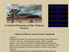
A Virtual Museum of the Mojave Desert
Students study deserts and the plants, animals, and people who inhabit them. In groups, they create their own stories about the inhabitants of the Mojave desert.
Curated OER
The Lake Effect
Fourth graders conduct an experiment demonstrating the effects of water and air temperature on precipitation. They create graphs demonstrating their findings using Claris Works for Kids.
National Wildlife Federation
Quantifying Land Changes Over Time in Areas of Deforestation and Urbanization
Is qualitative or quantitative research more convincing when it comes to climate change? In the eighth lesson during this 21-part series, scholars begin by performing a quantitative analysis of deforestation and urbanization. Then, they...
Curated OER
Exploring the USA and the World with Cartograms
Students investigate cartograms in order to explore the different countries on Earth. In this world geography lesson, students use the Internet to analyze data on different cartograms. Students compare data, such as population density,...

