Curated OER
Geography Application: The Cuban Missile Crisis
A complete activity! The class reads the provided text, then answers the 7 critical-thinking questions. Topics covered are interpreting informational text, reading comprehension, the Cuban Missile Crisis, and US Policy.
Indian Land Tenure Foundation
Maps and Homelands
You are never too young to learn about maps. To better understand the concept of a homeland, students work together to construct a map of their local area out of paper puzzle pieces. They'll put the maps together and then add details by...
Teach Engineering
Where Are the Plastics Near Me? (Mapping the Data)
The last activity in a nine-part series has teams create a Google Earth map using the data they collected during a field trip. Using the map, groups analyze the results and make adjustments to the map to reflect their analysis. A short...
Smithsonian Institution
Borders with the World: Mexican-American War and U.S. Southern Borderlands
The Mexican-American War created social borders—not just physical ones. Scholars learn about the effects of the Mexican-American War on the people living in the borderlands using text excerpts, maps, and partnered activities. Academics...
College Board
2003 AP® Human Geography Free-Response Questions
What role has tourism played in changing the landscape of a country? How do human migration patterns affect a nation? To what extent can urban development patterns help us understand our cities? Learners explore these ideas and more...
Curated OER
US Energy Geography
The maps display the statistics for energy consumption and power production, state by state. They are tremendous visual aids for your natural resources unit. Consider having your class compare energy consumption versus production, or...
Curated OER
Soil: Food Mapping
Pupils examine the concept of food mapping . In this agriculture instructional activity, students explore food and agriculture systems in the United States in the past and today. Pupils complete food mapping activities.
Curated OER
5th grade social studies geography
In this geography instructional activity, 5th graders complete multiple choice questions about hemispheres, maps, cities, ecology, and more. Students complete 25 questions.
Curated OER
California Geography
Fourth graders explore geography of four distinct regions of California: mountains, coast, central valley, and desert. They locate California on map, identify state's boundaries and borders, and explore agriculture, a major economic...
Curated OER
A Map Mystery
Second graders solve a map mystery. In this technology lesson plan, 2nd graders develop an awareness of maps and the symbols associated with maps as they the "Neighborhood Map Machine."
California Polytechnic State University
Australian Geography Unit
At the heart of this resource is a beautifully detailed PowerPoint presentation (provided in PDF form) on the overall physical geography of Australia, basic facts about the country, Aboriginal history, and Australia culture and lifestyle.
Curated OER
U.S. Geography: The South
Young geographers complete a research project. They list the physical features found in the American South. They then discuss the economy, culture, and geography found in the South. They work in groups to research one of the five...
Statistics Education Web
What Percent of the Continental US is Within One Mile of a Road?
There are places in the US where a road cannot be found for miles! The lesson plan asks learners to use random longitude and latitude coordinates within the US to collect data. They then determine the sample proportion and confidence...
Curated OER
Mystery State # 24
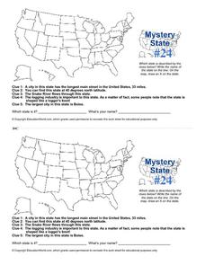
Prepare those brains for a rousing day of learning with a fun geography activity. Your pupils use five different clues to determine the name of mystery state number 24. Where do all those potatoes come from? Idaho!
Curated OER
Middle East Geography Worksheet
In this geography skills instructional activity, students examine the provided map of the Middle East, identify the noted countries, and write facts about each of the countries.
Freecloud Design
Stack the States™
Kids have fun learning US geography and state facts, including capitals, nicknames, major cities, and landmarks. They can choose between the game, or informational flashcards for each state.
Curated OER
European Elevation Sort
Given a prepared database of European countries, sixth graders sort the countries in ascending order by elevation and identify the five countries with the highest elevations. This cross-curricular lesson plan combines elements of...
Curated OER
E-mailing the Chamber of Commerce
Encourage effective internet research and e-mail correspondence as scholars investigate a US capital city they've never visited to find pertinent and relevant information. They begin by picking a city, then visit that city's chamber of...
Curated OER
Maps Can Help Us
First graders explore the geography of Montana by analyzing geographic maps of the area. In this Native American reservation lesson, 1st graders discuss the similarities and differences between reservations in the state of Montana....
Curated OER
Topographic Mapping Skills
In this geography worksheet, students read an excerpt about topographic maps and why they are useful for various jobs. They also respond to eleven questions that follow related to the excerpt and locating specific map points on the map...
Curated OER
United States Map- Map Legend/City Symbols
Students investigate the United States map. In this map skills geography lesson, students explore city symbols on the map legend and identify them. Students use post-it notes to mark various symbols.
Curated OER
Charts, Maps, and Graphs Lesson on the Holocaust
Students practice interpreting data. In this Holocaust lesson plan, students research selected Internet sources and examine charts, maps, and graphs regarding the Jewish populations in and out of Europe. Students respond to questions...
Curated OER
Africa: Geography Concept Map
In this geography skills worksheet, students complete a graphic organizer where they list African countries and their geographic features, languages spoken, natural resources, and historical facts.
Curated OER
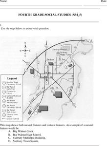
Fourth Grade Social Studies
In this social studies worksheet, 4th graders answer multiple choice questions on state maps, city maps, road maps, political maps, and more. Students complete 25 multiple choice questions.


