Theodore Roosevelt Association
Roosevelt's Legacy: Conservation
The legacy of Theodore Roosevelt carries through modern American politics, economics, foreign policy, and society. But his proudest and most profound efforts were in the world of conservation, and in preserving the natural beauty of...
Curated OER
United States Geography and Topography
Fifth graders recognize the major regions of the US while reading a map. Students study the physical features of the US. Student research and report on states and their capitols.
Curated OER
Settlement Patterns of the United States
Pupils examine the conditions that affected the way people settled in the United States. Using maps, they examine the topography and climate of different locations and determine the factors that do and do not allow settlement to occur....
Curated OER
Colonies and Revolution: Comparing US and Mexican History
Students examine the emergence of the United States and Mexico as independent nations. They compare the colonial history of the two countries and discover the emergence of social classes.
Curated OER
United States Map- State Capitals
Students explore the state capitals. In this geography lesson plan, students use a political map to identify the state capitals and place post-it notes on various capitals.
Curated OER
Illinois State Map
In this Illinois geography worksheet, students color and label a map of Illinois. Students study the location of the capital and where Illinois is situated in the United States. There is a black line map of the state with a grey US map...
Curated OER
Exploring South Carolina
If you are having your students conduct a State study this presentation could be a nice example to show them. This resource provides general information about the geography, animals, and city life one may find in South Carolina. Web...
Curated OER
Introduction to Canada
Ninth graders investigate the country of Canada by examining their media in this geography lesson. They use the Internet to research Canadian newspapers and analyze a topic covered by both US and Canadian media sources. After comparing...
Curated OER
Arkansas: A Changing Climate, a Changing Land
Here is a lesson on the climate zones and geography of Arkansas. In it, learners look at maps (embedded) of different climate zones found throughout Arkansas. They engage in discussions regarding how global warming and climate change is...
Curated OER
Latin America and United States Policy Today
Students compare the situation of Latin American immigrants with the situation of immigrants from other areas of the world. They use media to obtain information on topics of academic interest, personal interest, and intellectual interest.
Curated OER
State Poster Fair: US Geography, Social Science, Art
Students research a US state, design and construct a state 'poster' to display important facts about that particular state. They present their work to the class.
Curated OER
New Jersey State Word Jumble
In this word scramble worksheet, students use the words in the word bank to unscramble nouns and proper nouns about the state of New Jersey. Students unscramble 20 words.
US Mint
Absolutely and Relatively: The Puerto Rico Quarter Reverse
How much does your class know about Puerto RIco? How much can they learn from the back of a 2009 quarter? Use the coin, part of a series of quarters that depict US territories, to teach learners about the geography, culture, and history...
Curated OER
State Nicknames
In this US state nicknames activity, students identify and locate the nicknames of all fifty states in the USA. There are 50 nicknames located in the word search.
Curated OER
The 50 States
Fifth graders use maps and music to learn the 50 states. In this US Geography lesson, 5th graders map out a region of the United States and practice singing the song, The 50 States that Rhyme.
Curated OER
New Mexico State Quarter Printable
In this New Mexico worksheet, students study a picture of the state quarter of New Mexico. Using the information on the coin, students answer 3 short essay questions.
Curated OER
U.S. Geography: The Northeast
Students investigate U.S. Geography by creating a map in class. In this natural resource lesson, students create a map of the United States and research the Northeast based on their resources and recyclable materials. Students...
Curated OER
The Geography of Europe
Students examine maps of Europe. For this geography skills lesson, students interpret several maps to determine the boundaries of the European Union and respond to assessment questions about the maps.
Curated OER
Hottest US Cities Quiz
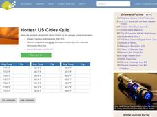
In this online interactive geography quiz learning exercise, students respond to 20 identification questions about the hottest cities in the United States. Students have 4 minutes to finish the timed quiz.
Curated OER
North Carolina State Quarter
In this North Carolina worksheet, students study a picture of the state quarter. Using the information on the coin, students answer 5 short essay questions.
Curated OER
New Hampshire State Quarter
In this New Hampshire worksheet, students study a picture of the state quarter for New Hampshire. Using the information on the coin, students answer 5 short essay questions about New Hampshire.
Curated OER
North Dakota State Quarter
In this North Dakota activity, students examine a picture of the state quarter of North Dakota. Using the information on the coin, students answer 5 short essay questions.
Curated OER
Rhode Island State Quarter
In this Rhode Island worksheet, students examine a picture of the state quarter of Rhode Island. Using the information on the coin, students answer 5 short essay questions.
Curated OER
South Carolina State Quarter
In this South Carolina worksheet, learners analyze a picture of the state quarter for South Carolina. Students use the information on the coin to answer five questions.

