Curated OER
Mapping It Out
This PowerPoint provides information about maps. Students discover the functions of legends, compasses, indexes, and scales on maps. Two resources links are provided, however one of them is broken.
Curated OER
Blank US Map
In this blank outline map worksheet, students study the physical boundaries of the 50 states that make the United States. This outline map may be used for a variety of geographic activities.
Curated OER
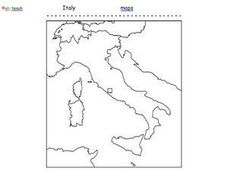
Italy Outline Map
In this outline map instructional activity, students examine the political boundaries of the European nation of Italy. The map may be used in variety of activities that individual teachers create to accompany it.
Curated OER
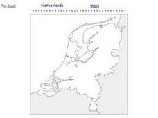
Netherlands Outline Map
In this outline map learning exercise, students examine the political boundaries of the European nation of the Netherlands. The map may be used in variety of activities that individual teachers create to accompany it.
Curated OER
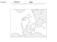
Denmark Outline Map
For this blank outline map worksheet, students explore the political boundaries of Denmark located in Europe. This map may be used in a variety of classroom activities.
Curated OER
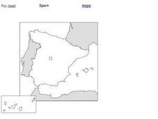
Spain Outline Map
In this blank outline map instructional activity, students explore the political boundaries of Spain located in Europe. This map may be used in a variety of classroom activities.
Curated OER
Kazakhstan Outline Map
In this blank Kazakhstan outline map worksheet, students study the political boundaries of the country. This outline map may be used for a variety of geographic activities.
Curated OER
Maryland State Map
In this map worksheet, students will study a map of the Maryland. Students will use this map to label and/or familiarize themselves with various aspects of the state.
Curated OER
Maine State Map
In this map worksheet, students will study a map of the Maine. Students will use this map to label and/or familiarize themselves with various aspects of the state.
Curated OER
Louisiana State Map
In this map worksheet, students will study a map of the Louisiana. Students will use this map to label and/or familiarize themselves with various aspects of the state.
Curated OER
Kentucky State Map
In this map worksheet, students will study a map of Kentucky. Students will use this map to label and/or familiarize themselves with various aspects of the state.
Curated OER
Biochemistry Concept Map
In this biochemistry worksheet, students complete a concept map using 12 vocabulary words showing the characteristics of organic compounds.
Curated OER
Massachusetts State Map
In this Massachusetts worksheet, students will study a map of the state. Students will use this map to label and/or familiarize themselves with various aspects of the state.
Curated OER
California's Golden History: 1848-1880
Using a variety of online resources, learners study life and society in California during the gold rush. They use a map to identify area where gold was located, explore pre-selected websites, describe mining practices, and create an...
American Battle Monuments Commission
World War II: A Visual History
Explore the enormity of World War II, including its causes, prominent battles, and historical figures, with an interactive map and timeline. Divided into each year from 1939 to 1945, as well as sections pre- and post-war, the resource...
Discovery Education
Submarines and Aircraft Carriers: The Science of Nuclear Power
As physics masters view this presentation, they learn how nuclear power is used in submarines. They use Google Maps to plot a course through the ocean and calculate the time required for surfacing and traveling. They learn about fission,...
K20 Learn
Filling Our Land with Landfills: Solid Waste Disposal
New ReviewThough it comprises only 5 percent of the world's population, the US generates 40 percent of the world's waste. Scholars learn about landfills, their safety, and other solid waste methods. They use experiments and research to learn more....
National Wildlife Federation
I’ve Got the POWER Wind Energy Potential at Your School
The 20th instructional activity in a 21-part series connects the wind data and expectations of a turbine to whether such devices should be built in your area. Scholars begin with estimating the wind potential at school by using long-term...
Curated OER
Read a Map ... It's a Snap!
Students are introduced to map and globe skills. They use grids and are able to construct their own simple maps of familiar places. Students are able to define a map, globe, and symbol and use the direction words north, south, east,...
Curated OER
Mapping School Grounds
Students map and analyze the natural and cultural environment of the school grounds. In small groups, they sketch the natural and cultural features of each side of the school building, create a map, participate in a class discussion,...
Curated OER
MAKING CONNECTIONS WITH MAPS
Students define choropleth map. They construct a choropleth map. They interpret a choropleth map. They present geographic information.
Curated OER
Scaling in Maps
In this recognizing map scale ratios worksheet, students use ratios and centimeter measurements to calculate the distances in reality. Students solve 8 problems.
Curated OER
Making Maps
In this map making activity, students learn about the science of making maps, which is cartography. They then answer the 11 questions on the activity. The answers are on the last page.
Curated OER
Making Maps
First graders create a map of their classroom that can be used to find a hidden treasure. They examine two- and three-dimensional objects and discover characteristics.
Other popular searches
- Land Use Mapping
- Land Use Maps
- Map Use
- Use Map Scales
- Ontario Land Use Maps
- How to Use Maps
- How to Use a Map


