Curated OER
Where In the World Are You?
Fourth graders fill in blank copies of the United States Map and then the World Map.
Curated OER
Cities of the World
Students identify the symbol for cities on a political map. For this world map lesson, students identify specific cities on the World Political Map. Students should identify the country in which the city is located. Students discuss the...
Curated OER
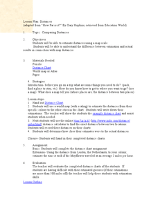
Comparing Distances
Students practice estimating distances by analyzing a map. In this length measurement lesson plan, students view a map with a distance key and use their measurement skills to estimate the distance between two cities. Students utilize an...
Curated OER
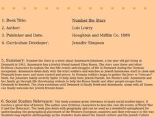
Number the Stars
Students read Number the Stars. For this social studies lesson, students read the story and use a map of western Europe and identify the countries involved in the war. Students locate the cities of Denmark that are discussed in the story.
Curated OER
Weather Patterns
In this weather worksheet, students identify with the symbols found on a weather map that show the locations of fronts, high- and low-pressure areas, and various types of precipitation across the United States. Then they use the map...
Curated OER
Rosie's Walk
Students use maps and globes to locate and describe locations, directions and scale. Using the maps, they identify man made or natural features of different environments. They practice using geographical terms to describe a specific...
Curated OER
The Bear Facts About Summarization
Students practice summarizing techniques in this lesson plan. They listen as the teacher reads from a non-fiction article, and the class creates a story map to highlight the most important facts from the article. They use the map to...
Curated OER
Cocoa Around the World
In this geography instructional activity, students answer 4 multiple choice questions regarding cocoa production around the world using the map and information boxes.
Curated OER
Ratios, Proportions, and Percents
Eighth graders use ratios and proportions to solve real-life problems. In this using ratios and proportions to solve real-life problems lesson, 8th graders estimate the cost of a road trip. Students estimate the distance...
Curated OER
Surprise at Pearl Harbor
Young scholars review the concept of courage and relate it to their daily life. As a class, they are introduced to the events of December 7, 1941 at Pearl Harbor. Using a map, they locate Hawai'i and label the islands. They use the...
Curated OER
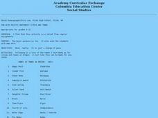
Fun With Pacific Northwest Cities and Towns
Intended for fun only, learners play with the names of cities common to their region or state. This lesson includes a list of cities in Oregon and not much else. What you and your class choose to do with your list of cities is up to you.
Curated OER
The Silk Roads Big Map
Pupils generate oversized rendition of the Silk Roads from Europe to East Asia, apply elements such as political and topographic features, the Silk Roads, products of the regions, and the routes of key travelers.
Curated OER
Geographics in Arkansas
Third graders discuss where Arkansas is located on the United States map. They use geographic tools to participate in activities.
Curated OER
Planet Earth
Students explore and analyze data from different maps in order to explain geographic diversity among the continents. Student groups research continents' physical features and examine how they contribute to quality of life for inhabitants.
Curated OER
Social Studies: The Human and Animal Connection!
Students infer the connection among humans, animals, and disease through the interpretation of concept maps. They are introduced to the idea of a connection human disease and the domestication of animals.
Curated OER
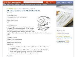
The Power of Words in Charlotte's Web
"How can a few good words save a pig's life?" Posed with this question, your ELD students explore E.B. White's Charlotte's Web in a meaningful, valuable way. By analyzing specific word choice from the book, especially the excerpts...
Conneticut Department of Education
Instructional Strategies That Facilitate Learning Across Content Areas
Imagine 28 instructional strategies, appropriate for all subject areas and all grade levels. Directed Reading-Thinking Activities (DRTA), Question-Answer Relationship (QAR) activities, KWL charts, comparison matrixes, classification...
Curated OER
A "Sweet" Lesson in Economics
Students discover how to determine the flavor of a jellybean using different key documents. In this economics lesson, students discuss Virginia economics and begin an activity in which they will help decide on the what jellybean...
Curated OER
Nature and Place Names in Arkansas
Middle schoolers examine the way that many place names in Arkansas came to be. By looking at Arkansas highway maps, they find names that come from the characteristics of each of the state's six geographical divisions. This interesting...
Curated OER
Ann Arbor Growth & Immigration
Third graders describe some of the factors that brought early settlers to Ann Arbor. They read Narrative-A Trip from Utica, New York, to Ingham County, Michigan in 1838. As an added challenge, 3rd graders can use maps to track Silas...
Polar Trec
The Amazing Antarctic Trek
This resource provides two ways to engage learners in using latitude, longitude, and research skills. In pairs, or on their own, learners will locate several Antarctic regions on a map. They will write the name of the place and a few key...
Curated OER
Life Snapshots
Students create Inspiration webs using graphics or photographs that depict high and low points in their lives. This technology-based Language Arts instructional activity for the upper-elementary or middle-level classroom is excellent for...
York Catholic
Elements of Drama
Introduce young actors to the key elements of performance with this handout that defines key staging terms and activities.
Curated OER
NIGHT AND DAY: DAILY CYCLES IN SOLAR RADIATION
Students examine how Earth's rotation causes daily cycles in solar energy using a microset of satellite data to investigate the Earth's daily radiation budget and locating map locations using latitude and longitude coordinates.


