Curated OER
Think GREEN - Utilizing Renewable Solar Energy
Students use data to find the best renewable energy potential. In this solar energy lesson students import data into Excel and explain how solar energy is beneficial.
Curated OER
Hurricanes As Heat Engines
Students examine sea surface temperatures to see how hurricanes get heat from the oceans surface. In this hurricanes lesson plan students use the Internet to find data and make line plots.
Curated OER
A Comparison of Cloud Coverage over Africa
Students identify different climate regions and local weather patterns. In this cloud coverage lesson students use NASA satellite data and import it into Excel.
Curated OER
Plants: Report Planner
Introduce your young learners to the basic research project. They explore plants using a three-page note-taking guide. On the first page, they write down things they would like to know about the topic and where they might look to find...
Curated OER
Water Quiz
Young scholars use a digital atlas to explore the effects of water on landscapes. They view view pictures and complete worksheets to study the properties of water. Students study the water cycle and the chemical role it plays in living...
Curated OER
The Hot Spot Hypothesis
Students use a digital atlas, geologic maps, and topography maps to explore geologic regions of Yellow Stone National Park. They locate evidence that support the theory of hot spots. Students research and explore the movements of Hot...
Curated OER
Name That Cloud
Learners explore the various categories of clouds and how they are formed. Through use of the Digital Atlas of Idaho, students research cloud types and formations. They use their information to answer questions on a worksheet. provided...
Curated OER
The Magic of Cranberries
Students research climatic and soil conditions for growing cranberries and illustrate how cranberries grow. They research how cranberries are used past and present and create an a-b-c book on cranberries.
Curated OER
Mountain Range Project
This is an outline for a geography project which requires learners to research, compare, and construct a book about various mountain environments around the world. Even though this is a simple outline, it contains some useful ideas and...
Curated OER
Biology and the Digital Atlas
Students participate in a scavenger hunt on the internet. Using a digital atlas, they find answers to specific questions related to plants found in Idaho. To end the lesson, they share their results to the class to discover what happens...
Curated OER
Using My Nasa Data To Determine Volcanic Activity
Students use NASA satellite data of optical depth as a tool to determine volcanic activity on Reunion Island during 2000-2001. They access the data and utilize Excel to create a graph that has optical depth as a function of time for the...
Curated OER
Underground Sleuths Discover Riches Beneath the Plains
Students identify Alberta, Saskatchewan, and Manitoba on map, and use Canadian Atlas to locate regions of natural resources in Central Plains, which have vital impact upon the economy. Students then complete scavenger hunt worksheet.
Curriculum Corner
Earth Day Book
This Earth Day, celebrate our beautiful planet with an activity book that challenges scholars to show off their map skills, complete a crossword puzzle, write acrostic poems, alphabetize, and reflect on their personal Earth-friendly habits.
Curated OER
Map Maker, Map Maker
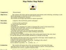
Map maker, map maker, make me a map! Your class can sing this tune as they work to create their own regional maps by taping paper to the wall, projecting an overhead transparency image, and tracing. Where this lesson plan intends for the...
Curated OER
Environment: Water & Air
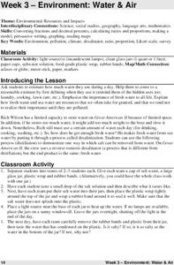
The introduction to the lesson plan mentions a sailor's limited capacity to store drinking water on his ship. Pupils then set up an overnight experiment to remove freshwater from salt water by distillation. There is a math and map...
Curated OER
Exploring Wyoming Species Habitats
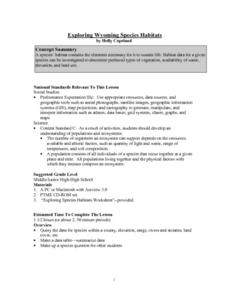
Students are introduced to the concept of species habitats and ranges. They introduced to ArcView GIS as a tool for mapping. Pupils use query data for species withina county, elevation, range, rivers and streams, land cover, and etc....
Curated OER
Exploring BC Through Mapping
In this mapping worksheet, students use an atlas or map to locate and label the rivers, mountains, lakes, and cities in British Columbia.
Curated OER
Project Map: Latitude And Longitude Worksheet
In this latitude and longitude learning exercise, students find the coordinates of 14 cities around the world and use this information to complete 14 short answer questions. This learning exercise includes online atlas web links.
Curated OER
Name that Mammal
Students become familiar with various mammals found in Idaho. They work in groups of three to four. Students use the digital atlas to identify mammals. They complete this activity by using the mammal section of the Digital Atlas.
Curated OER
Creating a Dichotomous Key for Amphibians
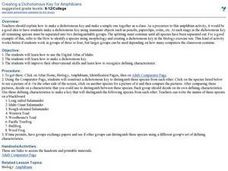
Students are introduced to the purpose of dichotomous keys and create one together as a class. In groups, they use a digital atlas to examine the different types of amphibians in Idaho. Using this information, they make their own...
Curated OER
Who Are the Aliens in Our Inland Seas?
Students work in teams to research specific landforms in Great Lakes Watershed, compile information into data table, and write legend explaining landform for children's book. Students then research area surrounding landform, compile...
Curated OER
Play Doh Map of Your State
Students create a state map using Playdoh. In this hands-on state geography lesson, students work in groups to form a three-dimensional map of their state using Playdoh made at home following a (given) recipe. Students use four colors...
Curated OER
Investigating Latitude and Longitude
Students examine the lines of latitude and longitude on a map, and explain why these lines might be useful. In this lesson students also explore websites that provide information to improve their understanding of how and why latitude and...
Curated OER
Teaching About the Hydrosphere
Eighth graders are introduced to the Earth's hydrologic system including the cycling of water in the atmosphere and the movement of water on the surface of the planet using the Great Lakes watershed as an example.


