Curated OER
Identifying Biomes
In this biomes worksheet, students will use an atlas to find the location of 12 cities listed on a graph onto their world map. Then students will use the cities' annual precipitation to figure out what biomes that city is found.
Curated OER
Using MY NASA DATA to Determine Volcanic Activity
Students explore how aerosols are used in science to indicate volcanic activity and how biomass burning affects global aerosol activity. Students access data and import into MS Excel using graphical data to make inferences and draw...
Curated OER
Exploring an Atlas
Learners explore global geography by participating in an atlas activity. In this countries of the world lesson, students collaborate in small groups and analyze an atlas while researching continents, countries and demographics. Learners...
Curated OER
First You Take an Ecumene
Although this was written regarding Canadian agriculture, it can be used in any agriculture or environmental science class. Learners evaluate agricultural and economic activity maps and consider land use competition. Activities that get...
Curated OER
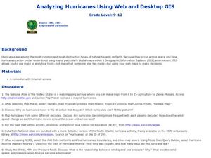
Analyzing Hurricanes Using Web and Desktop GIS
Students analyze hurricanes. In hurricanes activity, students use the Internet and GIS to analyze hurricanes. Students view the National Atlas of Maps to discuss the direction hurricanes move. Students study the wind and pressure fields...
Curated OER
Clouds & Condensation
Learners use the digital atlas of Idaho to study different weather patterns. They use the Climatology section of the Digital Atlas of Idaho to explore concepts such as relative humidity, dew point, condensation, and cloud formation.
Curated OER
These Maps are for the Birds
Students identify and study New York State Breeding Bird Atlas maps to learn where different bird species nest and how their distributions have changed over time. They also identify how maps serve as representations of a geographic...
Curated OER
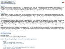
Searching the Digital Atlas
Students become familiar with the tools of a digital atlas. They use a digital atlas of Idaho to located specified information. Students identify national forests, locate butterfly families, find examples of resident fish, and explore...
Cornell University
Too Much of a Good Thing?
Continuing their study of beneficial insects, young entomologists discover where in the world some of these bugs are. By labeling, coloring, and using the scale on a map, pupils explore the territories and arrival of the Asian lady...
Curated OER
Rising Sea Levels: UK and Bangladesh
Learners explore the possible effects of global warming. In this geography/global warming lesson, students identify regions using an atlas and complete a global warming worksheet. Learners perform an experiment in which they simulate...
Curated OER
Plotting A Hurricane Using latitude and Longitude
High schoolers explore map and plotting skills by tracing the movement s of hurricanes through the Earth's systems. a hurricane map is developed from daily media reports.
Curated OER
Climate Characteristics of Canadian Localities
Tenth graders match the climate data to a Canadian city. They justify their choice, referring to factors that affect climate. They use the Atlas of Canada's Advanced Search to locate specific communities.
Curated OER
Water - Vulnerable to Climate Change
Students discuss how changes in the climate and weather can affect change in their own lives. In this climate change lesson plan, students use an atlas and answer short answer questions.
Curated OER
Earth from Space Maps
Students use photo images from space to create a large map of the United States or the world, find where they live and label other places they know. They are exposed to a Web resource that allows them to view photo images of Earth taken...
Curated OER
Comparison of Snow Cover on Different Continents
Students use the Live Access Server (LAS) to form maps and a numerical text file of snow cover for each continent on a particular date and analyze the data for each map, corresponding text file to determine an estimate of snow cover for...
Curated OER
Save an Endangered Species
Have your young learners work in pairs to find and research an endangered species. They use research to develop ideas about saving their animal from extinction. Pairs develop a three-dimensional model of the animal's habitat. Then, they...
Curated OER
A Comparison of Cloud Coverage Over Africa
Students use a NASA satellite data to contrast amounts of cloud coverage over different climate regions in Africa. They explore how Earth's major air circulations affect global weather patterns, and relate to local weather patterns.
Rainer Goebel
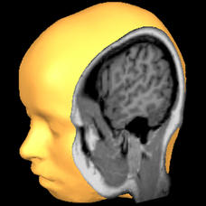
Brain Tutor 3D
The human brain is staggeringly complex, and its structure can seem impossible to grasp. This user-friendly app allows for exploration of the brain's anatomy, providing nomenclature, 3-D mapping, and functions.
Curated OER
Native Knowledge
Students investigate what type of climate and physical features certain Indigenous groups live in using an atlas and a provided worksheet. They then match the tribe and its location to the sustainable stategy employed in agricultural...
Curated OER
Give Me Some Latitude
In this latitude activity, students use an atlas or other reference to respond to 4 multiple choice questions about the equator and the poles.
Curated OER
Glacier Basics
Students are introduced to the powerful nature of glaciers. Using an atlas, they read the section on glaciers and examine pictures of before and after the glacier moved through an area. In groups, they complete a worksheet on the role...
Curated OER
Rainforest Data
In this geography worksheet, students use the climate data given to create a temperature line graph and rainfall bar graph for each of three locations given. Then they use an atlas to compare their graphs and draw conclusions about the...
Curated OER
Borah Peak Earthquake
learners use the internet, an atlas map, and other sources to explore a map of Idaho. They locate the Lost River Range and Mt. Borah. Students read the atlas map to locate earthquake faults, find the magnitude, fault, and epicenter of...
Curated OER
Scale/Ratio
Investigate the use of ratios in scale drawings. Learners scale objects up or down using ratios then find the actual size of something using ratios. They apply their knowledge of ratios as they make their own telescopes in science class....


