Curated OER
Hurricane Winds: A Spatial Hierarchy of Processes at Different Scales
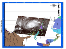
For this earth science lesson, students study a satellite image of hurricane Isabel and write answers to 5 questions that follow. They match predictions to the map locations.
Curated OER
A Map of Ghana
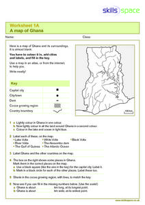
In this Map of Ghana worksheet, students are given a blank map and key. They are told to label major features and color according to directions.
Curated OER
Outline Map of Japan
In this geography instructional activity, students examine a black line outline map of Japan. There is a compass rose on the page. There are no labeled cities.
Curated OER
Maps/ Scales and Conversions
In this math worksheet, middle schoolers look for the actual values for the measurements of distance. The answers are found on page three.
Curated OER
Reptiles
In this reptiles worksheet, students use an idea map to compare amphibian and reptile adaptations. Students complete 2 short answer questions based on the idea map.
Curated OER
Measurement 4: Linear Measure
In this measurement worksheet, learners use a ruler to measure, in inches, the distance of various line segments. Then, using the scale drawing, they determine the actual distance in miles. Students may use their knowledge of proportions...
Curated OER
Globe Skills Lesson 5
In this map skills activity, students read a text selection about locations during the American Revolution and then respond to 8 fill in the blank questions.
Mathematics Assessment Project
Linear Graphs
A line is a line is a line. As a middle school assessment task, learners first identify graphs of given linear equations. They then identify the equations that represent real-world situations.
Curated OER
Freeform Texas Map
In this Texas map learning exercise, students research, label and discuss the most important cities in Texas, its physical attributes and the states that surround Texas.
Curated OER
Freeform Pennsylvania Map
In this Pennsylvania map worksheet, students research, study and label twenty important cities, physical attributes and the neighbors that surround Pennsylvania on a Pennsylvania map.
Curated OER
Problem-Solving Decisions: Reasonable Answers
For this problem solving worksheet, students answer 6 questions pertaining to a story problem about a tabletop scale model of the Nile River.
Curated OER
The Sustainable Olympics
For this sustainable Olympics worksheet, students utilize a large map of the British Isles, map scale a long piece of string to calculate the approximate distance between their school and 8 locations where some of the Olympic events may...
Curated OER
Lesson 3-5: Proportions and Similar Figures
For this similar figures worksheet, students use proportions to solve 6 short answer and multiple choice questions. Students use proportions to answer questions about map scales and height of trees given shadow lengths.
Curated OER
Measurement 3: Rulers
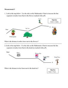
In this measurement worksheet, students measure the linear distance, in inches, between stated objects. Next, they determine the actual distance, in miles.
Curated OER
Having a Hot Time on Mars!
In this cosmic radiation on Mars learning exercise, students study a radiation map of Mars taken by the MARIE instrument on the Odyssey spacecraft. Students answer 4 questions using the radiation map and they answer questions about the...
Curated OER
Degrees and Minutes
In this latitude and longitude learning exercise, learners place 9 cities on a map using the latitude and longitude of each. Once cities are placed in the correct location, students complete 2 short answer follow-up questions.
It's About Time
Volcanic Hazards: Airborne Debris
Pupils interpret maps and graph data related to volcanic ash. Then they analyze the importance of wind speed and the dangers of the ash to both life, air temperature, and technology.
Curated OER
Real World Investigation- Math and Geography- Elevation Changes
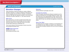
In this math and geography real world investigation, 6th graders plan a driving trip to a city that is located several states away from their home while recording the elevations of three cities that are included in the trip. They use...
Curated OER
Tooling Around Arizona: Measuring Distances
In this measurement instructional activity, student measure the distances between Arizona cities by using a the scale on an Arizona Cities map. Learners complete 15 problems.
Curated OER
Freeform Rhode Island Map
In this free form Rhode Island map worksheet, students study, locate and memorize key cities, physical attributes and surrounding states for a quiz. Students fill out the major cities on a blank map of Rhode Island.
Curated OER
Rivers Run Through It
In this mapping practice worksheet, 5th graders read an informational paragraph and answer 7 questions about the parts of a map along with places shown on a given map.
Curated OER
Comparing Ratios
In this comparing ratios worksheet, students solve and complete 3 different problems using the screens shown. First, they write a ratio that compares the shaded part to unshaded part illustrated. Then, students use the same grid to...
Curated OER
Mathematics of Image Processing
In this mathematics of image processing worksheet, students solve 10 various types of problems related to image processing on a computer. They type in all the commands listed and figure out what is going on. Then, students determine the...
Curated OER
Unit V: Worksheet 2 - Constant Force
Physics learners studying force and acceleration practice solving eight problems with this assignment. They calculate acceleration and deceleration, net force, and distances required for stopping a moving object. Kinematics equations and...
