Curated OER
United States Map- State Capitals
Young scholars explore the state capitals. In this geography lesson, students use a political map to identify the state capitals and place post-it notes on various capitals.
Curated OER
United States Map Lesson
Students explore basic map skills. In this United States geography lesson, students define "country" and "state," locate their state on a United States map, and identify and trace state boundaries defining their state and surrounding...
Curated OER
Finding Their New World
First graders place stickers on maps indicating their understanding of the cardinal directions. They locate Jamestown, England, the Atlantic, and Virginia.
Curated OER
Mesoamerica
Young scholars demonstrate knowledge of early Middle American civilizations. They study Mesoamerican i religions, governments, and achievements. They identify geographies of North and South America.
Curated OER
Going, Going, Ghost
Third graders research ghost towns. In this geography lesson, 3rd graders locate ghost towns on a map and choose one location to research. Students construct a research paper and present it to the class.
Curated OER
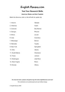
American States and Their Capital- Test Your Research Skills Worksheet
In this geography skills activity, students match the American state listed on the left with its capital city listed on the right by drawing a line from one to the other.
Curated OER
British Colonization-Settling the Thirteen Colonies (1607-1733)
Students study the thirteen colonies: geography, economics, politics, and religious groups. They explore early colonial life, and create a travel brochure, travel guide of the 13 Colonies, and word search.
Curated OER
European Explorers of North and South America
Sixth graders explore the connection between the geography of America and the migration of the Native Americans to the American continents to the future conquering of the continents by the Europeans. They discuss the causes and effects...
Curated OER
Colonial Maps
Students discover the history of America by identifying the traditional colonies. In this U.S. history lesson, students examine a world map and identify where the voyagers left from Europe to arrive at the United States. ...
Curated OER
All That Sparkles is Silver!
Students analyze photographs for information about life in Virginia City Nevada in the late 1800s. In this Nevada statehood lesson, students work in teams to analyze photographs from Virginia City. Students brainstorm adjectives to...
Curated OER
The Search for Mid-East Peace
Twelfth graders demonstrate an understanding of the competing forces and their demands in the Israeli-Palestinian peace process by completing a "Force Field Analysis" (developed by John Rossi at Virginia Commonwealth University) and by...
Curated OER
Circle the Earth - Explore Surface Types on a Journey around Earth
Students use CERES percent coverage surface data with a world map in locating landmasses and bodies of water at Earth's Equator.
Curated OER
Plate Tectonics: Recycling the Seafloor
Students classify earth's layers and plates using Ocean Seismicity data. In this plate tectonics lesson, students outline where the plate boundaries are on the world map. They then compare these predicted boundaries with USGS map of the...
Curated OER
Nigerian Elections Critical Analysis
Students examine the recent history of Nigeria and determine how its history and geography have effect current events in the area. They look at the challenges facing Nigeria as a new democracy and a developing nation. They determine...
Curated OER
American Indians
Sixth graders review and study the major regions of Native Americans and how their cultures were influenced by geography, natural resources and religious beliefs. They utilize chronological thinking, historical analysis and historical...
Curated OER
The Cay
Fifth graders read The Cay as a shared literature experience. This lesson plan has many good activities across the curriculum to keep your students actively engaged in the story. They will do math, art, music, science and geography...
Curated OER
Alabama Fever
Students describe life on the Alabama frontier. They identify topics important to early settlers and explain the impact of geography on development. They explore the government's role in the sale of public land.
Curated OER
Geographic Effects on Precipitation, Water Vapor and Temperature
Students investigate the factors affecting climate using Live Access Server. In this geography lesson, students graph atmospheric data using Excel spreadsheet. They compare and contrast temperature, precipitation and water vapor of two...
Curated OER
The Carlyle House and Gadsby Tavern
Fourth graders tour the Carlyle House and Gadsby Tavern while working on worksheets covering both places. They are to write an essay and thank you notes to finish the lesson.
Virginia Department of Education
Biomes of the World
Incorporate knowledge about biomes and ecosystems in multiple ways while encouraging creativity. Emerging ecologists collaborate and perform research to complete a graphic organizer about various biomes of the world. They conclude the...
Curated OER
Mapmaker, Mapmaker, Make Me a Map
Second and third graders practice with basic map skills. They create their own map including a legend and a compass rose. This fabulous plan has many excellent websites linked which allow learners to explore maps of all kinds; including...
Curated OER
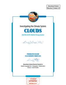
Investigating the Climate System - Clouds
Here is a fabulous lesson plan on the Earth's radiant energy system. This amazing, 31-page document is chock-full of great activities, worksheets, lab sheets, quizzes, rubrics, and assessments. Learners model and explain cloud formation,...
Curated OER
Clouds and the Earth's Radiant Energy System
Wow! What a lesson plan! Six terrific activities are described in great detail, in this 31-page document! Learners will model and explain cloud formation, sketch and identify certain cloud types, calculate and compare incoming and...
NASA
Precipitation
Here is a fabulous collection of lessons for your emerging meteorologists! In them, learners will utilize satellite data to determine distribution of rainfall, research global rainfall patterns, and utilize their knowledge to propose new...
Other popular searches
- Geography of Virginia
- Geography of West Virginia
- West Virginia Geography
- Civil War Geography Virginia


