Curated OER
Washington Vocabulary Word Jumble
In this word jumble worksheet, students unscramble the letters to spell words associated with the state of Washington. Students spell 20 words.
Curated OER
Washington cities word jumble
In this Washington cities worksheet, students unscramble the words that represent names of cities in Washington. Students unscramble 10 cities in Washington.
Curated OER
Geography: US States and Capitals Picture/Word #10
In this US states and capitals cities worksheet, students trace the sentences that list the capital cities of the following states: Virginia, Washington, West Virginia, Wisconsin, and Wyoming.
Curated OER
The Geography of Europe
Students examine maps of Europe. In this geography skills lesson, students interpret several maps to determine the boundaries of the European Union and respond to assessment questions about the maps.
Curated OER
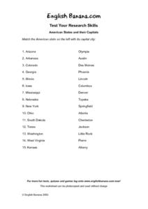
American States and Their Capital- Test Your Research Skills Worksheet
In this geography skills worksheet, students match the American state listed on the left with its capital city listed on the right by drawing a line from one to the other.
Digital History
The New Nation
George Washington and the new nation of the United States of America faced many problems in their inaugural years. Use this worksheet as a straightforward approach to learning about the reasons the country was experiencing a lack of...
Curated OER
Geography And The Revolutionary War
Students gain a deeper understanding of both geography and the Revolutionary War. They practice using on line research in examining historical events and using political, physical, and topographic maps.
Curated OER
Bordering States & VA Regions
In this Virginia geography worksheet, students respond to 2 fill in the blank questions and 16 multiple choice questions regarding the bordering states and regions of Virginia.
Curated OER
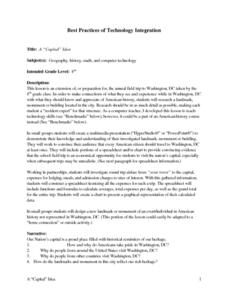
A "Capital" Idea
Eighth graders prepare for a field trip to Washington, DC by researching landmark, monument, or building in Washington. They use the information in small groups to design a multimedia presentation. They include a spreadsheet that shows...
Curated OER
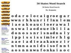
50 States Word Search
In this fifty states worksheet, students identify and locate all fifty states of the United States of America. There are 50 states located in the word search.
Museum of Tolerance
Disenfranchised People of the New Nation
Why are some immigrant groups in the United States embraced while others become disenfranchised? To answer this question, teams investigate why groups emigrated to the US, why some of these these peoples were disenfranchised, and their...
Curated OER
Regions of the US: Gulf Stream, States and Their Capitals
Fifth graders identify one way of dividing the US into geographical regions and then consider alternate ways of doing the same. They locate each of the fifty states and their capitals on a map. They research the Gulf Stream region.
Curated OER
Zoo-Goers Ready to Greet Baby Panda
The Smithsonian's National Zoo, also known as the Washington Zoo, is one of the oldest zoos in the United States. Youngsters read and discuss a news article about Tai Shan, baby panda that was one of the zoos most famous residents. They...
Curated OER
Country Capitals
Students locate country capitals on a world map. For this map skills lesson, students review the definition of the word country and discuss what a capital is. Students locate and label capital cities on a world map using a map marker.
Curated OER
Boundaries
Students are introduced to the term of mental mapping. Individually, they develop their own mental map of Washington state and discuss as a class what makes a boundary. They draw their mental map on paper and compare it with their...
Curated OER
Geography of the United States
Students examine the population growth of the United States. In this Geography lesson, students construct a map of the fifty states. Students create a graph of the population of the USA.
Curated OER
Introduction to the Virtual Atlas
Students use an atlas online to gather information about the state of Washington. Individually, they practice using the database and researching specific items in the Pacific Northwest. They complete a quiz to end the lesson.
Curated OER
United States & Canada: How Are We The Same? How Are We Different?
Students compare and contrast similarities and differences between Canada and the US. For this geography lesson, students read various articles and identify similarities and differences in economies, cultures, geography, climate, and...
Curated OER
Revolutions in Latin America: Bolivar, 1813-1814
Students compare the leadership skills of Washington and Bolivar. In this Latin American history lesson, students read biographical information about George Washington and Simon Bolivar. Students compare the men to better understand the...
Curated OER
States and Territories
In this United states learning exercise, 5th graders read a short script pertaining to the states and territories. Students complete 10 fill in the blank questions and self check this online interactive learning exercise.
Curated OER
The Hunter Using Children's Literature to Teach the Geography of Africa
Learners are able to answer basic questions about the region and the use of natural resources, sketch a mental map of the story's setting, and find their way through the thematic maze/map.
Curated OER
Treaty Trail: Crossing the Bitterroot Mountains
Students examine art and primary documents that depicts the Native Americans' crossing of Washington's Bitterroot Mountains to arrive at the Spokane Council. Students investigate and compare maps and other historical materials determine...
Curated OER
Historic Cemetery Project
Students use the Virtual Atlas to examine the cemetaries in the state of Washington. In groups, they view photographs of local monuments to celebrate the lives of local members. They choose one to focus on and research. To end the...
Curated OER
What Can We Learn about India from a Ten Rupee Bank Note?
The class finds and cites evidence showing India's unity in diversity and work to recognize some of the complex interactions of a civilized community. They read to understand how geography, history, politics, economics, beliefs, and...


