Curated OER
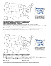
Mystery State # 39
Which state will be the answer to the five clues today? After considering each clue, learners will name the mystery state. If your class can determine which state was home to Chief Sitting Bull, they'll be able to answer South Dakota.
Curated OER
Making a Report to President Washington
Students gain an understanding of some of the challenges the U.S. faced at its birth. They are asked to compose a report on the state of the nation in 1790 (addressed to President George Washington), which includes a narrative, maps and...
Curated OER
Washington Map
In this Washington state outline map worksheet, students examine political boundaries of the state and the placement its capital city as well as its major cities. This map is not labeled.
Curated OER
Washington State Quarter
In this online interactive Washington state quarter worksheet, students examine a Washington quarter picture and answer 4 questions regarding it. This worksheet may be printed for classroom use
Curated OER
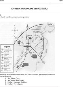
Fourth Grade Social Studies
In this social studies worksheet, 4th graders answer multiple choice questions on state maps, city maps, road maps, political maps, and more. Students complete 25 multiple choice questions.
Curated OER
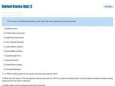
United States Quiz Two
In this United States worksheet, students answer short answer questions about which political party the Presidents belonged to and geography of the country. Students answer 20 short answer questions.
Curated OER
United States Quiz 3
In this United States worksheet, learners answer short answer questions about the geography and holidays of the United States. Students complete 10 short answer questions.
Curated OER
Capitals, Oceans, And Border States
Students investigate geography by completing games with classmates. In this United States of America activity, students examine a map of North America and identify the borders of Mexico and Canada as well as the Pacific and Atlantic....
Curated OER
The 50 States and its Holidays
Though the format of this ELL lesson is confusing (the standards listed are for plate tectonics, yet the objectives are for American geography and holidays), a teacher could glean some ideas from the main idea. Here, pupils complete a...
Curated OER
Traditional Tribal Homelands of Washington's Plateau Nations
Students investigate the Plateau tribes. In this Native American lesson, students use a political map of Washington state to identify the location of the Plateau tribes. Students brainstorm the needs and wants of the tribes and use an...
Curated OER
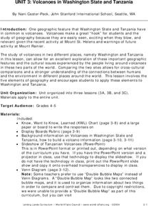
Volcanoes in Washington State and Tanzania
Students research volcanoes in Washington State and in Tanzania and create a poster on one specific volcano in each area. Once research is complete on each area, students compare and contrast volcanoes in Washington State and Tanzania.
Curated OER
Washington, D.C.
In this Washington, D.C. worksheet, students complete 6 pages of readings and questions about Washington, D.C. Included are general facts, geography, monuments, history, economy and people. There is a short text and 6 multiple choice...
Student Handouts
Geography of Dr. Martin Luther King, Jr.
Young geographers follow Dr. Martin Luther King's journey during the civil rights movement by identifying major events on a map of the eastern United States, such as his birth in Atlanta, Georgia and his famous "I Have a Dream" speech in...
Curated OER
Discovering the Physical Geography of Washington
Students develop a mental map of the state of Washington and draw it on paper. Using the Virtual Atlas, they identify the physical features of the state and draw them on their map. They also examine the populations and diversity of the...
Curated OER
Washington, D.C. Map
Here is an outline map of Washington, DC. Some of the points of interest in the city are labeled, as are Maryland, Virginia and Arlington. There are plenty of important monuments and locations not identified, making for a good project.
Curated OER
Geography: Puerto Rico
Take a trip to Puerto Rico! Learners engage in a web quest, identify Puerto Rico on the map, and gather information related to physical features and cultural factors. Their efforts culminate when they design a brochure comparing the...
Curated OER
Washington Cities Map Quiz
In this online interactive geography worksheet, students examine a map of the state of Washington and identify the 13 noted cities on the map using a pull down menu within 3 minutes.
California Academy of Science
California's Climate
The United States is a large country with many different climates. Graph and analyze temperature and rainfall data for Sacramento and Washington DC as you teach your class about the characteristics of Mediterranean climates. Discuss the...
Curated OER
Washington, Jefferson, Roosevelt, Lincoln
Students study four of the most influential and important presidents in United States history. In this United States presidents lesson, students learn the facts and histories to four of the most influential presidents in history - George...
Curated OER
Washington Acrostic Poem
In this acrostic poem worksheet, students write a poem about the state of Washington. Students use the letters in WASHINGTON to begin each new line of the poem.
Curated OER
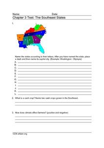
Chapter 3 Test: The Southeast States
For this geography worksheet, students complete a test about the southeastern United States. They name the states, tell about the climate and crops, complete a matching activity about the landforms. and another about the industry.
Curated OER
George Washington Carver
Second graders participate in an investigation of George Washington Carver and his life. They conduct research using the provided text. Specifically, 2nd graders use the large print and pictures to strengthen reading comprehension. They...
Curated OER
George Washington and the Beginnings of the French and Indian War
Learners read about the causes of the French and Indian War. In this French and Indian war lesson plan, students read about the physical and human problems that lead to the war. They also learn about George Washington's role in the war.
Curated OER
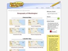
Washington
In this social studies worksheet, students label places on a map of Washington state. There are other worksheets on this link, including a scrambled places, word search and a crossword puzzle of places in Washington.


