Curated OER
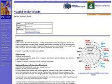
World Wide Winds
Students recognize that global winds move in specific directions in specific latitudes and describe that in a written form. They relate the motion of the wind belts to historical navigation.
Curated OER
Atlantic Canada Report
Ninth graders create a report that will show an in-depth knowledge of the various geographical and climatic features of Atlantic Canada. They produce various items, on paper and using the computer, to demonstrate knowledge of outcomes,...
Curated OER
Earth System Science
Students explore the Earth and its ability to support life. They discuss the geosphere and the water cycle and complete the Water Wonders activity. After completing the activity, they respond in their journals and reflect upon the...
Bridge
Mercury - Mercury is Rising
Hold a discussion in your class about the increase in mercury being found in fish that are caught commercially as food for humans. Given a worksheet, learners then calculate how much fish a person can safely eat each month to remain...
Curated OER
Fabulous Funnels
Students explore what tornados are, how they are created and measured, and what their effects are on communities. They keep a journal of their activities and explorations as part of an ongoing process of learning.
Curated OER
Tracking Satellites Using Latitude and Longitude
Students, viewing an Internet site, plot the path of several satellites using latitude and longitude over the course of an hour. They learn the four basic types of satellites and their purpose.
Curated OER
Climate Change
Students discuss problems associated with a world climate change. They examine how animals would be affected if the world heated up.
Curated OER
Shifting Coastlines
Learners study North Carolina's changing coastline during the Paleoindian and Archaic periods and determine the positions of the coastline at different times and decide what types of archaeological information has been lost due to rising...
Curated OER
Cruising the Mantle
Students explore the plate boundaries of the earth. Through the use of video, internet and hands-on activities, students examine the types of plate boundaries. They create a model to illustrate the movement and interaction of the...
Curated OER
Regions of the US: Gulf Stream, States and Their Capitals
Fifth graders identify one way of dividing the US into geographical regions and then consider alternate ways of doing the same. They locate each of the fifty states and their capitals on a map. They research the Gulf Stream region.
Curated OER
Classroom Triangles
Students use bearing measurements to triangulate and determine objects' locations. Working in teams of two or three, students must put on their investigative hats as they take bearing measurements to specified landmarks in their...
Curated OER
Biomes: Extreme Climate
Students create a web connecting global warming, the Arctic, and wold climate. They write a paragraph explaining the role of the Arctic in world climate.
Curated OER
Extreme Climate
Students discuss global warming, greenhouse effect, permafrost and other key words. In this climate lesson students create a web that connects global warming, the Arctic and world climate then write a paragraph explaining the role...
Curated OER
Is Climate Change Really Happening?
Students explore the impact of global warming. In this oceanography lesson, students investigate global climate change and write reaction papers about their research findings.
Curated OER
Birds
Students list marine birds in their area and report on the threats made to these species. In this marine life lesson students compare bird count data and argue either for or against its accuracy.
Curated OER
Where's the Beach?
Students use beach profile data to analyze how erosion and sediment transport changed seashore slopes. In this geology lesson, students plot the data provided and analyze erosion patterns. They also assess coastal erosion management...
Curated OER
Warm up to the Gulf Stream
Students find out the temperature difference between the Gulf Stream and the surrounding water. They locate the Gulf Stream on the infrared image of the eastern seaboard of the US.
Curated OER
Algebra, Multiplication, and Division of Fractions
Students gain knowledge by measuring time and distance for solving unknowns in an equation. They also will design an airplane and chance to communicate mathematically by writing essays.
Science Education Resource Center at Carleton College
Serc: Mn Step: Sinking Water: Glaciers, Ocean Currents and Weather Patterns
A lesson where students learn how warm water is less dense than cold water, and what this means for global climate change as ice from the polar regions melts. Students will do experiments in buoyancy and water density when hot or cold,...
