Curated OER
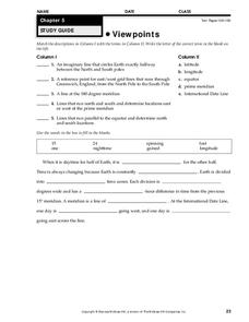
Viewpoints
In this map worksheet, students review latitude, longitude, equator, and prime meridian. This worksheet has 5 matching and 8 fill in the blank questions.
Curated OER
Mapping The Way With Lewis & Clark
Fourth graders analyze and compare maps used on the expedition of Lewis and Clark. Students write reports about the geography of the land. They answer questions about Lewis & Clark.
Curated OER
Mapping the Ocean Floor
Students study the bottom structure of underwater habitats and how they can be mapped.
Curated OER
The Pony Express
Fourth graders reasearch the history of the Pony Express on the internet or they can use books from the school or public library. They write a one-page story which incorporates their research. They share their stories with the class by...
Curated OER
Rapping Regions in America
Students determine what designates a place as a region. They apply their criteria for a region to the US map. They work in groups to write a rap about their region that describes its organization, type and structure.
Curated OER
Sharing The Land
Students investigate different geographical terms and concepts. This is done with practicing with maps of the United States to find major coasts, lakes, and rivers. They also put together a floor map of the United States. Students create...
Curated OER
A Brief History of Los Angeles
Learners study the diverse cultures that make up the population of Los Angeles.
Curated OER
Why Archaeologists Dig Square Holes
Students examine how archaeologists establish and maintain the context of artifacts. They interpret a plan view of an archaeological site and explain the importance of the grid system.
Curated OER
Follow the Drinking Gourd: Poem Activity
In this poem worksheet, students read a selection, "Follow the Drinking Gourd," then read about the background of the selection and complete a related crossword puzzle.
Curated OER
The Battle of Horseshoe Bend: Collision of Cultures (54)
Students discover the political and cultural conflicts that led to the Battle of Horseshoe Blend, Alabama, and evaluate historical maps of the Battle of Horseshoe Bend. They research American Indian cultures that were located in their...
Curated OER
1668 Map of Newark Activity
Eleventh graders read a map for historical information, decipher a map legend and symbols, and expand their knowledge of a historic time.
Curated OER
Maps that Teach
Students study maps to locate the states and capital on the US map. Students locate continents, major world physical features and historical monuments. Students locate the provinces and territories of Canada.
Curated OER
The Boundary Dispute between New Hampshire and Massachusetts, 1677-1741
High schoolers research primary and secondary source documents to examine the separation of New Hampshire from the larger colony of Massachusetts.
Curated OER
Lichens as Air Quality Indicators: A beginning lichen identification study (2003
Students use GPS and trees to explore lichens and air quality.
Curated OER
Bonkers About Beads
Learners explore written communication of different cultures, practice identifying letters of the alphabet, and recognize and create patterns with beaded letters.
Curated OER
Building on the Power of Your Ideas
Students examine a sculpture walkway by artist Jackie Ferrara and discuss the relationship of materials to function. They analyze the sculpture and answer discussion questions, and design and construct a model of a walkway for the school.
Curated OER
Learning Lesson: The Shadow Knows II
Young scholars discover and practice how to calculate the circumference of the Earth. They measure the length of their shadows and use the distance they are away from the equator to complete the calculations. They discuss winter or...
Curated OER
Telling Time Through the Zodiac
Learners compare the Chinese and Western zodiacs, their symbols, their meanings, and their calendars through a in-class discussion and a small group project. This lesson includes vocabulary and extensions.
Curated OER
Mapping the Local Community
Young scholars review the symbols and legends of a map. In groups, they follow a set of directions to create a map showing the route to a specific place. They present their map to the class and review the basic components of a community.
Curated OER
Studying Japanese Internment with Primary Documents
Eleventh graders view photographs of the Japanese society being interned in camps during World War II in the United States. In groups, they read and discuss Executive Order 9066 and try to determine what group they are trying to focus...
Curated OER
The Splendor of Canada's Provinces and Territories
Sixth graders use a map of Canada to label all provinces and territories as well as write information about each location. Using books, they read about each province and territory and write down adjectives describing them. They paint a...
Curated OER
Words and Pictures Connect Nature and People: The American Conservation Movement
Students research some of the men and women who help to raise the environmental consciousness of the American people through their writings and drawings. They write a persuasive piece about an outdoor place which will connect their...
Curated OER
The African-American Struggle for Equality in the World War II Era
Young scholars respect and appreciate the challenges people faced during World War II. They develop the different perspectives on race during WWII. Students develop that the nation's actions may not exemplify a nation's stated ideals....
Curated OER
Social Studies: Native american Tribal Sovereignty
Students examine the issue of tribal sovereignty for Native Americans. Following a mock trial simulation based on the case of Johnson v. McIntosh, they write opinion papers based on the results of the Supreme Court decision in 1823.
Other popular searches
- West Point Bridge Design
- West Point Bridge
- West Point Bridge Builder
- West Point Bridge Designer
- History of West Point
- West Point Revolutionary War


