Curated OER
Gettysburg: The Civil War's Costliest Battle
Students research the Civil War and the Battle of Gettysburg. In this Gettysburg lesson, students analyze journals and letters written by the Gettysburg soldiers. Students define Civil War soldier vocabulary words. Students compare and...
Curated OER
Louisiana Purchase
Students use maps to locate and describe the area purchased by the Louisiana Purchase. In groups, they write a letter to Thomas Jefferson in which they evaluate the topography, climate and geography of the land. They determine the land's...
Curated OER
Most Wanted Villians
Students review the characteristics of various characters in fairytales. As a class, they review the story details and create a concept map using a software program. They create their own wanted poster of the villians in the fairytale to...
Curated OER
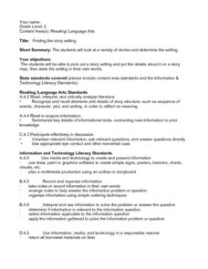
Finding the Story Setting
Second graders discuss important things to know when reading stories, identify setting in variety of stories, create story map to record information as they are reading, state setting in their own words, discuss whether they thought...
Curated OER
Figurative Language and Symbolism
Young scholars identify figurative language and symbolism in poetry as well as prose. In this literary elements activity, students read and discuss the role of symbolism in Yellow Man by Moonlight, A Christmas Carl, The House of Wings,...
Curated OER
Common/Proper Nouns
Students sort word card into two categories (common and proper nouns). They copy the class charts. Students create a table in Word including the headings, common noun and proper noun. They put the correct words onto their chart and add a...
Curated OER
How Can We Keep Our Forests Intact and Have Our Chocolate Too?
Fourth graders explore various methods of growing and harvesting rainforest foods in order to sustain its biodiversity. They discuss the various uses for trees from several viewpoints. Students research chocolate demand and land use...
Curated OER
Ft. Vancouver the Fur Trade: A Skin for a Skin
Students study Fort Vancouver. They discuss trading and what is meant by "a skin for a skin." They complete math story problems that represent possible trading scenarios. They explore the Chinook Jargon trade language.
Curated OER
What Time Is It?
Fourth graders distinguish between analog and digital clocks and read time from both types. In this clock reading lesson, 4th graders discuss the types of clocks and the time zones. Students find times in specific time zones. Students...
Curated OER
Taste Test
Third graders, in groups, complete a science lab in which they perform a blind taste test on eight different foods--some sweet, sour, salty, and bitter. They determine which parts of the tongue "taste" which kinds of foods. they record...
Curated OER
Earth Matters
Students identify Earth's equator, prime meridian, lines of latitude, lines of longitude, parallels, and meridians.
Curated OER
The Research Paper - Searching for a Subject
Students research a website to look for potential topics for a research paper. They develop a narrowed prioritized subject list on an index card (3X5) using word processing program.
Curated OER
Neighborhood Appreciation
Fifth graders examine the neighborhoods around their school. Using maps, they document landmark buildings and community organizations with digital cameras. They write about their journeys and share them with the community.
Curated OER
Kidsville USA
Second graders create an imaginary town using Kid Pix. They demonstrate their knowledge of specific vocabulary words and their knowledge and understanding of location by placing schools, stores, parks, etc. appropriately on their maps.
Curated OER
On the Surface
Students draw and label the 15 major rivers in Texas. They then draw and label another map with the major lakes and reservioirs of Texas. Students use the maps and locate and label the location of the following major Texas cities:...
Curated OER
Where Is Hoku?
Students are introduced to map making and reading. Using maps, they identify the cardinal directions and discuss the importance of a legend. They analyze the human characteristics of the classroom and create overhead view maps of the...
Curated OER
Treasure Hunt Region
Students are introduced to new geography related vocabulary words. In groups, they focus on a different region of the school and develop a new name for it. They create a treasure map for another group to use in the region of the school...
Curated OER
Deforestation
Students identify the different tropical rainforests in the world using a map. In this ecology lesson, students describe the different methods of deforestation. They create a memo and present it to class.
Curated OER
Social Studies: The Lewis and Clark Trail Today
Pupils locate present-day towns along the Lewis and Clark Trail and compare them to towns in 1800, 1900, and 2,000. Working in groups, they conduct Intenet research to locate the wons along the trail and research their history and...
Curated OER
Earth's Surfaces
Students identify and define geology and earth surface vocaulary and their meanings to classify rocks and explore caves and their properties. Students find rocks and test them according to Moh's scale. They create a color coded earth...
Curated OER
Boilermaker Geography
Fifth graders investigate the geography of central Indiana with an emphasis upon finding the location of Purdue. They make a connection to literature with the reading of a newspaper article to create the context for the lesson while...
Curated OER
Ways We Use Water
Fourth graders write a persuasive paper after a demonstration about the properties of water and how they work. The lesson also uses a mind map to outline the paper.
Curated OER
Virtual Field Trip/ Gasoline Cost
Students complete a word problem to determine the cost of gasoline per mile of their virtual field trip. They determine the travel time and gasoline costs for two routes and record the information on a data sheet. They check their work...
Curated OER
Korea Cultural Lesson Plan
Students engage in a study of geography and maps of Korea. They examine charts and graphs. Students are expected to interpret the information accurately and completely. The geography skills can be used on other countries as well.


