Laboratory for Atmospheric and Space Physics
Charting the Progress of New Horizons
In 2006, New Horizons began its mission to fly to Pluto. As it continues its journey, scholars track its progress with the help of an informative website, all the while reinforcing measurement concepts with the construction of a scaled...
Curated OER
Just Draw Me a Map!!!!
Students draw a map to give directions to someone rather then give them too many relative locations.
EngageNY
Forming a Research-Based Claim: Cascading Consequences Charts
Life is all about choices and consequences. Using a Cascading Consequences chart, scholars create a visual map of the effects of a particular choice or action related to water management. With their researcher's notebooks and copies of...
Curated OER
Create A Park Map
Students design ultimate park experience for Florida families as they demonstrate their knowledge of map legend skills.
Curated OER
Charts, Maps, and Graphs Lesson on the Holocaust
Students practice interpreting data. In this Holocaust lesson, students research selected Internet sources and examine charts, maps, and graphs regarding the Jewish populations in and out of Europe. Students respond to questions about...
Curated OER
Using a Concept Definition Map
Students define "natural disaster" by offering examples and charting them to discover what a concept definition map is. Then students create their own maps using the word "city".
Curated OER
Map It With Pixie
Fourth graders use the computer program 'Pixie' to create a topographic, detailed map for the state they live in. In this mapping skills lesson, 4th graders use Pixie to make a map of their state that includes topographic features, state...
Curated OER
Paint My Counties: Map Coloring the Counties of Arizona
Fourth graders identify the counties of Arizona. In this social studies lesson, 4th graders color a county map of Arizona using the fewest number of colors possible. Students write a persuasive paragraph.
Curated OER
Hawaii: A Stolen Star
Explore the islands of Hawaii. Investigate Hawaiian culture and compare their personal traditions to Hawaiian traditions. They locate Hawaii on a map and research the history of Hawaii.
Curated OER
Virtual Field Trip
Are we there yet? Young trip planners learn about their state and plan a trip. They will select sites to see in three cities in their state, and record associated costs in a spreadsheet. While this was originally designed as a...
Curated OER
Landscape Picture Map
Students design a landscape picture map. For this landscape picture mapping lesson, students understand when and why to use a landscape picture map. Students discuss landscape picture maps.
Curated OER
Principles of Flight: Where are We?
Students explore the concept of topographical maps. In this topographical map lesson, students discuss how airplanes know where to fly. Students use topographical maps to simulate a field trip on the computer.
Curated OER
Is there a map in that story?
Eighth graders examine different pieces of literature from specific isolated Pacific islands. In this Geography lesson, 8th graders read and interpret a written selection. Students construct a map of the stories setting.
Curated OER
Right Place, Right Time
Fourth graders complete mathematical word problems. They study the relationships among distance, speed, and time; and measure travel distances. They measure distances using a piece of string and a ruler and practice converting several...
Curated OER
The Great Race
Learners are presented with a story about two individuals running a race in which one is given a head start. Students must map the progress of the runners, create a chart examining patterns and graph the progress. In the end, learners...
Curated OER
Maps, Charts, and Graphs
Students define key geographic terms and track a hurricane on a map. They examine various types of maps and find locations on them,including rivers, cities and mountains.
Curated OER
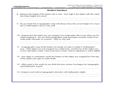
A Watered-Down Topographic Map
Eighth graders explore the ocean floor. In this topography activity, 8th graders compare topographical maps to bathymetric charts. They will create a topographic map and note landmarks and other land features.
Curated OER
Mapping My Pathway
Eighth graders create career portfolios, speak with the school counselor, and develop and educational plan. Individually, 8th graders discuss career options and how an educational plan can assist them in future goals. They explore...
Curated OER
Mapping The Ocean Floor
Young scholars explore and analyze the bottom structure of underwater habitats. They describe and explain what can't see through the collection and correlation of accurate data. Learners assess that technology is utilized as a tool for...
Curated OER
Treasure Hunters
High schoolers design an on campus treasure hunt to find various architectural vocabulary words which they then create definitions for on the blog page on the Environmental Design website.
Curated OER
Exploring the Constellations, a WebQuest Activity
Learners explore space science by participating in a class WebQuest. In this constellation identification lesson, students view star charts based on the four seasons and identify the changes our sky goes through in the course of 12...
Curated OER
Indian Resistance
Students observe the pictures and maps of the Sequoyah Indians. In this Sequoyah lesson plan, students use the maps and pictures to discuss observations and write responses of the Indian point of view.
Curated OER
Mapping the Ocean Floor
Students study the bottom structure of underwater habitats and how they can be mapped.
Curated OER
Using Charts and Graphs to Study East Asia's Modern Economy
Students examine East Asia's modern economy. In groups, classmates use the internet to compare the resources, products, and economy of specified countries. After collecting the data, pupils create charts, tables and graphs. They...

