Curated OER
Mapping Electricity
Students complete Internet research and use their map reading skills to learn about how the United States creates and uses electricity in different states. In this energy sources lesson, students study the mini map of energy usage in the...
Curated OER
Reading a Local and National Weather Map
Students investigate weather maps. In this weather lesson, students discover the meaning of different weather icons and symbols. Working independently, students use the local forecast to correctly label a state map.
Curated OER
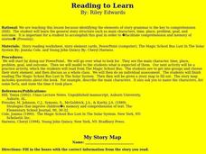
Reading to Learn
Students complete story maps in this lesson. Students read "The Magic School Bus", and get into groups to choose their story element. Each group shares their information with the class. They then complete a story map for a book read...
Curated OER
Weather Maps and Prediction
Second graders point out symbols for high and low pressure that would be found on weather maps. They break into small groups and use a copy of the weather maps file to make observations about the maps and come up with an explanation of...
Curated OER
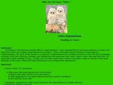
Ollie the Own Says: WHO
Scholars examine the strategy of making a story map or outline to identify the main elements of a story. They discuss the who, what, where, when, why, and how of a story, in an outline form. As a class they read a short story, answer the...
Curated OER
River Run Through It
With vocabulary lists, worksheets, and more, this lesson sets learners on an exploration of the Hudson River area. They read an essay about the area, analyze a relief map of New York State, and complete a worksheet.
Curated OER
Rivers Run Through It
Using a relief map of New York State, learners answer questions about the distance between different cities, identify bodies of water, and more. First, they discuss vocabulary related to the Hudson River area. Then, they complete a...
Curated OER
National Expansion
Students investigate the Manifest Denstiny. They explore how the idea was evident in 19th century American maps. Students brainstorm the relationships between maps and national expansion. They review a map from 1816 that called for...
Curated OER
Christopher Columbus
Help first graders gain an understanding of the beginnings of our nation by learning more about Christopher Columbus. They begin by listening to a read aloud of Christopher Columbus and His Voyage to the New World (another title could be...
Curated OER
Reading a Map
Third graders become familiar with the vocabulary and skills related to mapping. For this guided reading lesson, 3rd graders find proper nouns on from the map. Students read Goldilocks. Students make a map of their room.
Curated OER
Saturday Market by Patricia Grossman
Readers make personal connections to Saturday Market by Patricia Grossman and answer comprehension questions while reading the book. Comparing and contrasting the different characters in a Venn diagram leads to a kinesthetic activity...
August House
How Tiger Got His Stripes
How did the tiger get its stripes? Kindergartners read a Vietnamese folk tale, "How the Tiger Got His Stripes," retold by Rob Cleveland, and work through several reading comprehension and literary analysis activities.
Scholastic
Drones Take Off
Ever wonder what drones are doing high above us in the sky? This article gives your class an insight to what those robots in the sky are doing. After reading an article on drone technology, pupils are prompted to respond to a variety of...
NET Foundation for Television
1850-1874 The Kansas-Nebraska Act
How the Kansas-Nebraska Act created Bleeding Kansas is complicated—until scholars research and examine documents from the time. After completing activities that include mapping, photo, document analysis, and discussion, learners...
NET Foundation for Television
1850-1874 Railroads and Settlement
Have you ever wondered how your town was placed where it is? Scholars research the impact the advancement of the railroad due to the passage of the Kansas-Nebraska Act had on the formation of civilization in the Great Plains. Map...
Curated OER
Story Map
For this reading worksheet, students recall important story elements by filling out a simple story map. Included are setting, author, characters, beginning, middle and end.
Curated OER
Story Map for Bud, Not Buddy
Why should your class complete a story map? After reading Bud, Not Buddy, divide your class into pairs or small groups to complete the included worksheet. They list the main characters, the conflict, main plot events, the resolution, and...
Curated OER
Moving West with the Forts: Using an Interactive Map
Seventh graders practice reading maps and locating the forts stationed in Texas. Using the internet, they analyze westward movements from statehood to the Civil War. In groups, they complete a worksheet about the forts and share their...
Curated OER
Introduction to Age of Absolutism
Who were the absolute monarchs of Europe and what effect did they have on their countries? Young historians begin by naming qualities they believe are important for a monarch to possess. They then take notes on four key factors leading...
California Mathematics Project
Meteorology
See how estimation is essential to making temperature weather maps. Scholars use ratios and rates of change to estimate temperatures at locations where temperature readings have not been made. They connect this idea to linear functions.
The Alamo
The Alamo
Remember the Alamo! Scholars investigate the Battle of San Jacinto during the Texas Revolution. Using models, maps, quotes, biographies, and the Oath of Allegiance, the Alamo comes to life as the stories of those who fought and died in...
North Carolina Consortium for Middle East Studies
Journey of Reconciliation, 1947
After examining the Jim Crow laws and reading primary source materials about the 1947 Journey of Reconciliation, class members create historical markers that honor riders and their journey.
Curated OER
Mapping Districts
Learners become literate in their use of maps. In this 2010 Census lesson plan, students visualize census data on maps, use map keys to read population maps, and explore the concept of population density.
Curated OER
Mapping Districts
Students use maps to learn about the U.S. Census. In this 2010 Census lesson plan, students visualize census data on maps, use map keys to read population maps, and explore the concept of population density.


