Curated OER
World: Political Map
In this world political outline map worksheet, students examine boundaries of each of the countries in the world. This map not is labeled.
Curated OER
World Political Map
In this blank outline map worksheet, students note the political boundaries of the nations of the world on a Mercator projection map.
Curated OER
Asia and the South Pacific: Political Map
In this Asia and the South Pacific map instructional activity, students examine national political boundaries and national capitals in this region of the world.
Curated OER
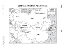
Central and Northern Asia: Political
For this Central and Northern Asia map worksheet, students examine national political boundaries and national capitals in this region of the world. The map is labeled.
Curated OER
Central American Map
In this Central American political map worksheet, learners examine the boundaries of this region of the world. The map may be used in a variety of classroom activities.
Curated OER
Central America: Unlabeled Map
For this Central American political map worksheet, students examine the boundaries of the countries and capital cities located in this region of the world.
Curated OER
Central America Map
In this Central American political map worksheet, students make note of national boundaries and capitals in this region of the world.
Curated OER
World: Continents Map
In this World outline map worksheet, students note the political boundaries of the continents of the world on this Robinson projection map.
Curated OER
World: Continents Map
In this outline map worksheet, learners note the political boundaries of the continents of the world. The map is labeled with the names of the 7 continents.
Curated OER
Asia and the South Pacific : Political Map
In this Asia and the South Pacific map worksheet, students examine the boundaries of the nations in this region of the world. Students also note the location of capital cities as they are denoted by stars. Major bodies of water are labeled.
Curated OER
Eastern European Studies
One worksheet, three projects. Learners explore Eastern Europe and mark Eastern European countries on a map. They then collect and record census data on thirteen different countries, and write a 3-5 page expository essay on one of the...
Curated OER
Central America Outline Map
For this Central American political map worksheet, students make note of national boundaries and capitals in this region of the world. National capital city locations are noted with stars.
Curated OER
Central America Outline Map
In this Central American political map worksheet, students make note of national boundaries and capitals in this region of the world. National capital city locations are noted with stars.
Curated OER
Central America Outline Map - Labelled
In this Central American political map worksheet, students make note of national boundaries and capitals in this region of the world. National capital city locations are noted with stars.
Edline
How Did the Unification of Germany Change the Course of World History?
Here you'll find a nice guided notes learning exercise on Otto von Bismarck, which details Bismarck's plan to unify Germany, as well as asks learners to analyze his motivations and overall impact.
Curated OER
World: Continents
In this blank outline map worksheet, students note the political boundaries of the continents of the world on a Robinson projection map.
Curated OER
South east Asia and the South Pacific: Political: Labeled Map
In this Asia and the South Pacific map worksheet, students examine the boundaries of the nations in this region of the world. Students also note the location of capital cities as they are denoted by stars. This map is labeled.
Curated OER
Eastern Hemisphere Map
In this Eastern Hemisphere polar map worksheet, students examine the Eastern Hemisphere including the political boundaries formed by the countries in this region of the world.
Curated OER
Where Am I? Map Activity
In this map activity worksheet, learners determine which countries are shown on a set of 16 maps, then read facts about each country designed to help with a report on that country.
Curated OER
Causes of World War II
In this World War II worksheet, students view a PowerPoint presentation on the war and then respond to 82 short answer questions about the content of the presentation. The PowerPoint presentation is not included with this worksheet.
Geography 360°
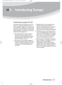
Introducing Europe
Provide your learners with a comprehensive introduction to Europe with this great set of worksheets. Map activities include matching European countries to their capitals and places on a political map, as well as...
Curated OER
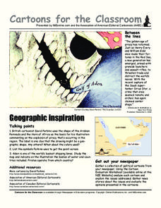
Cartoons for the Classroom: Geographic Inspiration
In this current events worksheet, students analyze a political cartoon about piracy near the Arabian Peninsula and respond to 3 talking point questions.
Curated OER
Cartoons for the Classroom: Geographic Inspiration
A wonderfully graphic cartoon entices learners to read more about issues near the Arabian Peninsula. They will use the provided cartoon and critical thinking question to practice building their analytical and critical thinking skills....
GCSE Modern World History
Mao's China
Here is a great textbook chapter on China's establishment as a communist state in 1949 and the effects of World War II on the nation. The first page prompts learners to complete a timeline activity as they read the material,...
Other popular searches
- Political Map of World
- Blank World Political Map
- World Political Map Labeled
- Political Map of the World


