Curated OER
Remote Sensing and Landsat Satellite Imagery
Students comprehend how satellites use remote sensing to produce images. They use supervised classification with Landsat images. Students recognize that the earth's surface has different basic land surfaces that reflect/emit different...
Curated OER
IMAGE Satellite and Solar Cells
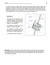
In this IMAGE satellite and solar cells worksheet, students calculate the surface area of the satellite in order to determine how much electrical power can be generated by the solar cells.
Discovery Education
Satellite Telemetry
Satellites require rockets to launch, but it doesn't take a rocket scientist to understand them. Future engineers learn about how satellites send data to Earth and how to interpret satellite images. They see how radio waves play a role...
Curated OER
Annotating Change in Satellite Images
Students construct a movie using Landsat images to observe changes over time on Earth. In this satellite images lesson, students observe changes in land use over time and document one type of change they observe. They produce an...
Curated OER
Satellites and Solar Cells
In this satellite and solar cells learning exercise, students determine the electrical power generated by the solar cells on the IMAGE satellite. Students solve 3 problems including finding the usable area of the satellite, determining...
CK-12 Foundation
Satellites, Shuttles, and Space Stations: Satellites in Orbit
Blast off! How do satellites, space shuttles, and space stations escape Earth's gravity and achieve orbit? Young astronauts study rocket science (literally) with an interactive lesson. They discover the four main uses for satellites, how...
NASA
NASA Visualization Explorer
Read some of the most up-to-date information available from NASA's current Earth and space research! Along with showcased stories, you will find computer animations and satellite images that help you to view what humans cannot see with...
Curated OER
Imagers: The Adventure of Echo the Bat Number to Pictures: How Satellite Images are Created
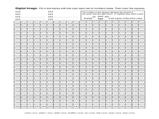
Students examine the three primary colors of light and design a numerical code to represent those colors. They tell how satellites use numbers to create satellite images after completing a number of experimental activities.
Curated OER
Amelia the Pigeon: As a Pigeon Flies
Students follow Amelia's adventure on a satellite image. They use measuring and math skills to determine the distance she traveled.
Curated OER
Orbital path of Landsat
Students comprehend how Landsat satellites orbit teh Earth to produce images. They comprehend the elliptical path of satellites. Students recognize that a different orbital path is needed for different satellites to perform their tasks....
NASA
The Saturn System Through the Eyes of Cassini
Get a close-up view of Saturn. Pupils read a NASA eBook filled with images of the Saturn system, including the rings and moons of Saturn along with images of the planet itself. Learners become familiar with the planet's system as they...
Curated OER
Image Classification
Students explore what are "multi-spectral" or "multi-band" images? They investigate how landscapes change over time- at least over the time-span of satellite imagery, particulary due to human influences. Students explore how to train...
Curated OER
Exploring Biomes Lesson 1: Mapping Biomes
Environmental science learners examine satellite imagery of temperature, vegetation, precipitation, and productivity. They use these maps to understand how scientists divide the planet into major biomes. As part of a larger unit on...
NOAA
Ground-truthing Satellite Imagery with Drifting Buoy Data
Ground-truthing ... is it even a word? The last installment of a five-part series analyzes how scientists collect sea surface temperature data. Scholars use government websites to compare temperature data collected directly from buoys...
Space Awareness
A View From Above
Analyzing and interpreting satellite data takes knowledge and patience. Through a detailed lab investigation, young scholars learn the process of analyzing this data. They use technology to create color images and maps from real...
American Museum of Natural History
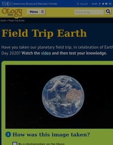
Field Trip Earth
Take a field trip around Earth by way of satellite images. Learners watch a video lesson that describes different images taken from orbiting satellites. They then test their visual skills in a 14-question online quiz.
Association of American Geographers
Project GeoSTART
Investigate the fascinating, yet terrifying phenomenon of hurricanes from the safety of your classroom using this earth science unit. Focusing on developing young scientists' spacial thinking skills, these lessons engage learners in...
NASA
Speaking in Phases
Hear from deep space. Pupils learn how satellites transfer information back to Earth. They learn about three different ways to modulate radio waves and how a satellite sends information with only 0s and 1s. Using sound, class members...
Curated OER
Satellite Mobiles K-2
Students explore satellites and their function. They view a photo essay about the many kinds of satellites and the jobs they do. Afterwards, they construct satellite mobiles, discuss the various features of their satellites, as well as...
Curated OER
The Global Precipitation Measurement Mission (GPM) Lesson
Introduce your class to one of the ways that technology is benefiting humanity. The Global Precipitation Measurement Mission involves the data collected by nine satellites from different countries with a united focus on studying world...
Curated OER
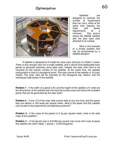
Optimization
In this optimization of satellites worksheet, students read about the Octagonal IMAGE satellite and solve 4 problems related to the size and shape of the satellite and the solar cells used to power the satellite. Students find the mass...
Curated OER
Coronal Mass Ejection
In this coronal mass ejection worksheet, students read about the coronal mass ejections detected by the IMAGE satellite and the Hubble Space Telescope resulting in auroras. Students solve 6 problems and determine the speed of the coronal...
International Technology Education Association
Pixel This!
Did the image I drew match the image you saw? By simulating a satellite and a ground station, teams of two transmit data in the form of pixels in order to recreate an image. They use four different levels of brightness, creating slightly...
Curated OER
Digital Images: From Satellites To The Internet
High schoolers examine digital images and how satellites orbiting Earth send information and pictures to Earth over the Internet. They use a digital camera to put pictures on a computer and decode a satellite image from space.


