Compton Unified School District
How Can We Locate Places?
How can we locate places? Maps, of course! Expose second graders to the tools available in maps and discuss how these tools can help people find locations. Students also look at communities, including what makes a community and the...
Curated OER
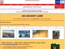
Australia- An Ancient Land
In this online Australia- An Ancient Land worksheet, students use the links to answer questions about the landforms, and ancient life of the country. They look at pictures and internet sites to find the answers to 11 short answer questions.
Curated OER
Sculptured Landscapes
Students research glaciers, how they are formed and what kind of landforms they carve out of the rock they pass over. They organize their findings into a mock newscast in a presentation for the class.
Curated OER
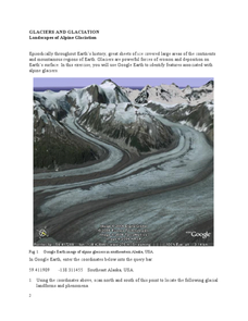
Landscapes of Alpine Glaciation
In this glaciers worksheet, students use Google Earth to look for examples of different glacial landforms and phenomena. Students complete 2 short answer questions.
Curated OER
Physical Geography of Africa
Fifth graders investigate the topography of Africa. In this physical geography instructional activity, 5th graders research the six regions of Africa and complete a physical map. Students locate various landforms in Africa. Students...
Curated OER
Earth Structure and Processes
Students classify different rocks according to their types. In this earth science lesson, students explain how plate tectonics created Earth's landforms. They explain the continental drift theory and sea floor spreading in their own words.
Curated OER
U.S. Geography for Children: The Northeast
In this map skills of the northeastern United States worksheet, students observe an outline map, locate and label the states, and designated landforms and bodies of water; and create symbols and a map key for sources of economy and other...
Curated OER
U.S. Geography for Children
In this U.S. map activity worksheet, students observe maps of the continental United States, Hawaii, and Alaska, locate and label landforms and bodies of water, and create symbols for natural resources and places of interest. Students...
Curated OER
Map Your State: Regions of Arizona
Fourth graders define vocabulary and locate physical features on maps. In this mapping lesson plan, 4th graders explore regions of Arizona through landforms found on topographic maps. Students research the history and culture of the...
Curated OER
Windbreakers; Earth Science, Topography, Weather
Learners consider how topography affects weather and human activity. Students simulate a mountain range and observe surrounding wind patterns.
PBS
Regional Patterns of Climate: Pacific Northwest
Climate systems involve sunlight, ocean, atmosphere, ice, land forms, and many other factors. Scholars explore each of these variables related to the Pacific Northwest rain forest. They use an online interactive to investigate the polar...
Curated OER
Surveying the Land
Students explore the different kinds of maps and the purpose of each. In this Geography lesson, students work in small groups to create a map which includes the use of a map key.
Curated OER
Rivers, Maps, and Math
Students use maps to locate and label the major rivers of North and South America. Using the internet, they identify forests, grasslands, mountain ranges and other landforms on the continents as well. They compare and contrast the...
Curated OER
Earth's Land and Water
Students describe physical characteristics of bodies of water and landforms. In this land and water lesson plan, students model land and water with modeling clay and also discuss why people live near bodies of water.
Curated OER
Rock Cycle
Third graders identify various types of landforms of the United States. They discuss earth movements that produce geologic structures and landforms and define cycle as it relates to rocks and soil. They demonstrate the processes forming...
Curated OER
Virginia Geographic Regions
Third graders observe the five geographic regions of Virginia which have distinctive characteristics based on their landforms and bodies of water. They then describe the types of landforms and bodies of water in the region where they live.
Curated OER
Pass the Plate
Students define constructive forces. They describe how landforms are created as a result of constructive forces. Students recognize active volcano areas in the United States. They demonstrate an understanding of Panagea.
Curated OER
Plate Tectonics
Students identify that most of mountain ranges found on all major land masses and in the oceans are external reflections of tectonic movements within the earth. They identify that earthquakes and related phenomena are caused by the...
Curated OER
Create a Travel Brochure
Pupils determine how geography affects how people live, work and play. They identify the different landforms in the three regions of Peru and create a travel brochure highlighting Peru's attractions.
Curated OER
Plate Tectonics
Students examine plate tectonics and landforms. For this plate tectonics lesson students complete an activity. Students practice drawing maps that show different fault lines and the land formations that were caused.
Curated OER
California Regions
Students explore and compare and contrast the four main regions of California: mountains, coast, central valley, and desert. students use pictures and research to describe how regions vary in land use, vegetation, wildlife and climate.
Curated OER
The Great Continental Drift Mystery
Students stud the concept of Pangaea by using Wegener's clues to construct a map of the continents joined together. They determine how fossil distribution can be used to enhance the study of continental drift. They locate the...
Curated OER
Geographic Context for War
Students explore the geography of Korea. In this Korean War instructional activity, students examine maps of the country and label landforms, bodies of water, climate, population centers, and neighboring countries to determine the...
Curated OER
The Country of Chile - Map Work
In this map worksheet, students label a map of Chile by following 11 directions given at the bottom of the page. They label landforms and water bodies associated with the country.


