Curated OER
How Much Land Does It Take To Produce Your Food?
Students calculate the amount of land required to produce the food eaten by an individual for one year and compare the amount of land required to produce animal versus plant products. They use calorie counting resources to compile the...
Curated OER
Land Use Issues
Students participate in activities in which they examine land use. They examine the types of animals in a surrounding and how they blend in with the environment. They also examine food resources.
Curated OER
Does Cloud Type Affect Rainfall?
Student uses MY NASA DATA to obtain precipitation and cloud type data. They create graphs of data within MY NASA DATA. They compare different cloud types as well as precipitation types. They describe graphs of the precipitation and cloud...
Curated OER
Machines Rice Farmers Use
Second graders investigate rice farming. In this farming equipment lesson, 2nd graders discover what type of equipment is needed to get rice farms ready to plant. Students gain knowledge about what a combine does and how it is important...
Discovery Education
School of Rock
Why do rocks break down over time? Learners explore this concept by simulating physical and chemical weathering of different types of rocks. They use an abrasive to demonstrate physical weathering and acid to demonstrate chemical...
Oregon State
World Map of Plate Boundaries
Young geologists piece together the puzzle of plate tectonics in an earth science lesson. Given a physical map of the world, they search for land formations that indicate the location of different types of plate boundaries.
Space Awareness
Valleys Deep and Mountains High
Sometimes the best view is from the farthest distance. Satellite imaging makes it possible to create altitude maps from far above the earth. A three-part activity has your young scientists play the role of the satellite and then use...
Cornell University
Study Soil
What's in soil? Young scientists study the pH levels of soil from their school yard. They observe the land and area the soil came from to decide if location has anything to do with acidity level.
Curated OER
Landform Dictionary
Third graders use a word processing program to create a working dictionary, including definitions and pictures, of physical land forms used in the study of different regions of the world.
Curated OER
Surveying the Land
Students explore the different kinds of maps and the purpose of each. In this Geography lesson, students work in small groups to create a map which includes the use of a map key.
Curated OER
How Did That Get There?
Students evaluate the role of government in addressing land use and other environmental issues. They analyze the powers, responsibilities, and limitations of elected and appointed officials in the national legislative, executive, and...
Curated OER
Impervious Surfaces
Young scholars comprehend impervious surfaces. They recognize the problems caused by impervous surfaces. Students observe how land use can influence impervious surfaces. They chose four of the seven basic land surface, young scholars...
Curated OER
Soils
Students apply knowledge of soil, environmental impacts, economics, multiple human demands, and use given data for a proposed scenario in making land use decisions. They debate land use issues and/or scenarios and discuss a case study.
University of Wisconsin
Noting Notable Features for Rain Gardens
Eight groups in your class are each responsible for a different aspect of surveying the campus for a suitable rain garden location. Features to consider include water flow, topography, sun/shade patterns, land surface, vegetation,...
Curated OER
Earth's Water
If the majority of our planet is covered with water, why do we need to bother conserving it? With a thorough and varied investigation into the location and types of water on the earth, learners will gain an understanding of why this...
McGraw Hill
Lines and Angles
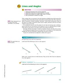
Why was the obtuse angle upset? Because it was never right! A valuable resource is loaded with background information on types of angles and lines. Learners review the characteristics of parallel, perpendicular, and intersecting lines,...
CK-12 Foundation
Topographic and Geologic Maps: Topographic Maps
Maps are great for helping you get where you're going, but what does that place actually look like? Geology scholars compare and contrast the features of topographical and geologic maps using an interactive lesson. The resource describes...
Richmond Community Schools
Map Skills
Young geographers will need to use a variety of map skills to complete the tasks required on this worksheet. Examples of activities include using references to label a map of Mexico, identify Canadian territories and European countries,...
Big History Project
Human Migration Patterns II
While humans have always been on the move, the period between 1400 and 1800 saw vast migrations of people between the East and the West. These migrations—whether through slavery or a desire to colonize new lands—shaped the modern world....
Curated OER
Ecosystems
Students role play as members of interest group with a stake in a local land use issue. In preparation for the town hall meeting, students research their issue and gather pertinent information to persuade their audience.
Curated OER
Classification and Adaptations- Streams, Rivers, and Lakes - Where the Land Meets the Sea And Caribbean Reef
In this science worksheet set, students answer 14 short answer questions about the classification and adaptation of life in streams, rivers, and lakes. They also answer 15 questions about life "Where the Land Meets the Sea" and in a...
Curated OER
Types of Faults
This set of black-line diagrams of the three different types of faults can be used with your upper elementary earth scientists. Simply have them color the layers to show where the land once lined up. Another use for this resource would...
Curated OER
How Much Land Does It Take To Produce Your Food?
Students calculate the amount of land required to produce the food eaten by an individual for one year. They compare the amount of land required to produce animal versus plant products. Students visualize the areas of land calculated.
Curated OER
Land as a Valuable Resource
Students investigate why the soil is important to our lives. In this natural resources lesson, students have a farmer as a guest speaker. Students begin to understand how farmers use and protect our natural resource. Students write...


