Artisan Global
QuakeFeed Earthquake Map, Alerts and News
Amateur seismologists explore Earth's earthquakes in real time using a variety of map styles and parameter selections.
Just Health Action
Environmental Justice Matters: Mapping Environmental Justice Impacts (Part 1)
A case study of Seattle, Washington permits class members to compare and rank how different areas of Seattle are impacted by environment burdens. Groups investigate different zip codes, collect data on five categories, and color-code a...
Space Awareness
Valleys Deep and Mountains High
Sometimes the best view is from the farthest distance. Satellite imaging makes it possible to create altitude maps from far above the earth. A three-part activity has your young scientists play the role of the satellite and then use...
University of Richmond
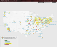
Mapping Inequality: Redlining in New Deal America 1935-1940
Redlining—or the practice of racial discrimination in housing loans—directly led to today's segregated living patterns in America. Using data from the federal Home Owners' Loan Corporation, classmates visualize the impact of policy on...
Curated OER
Orienteering: Map Skills
Students use a map to locate six specific landmarks on a course using a map. They identify how maps can help us and write a paragraph describing how to get from one landmark to another on the map.
Curated OER
Color-Coded Sentence Diagrams
Young scholars read Ruth Heller's books and learn to identify various parts of speech. They label words according to the parts of speech and use the words to form simple and then more complex sentences. Afterward, they analyze sentences...
Curated OER
Learning a New Environment
Students review a school map with color-coded markers and use it to locate classrooms, bathrooms, library, principal's office, etc. They color a school map, cut it into puzzle pieces and then reassemble the pieces.
Curated OER
Sea Ice: Unscrambling the Egg Code
Students determine sea ice thickness, concentration, and floe size by reading egg codes. In this sea ice conditions lesson, students color code a map based on prescribed criteria and use the maps to identify changes in sea ice...
Curated OER
Color Enhanced Maps
Students download or create maps with numerical weather data. They add isolines and color to create regions on their maps. They explore the visual properties of color palettes and create a visualization applying their knowledge.
Curated OER
Ancient River Valley Civilizations
Ziggurats, cuneiform writing, the Tower of Babel, hieroglyphics, pyramids, the Great Wall. Launch a unit on ancient cultures, with a presentation that introduces viewers to ancient Mesopotamia, Babylonia, Sumer, Egypt, Indus, and China....
Reporters Without Borders
2017 World Press Freedom Index
Freedom of the press was seen as a right so important that the Founding Fathers listed it as part of the first amendment to the United States Constitution. Americans pride themselves on this freedom, but just how free are American...
Curated OER
Water Conservation
Open learners' eyes to the challenge of finding safe drinking water – something we often take for granted in our country. The PowerPoint presentation includes images, graphs, diagrams, and even a video to stimulate discussion on how we...
Curated OER
Wales: An Interdisciplinary Unit
Students practice basic map and geographic skills as they compare Oregon to Wales. Students color map of Wales and Oregon using color codes to distinguish between land, water, and bordering nations or states, listen to stories and...
Curated OER
Continents and Oceans
Students identify oceans and continents and their locations on a map. They color-code and label their own map of the world's continents and oceans. They play the game Continents and Oceans to identify specific areas.
Curated OER
Majority Rules
Students color code a map of the United States and label the amount of Electoral votes each state has. In this Electoral College lesson plan, students conduct a vote of their own.
Maths Revisions
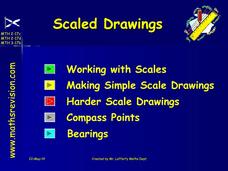
Scaled Drawings
Your carpenters will enjoy learning scaled drawing techniques and applying their new knowledge to make some real-life scale drawings of gardens. Your carpenter scholars will be reviewing some basic skills in a warm-up section of problems...
ProCon
Electoral College
The Electoral College's role in elections is sometimes confusing and controversial. Pupils use a debate topics website to research the pros and cons of the practice to debate whether the United States should still use the Electoral...
ProCon
Obesity
Is obesity a disease or just a preventable risk factor for other diseases? Scholars attempt to form their own opinions by reading a background of the issue and watching videos that explore the main pro and con arguments using an included...
ProCon
Drug Use in Sports
The ancient Greeks used performance enhancing drugs, such as opium juice, when they participated in the original Olympic Games. Pupils research a website with debate topics to decide if athletes' use of such drugs in modern sports is...
Curated OER
North Carolina Salt Dough Map Social Studies Project
In this lesson, North Carolina Salt Dough Map, 4th graders create a salt dough map of North Carolina, Students use dough to form the shape of the state of North Carolina. Students label the three regions of North Carolina and all of...
Curated OER
Location on a Grid
Make coordinate pairs more engaging by having beginners color-code a grid based on given locations. The grid has numbers along the y-axis and letters along the x-axis, introducing them to the ordering of coordinate pairs with the x-axis...
Curated OER
The Country of Venezuela
For this map skills of Venezuela worksheet, students use an outline map to find an label important cities landforms, and bodies of water. Students label and color code 10 answers.
Curated OER
The Mussels Are Coming
Young scholars work together to identify and describe the various types of mussels. Using a color-coded system, they plot the arrival date of zebra mussels in North American waters. They discuss the increase in their population with the...
Curated OER
North American Biomes
In this Science worksheet, learners color a biome map of North America. Students color the map by solving the clues listed on a separate sheet of paper.


