Curated OER
What State Are You In?
Students identify the major U.S. cities. In this U.S. geography instructional activity, students work in pairs and use game cards to name various cities in the United States.
Curated OER
What Lives in the Open Ocean and Where Do They Live?
Young scholars explore oceanography by participating in a flash card activity. In this ocean inhabitant lesson, students define a list of ocean related vocabulary terms and answer ocean geography study questions. Young scholars utilize...
Curated OER
Straberry Girl: Florida's Location and Shape
Learners explore geography by reading a story about Florida. In this Florida vegetation lesson, students read the book Strawberry Girl and identify the locations in Florida that are mentioned in the book. Learners identify the type of...
Curated OER
Journeys...The Voices of Change
Students trace the immigration patterns of their ancestors. They plot information on a world map, develop a timeline of target immigration patterns, research and write a report on immigration and participate in a class play.
Curated OER
Social Studies: Geographic Regions
Third graders create Powerpoint presentations about the five themes of geography in regions of the United States. They focus on the Northeast, Southeast, and Midwest regions. Students use both pictures and words in their shows.
Curated OER
The Global Grapefruit - Representing a 3-Dimensional Globe on a 2-Dimensional Map
Students compare and contrast world maps and globes. They convert a 3-dimensional globe to a 2-dimensional map. They are introduced to the Mercator map projection. They observe map distortions of shape, area, distance, directions and angle.
Curated OER
What Color is the Ocean?
Learners view satellite pictures of the ocean, and discuss the presence of phytoplankton and the colors of the ocean. Students compare/contrast ocean satellite images with maps and globes, then color world maps to replicate the satellite...
Curated OER
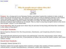
Why do people mover where they do?
Students read factual stories of migration to Hawaii, analyze and explain push and pull factors, interview parents about their cultural heritage, identify countried of origin of their ancestors, graph migration patterns on an world map,...
Curated OER
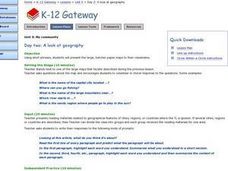
A Look at Geography
Students discover geographical places and terms in another language. In this geographical identification lesson, students utilize their geographical vocabulary to describe to other classmates where they would like to go or where...
Curated OER
Geography Made Fun with Technology
Learners incorporate knowledge box into their classroom activities. In this technology integration lesson plan, students fill out a graphic organizer using Glossopedia to analyze a new subject.
Curated OER
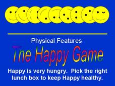
The Happy Game: Physical Features
Students love to test their knowledge, use this game to see what your students know about landforms and other basic geographic terminology.
Curated OER
Rivers Run Through It
Using a relief map of New York State, learners answer questions about the distance between different cities, identify bodies of water, and more. First, they discuss vocabulary related to the Hudson River area. Then, they complete a...
Agriculture in the Classroom
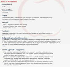
Wad-a-Watershed
What kind of impact do humans have on watersheds? Find out in a lesson that defines, explores, and promotes ways to protect our watersheds. The ultimate goal of the lesson is for learners to discover how a watershed is impacted by...
Roy Rosenzweig Center for History and New Media
American Indians and their Environment
People could take a page in ingenuity and survival from the Powhatans. Deer skins became clothes, and the members of the Native American group farmed the rich Virginia soil and hunted in its forests for food. Using images of artifacts...
University of Texas
Let's Go to Argentina/¡Vámonos a Argentina!
Give your young Spanish language learners a lesson in culture! Focus on learning Spanish though exploring Argentinian culture. Pupils interact with maps, fill out travel journals, discuss time and food, learn and practice new vocabulary...
Council for the Curriculum, Examinations and Assessment
Victorian Historians
Take the class back in time to the Victorian Era! The resource provides a plethora of activities that create experiences for scholars in class. Some activities include a fun fair, viewing the starry-night painting, and even experiencing...
Arcademics
Capital Penguin
Hop across the country like a penguin from ice floe to ice floe using an interactive video game. Acting as a penguin, learners match capitals to their states. Game features allow teachers to set up competitions and check learning progress.
National Wildlife Federation
Sensory Discovery Walk
Let your senses be your lead. Pairs of pupils blindfold their partners and then lead them around nature areas. They use their senses to find landmarks and create maps with their findings. Once they create their maps, they go back to the...
K12 Reader
Location, Location, Location
Why do some places in the world have more people living there than other places? Learn about the ways the countries have formed around natural resources with a reading comprehension activity. After kids read a short...
pps.k12.or.us
50 States
An absolute must-have for your unit on the 50 states, this resource contains reading handouts, activity-based worksheets, and comprehension questions for each and every one of the United States of America.
DocsTeach
Around the World with First Lady Pat Nixon
Travel the world with the First Lady! Academics study images from Pat Nixon's travels as First Lady to discover her role in Richard Nixon's presidency. Historians match images to world locations, complete a worksheet, and...
Curated OER
Mapping Martin Luther King Jr.
Students examine geographic locations that were important in Martin Luther King Jr.'s life. They research Martin Luther King Jr., and create U.S. maps that show the locations important to him.
Curated OER
Mapwork: A Place In the News
Students determine how to find geographic information about places they read about in the news. In this geography lesson, students look at political and physical maps to determine the difference. They access maps online to find the...
Curated OER
Physical Features
Students draw physical land features using ClarisWorks or Kid Pix, write their definitions, create slideshow, and create class geography book.
Other popular searches
- Five Themes of Geography
- U.s. Geography
- China Geography
- Africa Geography
- Mexico Geography
- Canada Geography
- Asia Geography
- France Geography
- Japan Geography
- World Map
- Ireland Geography
- Geography Studies


