Curated OER
You Can Find It!
Pupils locate different places including U.S. cities using longitude and latitude coordinates. In this longitude and latitude lesson plan, students locate 10 different locations.
Curated OER
Columbus' Perception of the New World
students investigate readings relating to the voyage of Columbus in 1492 and to make historical connections based on those readings. They form pairs to share insights and answer specific questions, and share information in a final class...
Curated OER
Underground Rails: The New York City Subway System
Students explore the New York Subway system. They investigate its usefulness as mode of transportation for the people in the city and study its history compared to other city subway systems. They examine how the subway connects the...
Curated OER
Sunshine Math- 1
In this problem solving worksheet, students complete 7 word problems that include telling time, maps, place value, fractions, and patterns. Note: The first page of this looks slanted, but is legible.
Curated OER
Environmental Issues
Students expand environmental awareness by brainstorming list of environmental issues in the world today, researching issues in small groups, and displaying their work for classmates to see.
Curated OER
Oceans Away
Students explore oceans. In this science lesson plan, students locate oceans, seas and continents of the world, identify ocean-related occupations, and complete activities pertaining to food chains as well as pollution.
Curated OER
What Color is the Ocean?
Learners view satellite pictures of the ocean, and discuss the presence of phytoplankton and the colors of the ocean. Students compare/contrast ocean satellite images with maps and globes, then color world maps to replicate the satellite...
Curated OER
Lesson: Journey of a Tree
Third graders explore the operation of a Christmas farm and how trees are shipped. After taking a tour of a Christmas tree farm and researching transportation, location and cost issues, 3rd graders create a map to show the distribution...
Curated OER
Foods and Languages of the World
Young scholars review Mexico's location and language and learn to pronouns 10 new Spanish food words. Students listen as the book, Corn is Maize is read, touching and passing around an ear of Indian corn. Young scholars discuss the...
Curated OER
Communities Around the World
Students investigate the idea of community by taking a field trip. In this civics lesson, students participate in a supervised walk around their neighborhood while identifying characteristics and objects that make their home town...
Curated OER
Mapping the Circulatory System
Students investigate the circulatory system in human beings. In this human body lesson, students create an outline of a human body using colored markers and butcher paper. Students use red and blue colors to simulate the...
Curated OER
Wonders of the World
Third graders examine two-dimensional objects and create a 3-D image of the object. They make models of the Taj Mahal and buildings in Delhi.
Curated OER
Folktales around the World (Middle, Reading/Writing)
Students analyze, synthesize, and use the elements of various US cultural folk tales to describe the elements of fiction in general and in folk tales specifically.
Curated OER
You Got The Whole World In Your Hands: Geology, Earth's Layers, Science
Students make a model of the Earth's crust out of foam in order to better explain the make-up of the Earth's layers. They add continents and oceans.
Smithsonian Institution
The Sounds of an Island: Jamaican Music for the Classroom
Introduce young explorers to the music and history of Jamaican culture through game songs and dances. As a bonus, class members get to play simple songs transcribed for the recorder.
Curated OER
The Seven Continents Scavenger Hunt
Who doesn't enjoy an engaging scavenger hunt? Here, scholars listen to, and discuss, the informative text, Where is my Continent? by Robin Nelson. They then explore the seven continents and four major oceans using...
Curated OER
Where Am I, and How Do I Get Where I am Going?
Students describe geographical places through art, music, writing, and math. They compile information in booklets which may be published.
Centers for Ocean Sciences
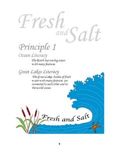
Ocean and Great Lakes Literacy: Principle 1
Is your current lesson plan for salt and freshwater literacy leaving you high and dry? If so, dive into part one of a seven-part series that explores the physical features of Earth's salt and freshwater sources. Junior hydrologists...
Curated OER
Cartography
Students research about cartography and how to be a cartographer. In this math activity, students draw a map of their classroom. They use a robot to explore navigation using a compass rose.
Curated OER
Investigating Haiti
Students engage in a instructional activity that is about the island of Haiti. They conduct research using a variety of resources. The information is used in order to help students locate the island on a map. They answer questions while...
Curated OER
Becoming A Local Historian
Students practice the art of being a historian. They compare primary and secondary resources to conduct a critical thinking assignment. Students compare the map of the Baton Rouge area to a modern one in order to make inferences about...
Curated OER
Nunavut, Our Communities
Students locate the communities of Nanavut on a territorial map and identify community characteristics. They research the online Atlas of Canada
Curated OER
LA CENERENTOLA (Cinderella)
Students work in groups to create a map key. The map key represents the diversity of each of the Cinderella stories previously read. They explore the cultural dimensions and contributions of the arts.
Curated OER
Tear the Continents
Students tear paper into representative continent shapes and configure them with world oceans through relative location, direction and latitude and longitude starting points. They recognize the shape of the continents. Students recognize...
Other popular searches
- World War Ii Map
- World War I Map
- World War 2 Map
- World War I Outline Map
- World Climate Map
- World Biomes Map
- World Outline Map
- Blank Map of the World
- World Political Map
- Ancient World Greece Map
- World Time Zone Map
- Deciduous Forests Map World
