NASA
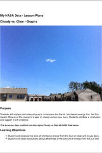
Cloudy vs. Clear - Graphs
Explore the link between solar energy and cloud cover using real data from NASA from China! Future climatologists analyze and interpret graphs of solar energy on clear and cloudy days using a literacy cube. Investigators draw conclusions...
Curated OER
Say "Thank You" in 100 Languages!
Young scholars put the "Thanks" back in Thanksgiving with this geography and language activity that teaches students to say "thank you" in many languages.
Curated OER
Every Grain Counts
Students research a variety of facts about rice. They read books, access information on the Internet and use maps to determine major rice growing areas in the world and the patterns of distribution for this crop. Students create maps to...
Curated OER
Jewish Diversity: Travels of Jewish Foods and Jewish Families
Young scholars are introduced to Jewish history thorugh food and various ingredients. As a class, they read a passage from the Bible about the exodus from Egypt and answer discussion questions. They make traditional Jewish meals with...
Curated OER
Pilot Takes Off in Kid-Built Plane
Young scholars read a current events news story an answer vocabulary and comprehension questions. In these real world lessons, student use the internet to watch video clips, read blogs, and research pertaining to the planes and pilots....
Curated OER
Asian Americans: Where Do They Come From?
Students identify 15 places (14 countries plus Hawaii) from which large populations of Asian Americans originate. They create a graph to help themselves visualize the places from which large populations of Asian Americans originate. Then...
Curated OER
Testing the Waters
Students explore water in depth through discussion, research, and experiment. Students apply map skills to locating particular regions of the world as they relate to water. Students predict water quality based on information researched...
Curated OER
Snacks in a Bag
Learners brainstorm a list of their favorite snacks. Using clues, they identify the type of snack being described. On a map, they identify and locate the origin of the ingredients used to make it. They write their own clues for...
Curated OER
Back-to-school ESL Ideas
Students share their countries and languages, flags, cultural identity, and pride in home culture.
Curated OER
Lori Schmidt's Lovely Lesson
Young scholars color code a world map by region to show the different amphibians and reptiles that live there. They discuss the Nile Crocodile, Snapping Turtle, Komodo Dragon, Indian Python, and Lacertidae. When completed, they create a...
Curated OER
Island Countries
Students define the meaning of an island. In this island mapping lesson, students identify islands on the map. Students discuss the sizes of various islands.
Curated OER
Geography of the English Settlements
Third graders locate several important American colonial cities on a map and research how their proximity to water and nearby arable land affected the rate and success of settlement.
Curated OER
Cool Coral Reefs
Students identify, color and label the continents of the world and the equator. They identify and produce water temperature between 74 and 78 degrees. They identify and discuss the term polyps and construct a colony of polyps.
Curated OER
On the Road Again": Moving People, Products, and Ideas
In this lesson students learn how to identify modes of transportation and communication for moving people, products, and ideas from place to place. Students also study the advantages and disadvantages of different modes of...
Curated OER
The American Rainbow
Third graders are introduced to the concept of ancestry. Using their own family, they gather information related to the family roots. In groups, they locate the countries on a map and discuss the concept of migration. They identify...
Curated OER
On the Surface
Students draw and label the 15 major rivers in Texas. They then draw and label another map with the major lakes and reservioirs of Texas. Students use the maps and locate and label the location of the following major Texas cities:...
Curated OER
Our Way of Life
Students interview Native American Elders about animal migration, traditional food gathering, and subsistence. They research endangered animals, draw a game cycle, and create maps of local migration of animals.
Curated OER
Naming Roads
Young scholars investigate the aspects of a historic map of roads and trails in the Southeastern United States. They explore reasons for giving roads certain names and decide on names for other roads themselves.
Curated OER
Surface Water Supplies And The Texas Settlements
Students engage in a lesson that is concerned with the allocation and finding of water resources. The location of different settlement areas is considered as one looks how the water is distributed. They map some of the early Spanish and...
Curated OER
Plot Studies
Third graders are introduced to how to properly read a plot map. As a class, they take a field trip to an area surrounding the school and work together in groups to examine small sections of the different environments. To end the...
Curated OER
Eating Up Energy
Students will compare and contrast amount of energy consumption and CO2 emissions among the top ten user countries to understand global effects of emissions. They also map the global impact of energy consumption and CO2 emissions.
Curated OER
Sharing The Land
Students investigate different geographical terms and concepts. This is done with practicing with maps of the United States to find major coasts, lakes, and rivers. They also put together a floor map of the United States. Students create...
Curated OER
Star Patterns
Third graders create constellation maps and record their own legends of how constellations came into existence. After observing the sky at night, 3rd graders discuss star maps, read previously recorded legends on the origin of stars. ...
Curated OER
Destination Investigation!
Students interpret a map or Atlas. They determine latitude, longitude, and absolute location and create and evaluate a travel itinerary. They identify the benefits and drawbacks of an itinerary and conduct online research as a means to...
Other popular searches
- World War Ii Map
- World War I Map
- World War 2 Map
- World War I Outline Map
- World Climate Map
- World Biomes Map
- World Outline Map
- Blank Map of the World
- World Political Map
- Ancient World Greece Map
- World Time Zone Map
- Deciduous Forests Map World
