Curated OER
State Quizzes-Grades 3-6 State Quiz Elementary Education Lesson Plans
Here is an interractive, on-line activity which allows learners to test their knowledge of the states. They have the opportunity to take quizzes on any of the 50 states. These quizzes determine the students retention of important...
Curated OER
China Quest
Read and research information on China. Young researchers complete a knowledge hunt about China then locate and describe each location using directional words. They recognize the word meaning through context clues and application practice.
Curated OER
The Natural State
Following an examination of the Arkansas state quarter, your class will discuss the state's nickname: "The Natural State." They will focus on its abundance of natural resources. Printables for the activities are included.
Curated OER
Rock On!
After five class sessions, young scientists will be able to identify common rock types: igneous, sedimentary, and metamorphic. This plan involves hands-on activities, includes various handouts and worksheets, and requires there to be...
Curated OER
Colonial Vacation Planner
Looking for a good lesson plan on the Colonial Period for your upper-elementary class? Then, this lesson plan is for you! They use website designs, U.S. travel publications, and maps to plan a family vacation to states which were part of...
Curated OER
Neither Wind Nor Rain
Here is another in the interesting series of lessons that use the special State Quarters as a learning tool. This one uses the North Dakota State Quarter. During this lesson, your class learns about the different patterns of erosion, and...
Curated OER
El Mundo Hispano
Colorful maps are clearly labeled in this PowerPoint to show viewers where different Hispanic countries are located within Central and South America. Each country is listed on its own slide with a title, the capital, close-up map, flag,...
Curated OER
Baseball Challenge - Basic Geography Skills
A fabulous presentation/activity based on geography. The author has designed a "baseball game" where batters advance to the next base if they correctly answer a multiple choice question about geography. Geographic terms are used, along...
Curated OER
Blank Jeopardy
Games are a great way to motivate learners to internalize information.. Using this PowerPoint which is in a Jeopardy format, students can review map skills and facts about the Civil War, famous places, and our government. This is a handy...
K20 LEARN
But What About Me?: Teaching Perspective In The Social Studies Classroom
How would the story of the discovery of America be different if indigenous people told it through their eyes? Individuals compare the conventional account of this moment in history to an account given by one of the native peoples. After...
University of California
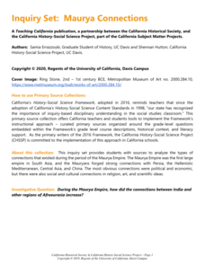
Maurya Connections
While many can name important European explorers, the Maurya empire and its role in building global trade is often neglected in world history curricula. Expand teaching on ancient India topic. Resource set includes ancient texts, such as...
University of California
Silk Roads
We take for granted globalization today, but its roots run deep within China centuries ago. Using texts from ancient Chinese historians and photographs of items showing growing Eurasian trade, scholars look at the traces of...
University of California
Hellenistic Culture
It doesn't take long to change the world! Alexander the Great's reign may have been short-lived, but his vision for a multi-cultural Hellenistic world shaped Afroeurasia for centuries. Pupils examine documents, such as excerpts from...
University of California
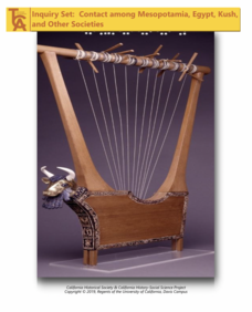
Contact among Mesopotamia, Egypt, Kush, and Other Societies
Trade has always been a global affair. Explore what global trade meant for ancient Mesopotamians, Egyptians, and Kushites using a collection of documents from the historic societies. By examining literary works such as the Epic of...
University of California
Migration of Early Humans: Evidence and Interpretations
While much of prehistory is cloaked in mystery, ancient ancestors left evidence in DNA, languages, and materials from their time. Using photographs of items such as cave paintings and ancient tools, as well as maps of linguistic patterns...
ESRI
Juneteenth: An American History through Maps
An interactive website traces the history of Juneteenth celebrations from their origin in Galveston, Texas, on June 19th to the present day. Using interactive maps, learners can find information about the African-American population...
Academy of American Poets
Teach This Poem: "Maps" by Yesenia Montilla
After examining a physical map of the world, learners conduct a close reading of Yesenia Montilla's poem "Maps." They note the interesting words and phrases, the way the poem is structured, and list questions they might have. After...
Angel Island Immigration Station Foundation
Where Is Angel Island? An Introductory Geography Lesson
Prepare young historians for a study of Angel Island Immigration Station with a lesson examining primary and secondary source materials, maps, and websites. Using what they have learned, individuals create a map of Angel Island, labeling...
DocsTeach
Around the World with First Lady Pat Nixon
Travel the world with the First Lady! Academics study images from Pat Nixon's travels as First Lady to discover her role in Richard Nixon's presidency. Historians match images to world locations, complete a worksheet, and participate in...
C-SPAN
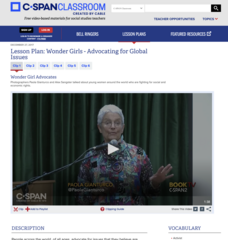
Wonder Girls - Advocating for Global Issues
Move over Wonder Woman ... here come the Wonder Girls! Using video clips of photographer Paola Gianturco talking about her work, pupils consider the life experiences of girls around the world, including places such as Tonga and India....
National Endowment for the Humanities
Hopi Place Names
What's in a name? Historians consider the question as they examine places important to the Hopi people and the meanings of their place names. Included worksheets include maps and charts to help class members examine the geography of Hopi...
Museum of Science
Make a Map
It's important to know the final destination. Scholars first measure distances in a region of interest using a standard measuring device or by counting steps. They then use an appropriate scale and graph paper to create a map of the...
University of Wisconsin
We're Off to India!
Pack your bags and set off to the wonderful country of India in a multi-day cultural unit. The lesson is a 17-day series focusing on literature, music, art, geography, and the culture of India. Scholars complete several activities,...
Arcademics
Penguin Hop
It's a race to learn the state capitals. Using a multi-player video game, participants hop from iceberg to iceberg as penguins in response to questions about state capitals. The real-time practice lets both teacher and learner assess...


