Curated OER
Those Who Have Come Before Me
Class members are transformed into explorers as they work in groups to locate hidden items and map their journey along the way. They then leave clues for other groups of students to follow, and ultimately discover how past explorations...
Curated OER
What Do Maps Show?: Lesson 4 How to Read a Topographic Map
Students examine the use of topographic maps as two dimensional representations that show elevations and slopes with contour lines. They read maps of the Salt Lake City, Utah area and complete the associated worksheets that show map...
Curated OER
Do the Tallywalker
Students study the basics of mapmaking, then make a tally walker, (geographic location device used in secret).
Curated OER
Journey to Gettysburg
Students use latitude and longitude to map the path of the Battle of Gettysburg.
National Endowment for the Humanities
Lesson 3: On the Road with Marco Polo: From Hormuz to Kashgar
Young explorers examine the route that Marco Polo and his father traveled to reach China. They examine online maps of the Silk Road and harsh terrain of Afghanistan to determine challenges that may have been encountered during travel.
Curated OER
Geography Terms
Introduce the terms and concepts related to basic map and geography skills. Terms include full definitions and cover latitude, longitude, the Equator, Tropic of Cancer, Tropic of Capricorn, Prime Meridian, and the International Date Line.
Curated OER
On the Road with Marco Polo: Marco Polo in China
Learners investigate who the Mongols were and where their empire was located. They research Kublai Khan and the region he ruled. They study the major products of 13th Century China.
Curated OER
Grocery Store Field Study
Young scholars visit a local grocery store (not a community market) to gather information about where some commonly eaten produce items come from. Once they have collected this information, locate the countries of origin on a map and...
Curated OER
Using Old Maps as Tools to Explore Our World
Learners explore historical maps. In this primary source analysis instructional activity, students uncover the meanings in selected historical maps as they use them to enhance lessons on historical events. Samples for classroom use are...
Curated OER
Make Your Map
In this map making worksheet, students make their own maps, draw symbols and place them in the map key area, and draw a compass rose to show directions for the map.
Moanalua Gardens Foundation
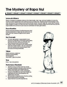
The Mystery of Rapa Nui
What caused the collapse of the environment on Rapa Nui (Easter Island)? Who constructed the Moai? What was their purpose? Class members assume the role of investigators and use evidence drawn from field studies, ships' logs, and...
Curated OER
Creating a PowerPoint Displaying Respectful Behavior
Respect is vital to every relationship and every classroom. Here you will find a resource which will help your pupils to create a multimedia presentation on the topic of respect. They relate their personal behavior and experiences with...
Library of Congress
Marco Paul's Travels on the Erie Canal: An Educational Voyage
Following the book, Marco Paul's Travels on the Erie Canal, readers complete an activity for each chapter, take part in discussions, and respond to several questions. To show what they know, scholars create an alphabet book using primary...
US Mint
Symbols in My Eyes
Explore the hidden meanings behind the images on US currency with this elementary school lesson on symbolism. Starting with a class discussion about symbols, children go on to brainstorm different objects that represent the Unites States...
McGraw Hill
Study Guide for Bridge to Terabithia
Bridge to Terabithia is a story about friendship that brings magic into ordinary life. Study guides may not be magical, but the guided questions, graphic organizers, extension activities, vocabulary, and discussion questions help...
Curated OER
Social Studies: Where I Come From
Learners research the countries of their origins and examine life there today. They write family travel logs by interviewing family members about their heritages, and they visit the Xpeditions Website for online resources about their...
Curated OER
Compass Rose
Keep it simple and visual when practicing directions using this compass rose labeling worksheet. Learners fill in the compass themselves, using cardinal and intermediate direction abbreviations. Consider using their compass on a map to...
Curated OER
U.S. Political Map
Pupils explore the symbols found in a map legend. For this map skills lesson, students locate the legend on a political map and explain what each of the symbols mean. Pupils locate and identify several symbols on the map.
Curated OER
Political Legends and Map Symbols
Learners identify the legend and map symbols. In this map skills lesson, students use a world map to find various locations using a map key.
Curated OER
Globe Skills Lesson 7 The Transcontinental Railroad
Young scholars explore the Transcontinental Railroad. In this geography skills lesson, students use map skills in order to locate legs of the Transcontinental Railroad on globes.
Curated OER
Charting Neptune's Realm:
Students explore how to construct and interpret maps and globes and find information about people, places, regions, and environments.
Syracuse University
Erie Canal
While canals are not the way to travel today, in the first half of the nineteenth century, they were sometimes the best way to move goods and people. Scholars examine primary sources, including maps and pictures, to investigate the role...
Channel Islands Film
Arlington Springs Man: Lesson Plan 4
West of the West's documentary Arlington Springs Man introduces viewers to the remarkable finds on Santa Rosa Island. Archaeologist have discovered on this small island that is part of the Channel island chain, human and pygmy mammoth...
Curated OER
Maps
Maps, globes, and computer software aid young explorers as they locate state capitols, major cities, geographic features, and attractions for states they are researching. They then use desktop publishing software to create a map to share...


