Curated OER
Bank Loans Money to Start Businesses
After locating Latin American countries on a world map, children read about how microbanks are loaning money to help start small businesses. Involving both current events and economics, the teacher introduces the article with a map...
Curated OER
Recreate the Race
Learners research and find the route of the Alaskan dog sled race.In this Iditarod race lesson plan students find the checkpoints for the Iditarod on a map. Learners research information in pairs about each one of the checkpoints....
Curated OER
A Long Way from Home: A Hands-on Geography Lesson about World War II
Students build World War II directional signs. In this World War II lesson, students explore the geographic locations of the war as they analyze primary sources and conduct research regarding places of significance in the war. Students...
Curated OER
Louisiana Purchase
Students use maps, lecture and discussion to explore the unique contributions to the U.S. resulting from the purchase of the Louisiana Territory. They complete worksheets, label maps and participate in discussion groups.
Curated OER
People and Parks in the U.S.A.
Fifth graders explore the National Parks in the United States. After locating specified states, 5th graders predict which states have the most National Parks. Given the population of each state, students determine the average acre per...
Curated OER
The Golden Door: U.S. Immigration Through Ellis Island
Students complete a unit covering various aspects of immigration to the United States through Ellis Island. They plan a fictional trip to America, entering at Ellis Island. and actually visit Ellis Island and the Statue of Liberty.
Curated OER
Attu Battlefield: U.S. Army and Navy Airfields on Attu
Students use maps, readings, drawings and photos to research the World War II Battle of Attu. They explain the importance of the battle, discuss the valor and loyalty of both American and Japanese troops and analyze sources of historical...
Curated OER
Japan: Land of the Rising Sun
Students locate Japan on a globe, name the major physical features, and describe the physical environment. They survey the differences and similarities between the life and culture of Japanese young people and American young people.
Curated OER
50 States: New England States
Students discover where certain states are located and what the look like. They look for their information on a web site. Each student is assigned a state which they must research then present to the entire class.
Curated OER
Where in the World Is That Volcano?
Identify the Earth's major volcanoes with an earth science lesson plan. Elementary and middle schoolers locate major volcanoes on a world map. Then, in groups, they research how the volcano affects the region in which it is located.
Curated OER
Where in the World Is Mexico?
Students practice map-reading skills as they locate Mexico and its cities on a world map. By creating a puzzle out of a map of Mexico, students engage in a meaningful hands-on activity to help them explore that country's geography.
Curated OER
My Name is Osama - Bullying and Name-Calling
Students read the story of an Iraqi immigrant boy named Osama who faces taunts of terrorist in his U.S. school after the attack of September 11.
They discuss the characters and their struggles in the story. Students respond to...
Curated OER
National Marine Sanctuaries Shipwrecks
Junior oceanographers access the Channel Islands National Marine Sanctuary Shipwreck Database and plot the locations of several shipwrecks. Shipwrecks are always an enthralling subject and this activity allows your learners to act as...
Curated OER
Tears of Joy Theatre Presents Anansi the Spider
Accompany the African folktale, Anansi the Spider, with a collection of five lessons, each equipped with supplemental activities. Lessons offer multidisciplinary reinforcement in English language arts, social studies, science,...
Curated OER
Jamestown Celebrates 400th Anniversary
Students view a world map and identify the locations of England and Virginia and discuss what kinds of things they would take with them on this kind of trip. They read the words in the news box on the student page and fill in the blanks...
Curated OER
You Can Find It!
Students locate different places including U.S. cities using longitude and latitude coordinates. In this longitude and latitude lesson plan, students locate 10 different locations.
Curated OER
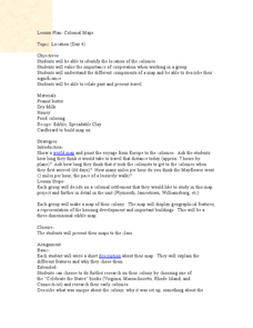
Colonial Maps
Students discover the history of America by identifying the traditional colonies. In this U.S. history lesson, students examine a world map and identify where the voyagers left from Europe to arrive at the United States. ...
Curated OER
GEOGRAPHY OF FOOD & FIBER
Students will explain the ways geography determines the crops grown in the United States and other countries, and the resulting trade relationships.1. Discuss trade routes, both ancient and current. Discuss why the most direct route from...
Curated OER
Home Sweet Home-Far From Home
Students observe slides of U.S. coastal geography. They study topography and vegetation maps for one region. They gather geographic facts on a guided worksheet. Students pretend to be colonists. They decide what kind of economic system...
Curated OER
Mapping Population Changes In The United States
Students create a choropleth map to illustrate the population growth rate of the United States. They explore how to construct a choropleth map, and discuss the impact of population changes for the future.
Curated OER
The Geography of Tornadoes OR
Students learn some basic facts about tornadoes and map two selected tornado statistics by state, and observe, analyze and speculate about the pattern(s) created by the completed map.
Curated OER
Made in the USA
Young scholars map products made in the United States. They discuss regional interdependence and identify goods the U.S. produces and trades. They describe how economic links make Americans more alike, and locate major manufacturing...
Curated OER
State Report
Students create a state report/ presentation. They research U.S. state information using the Internet and retrieve information about specific topics (Individual States in the USA) using technology resources.
US Mint
Absolutely and Relatively: The Puerto Rico Quarter Reverse
How much does your class know about Puerto RIco? How much can they learn from the back of a 2009 quarter? Use the coin, part of a series of quarters that depict US territories, to teach learners about the geography, culture, and history...
Other popular searches
- U.s. Geography Lesson Plans
- U.s. Geography Southeast
- U.s. Geography Slavery
- U.s. Geography Northeast
- U.s. Geography California
- U.s. Geography Oregon
- U.s. Geography and Economics
- U.s. Geography Pdf
- U.s. Geography West
- U.s. Geography Activity
- U.s. Geography + Slavery
- U.s. Geography Southwest


