Curated OER
Three Scale Drawing Activities
In this scale drawing worksheet, students complete three different scale drawing activities. One activity is making a scale drawing, one involves answering questions from a given scale drawing, and one is a cross-number puzzle. The...
University of Nottingham
Drawing to Scale: A Garden
See how design and geometry go hand in hand. The activity asks learners to use geometry to design a backyard garden given dimensions of each feature. Scholars work with ratios and scale to develop an accurate scale drawing that includes...
Curated OER
Scale Skills
In this mapping skills worksheet, students read an excerpt that describes three different types of scales and how to calculate distance on a map. They respond to two short answer questions using the map provided on the sheet and to...
Curated OER
Unit 19 Scale Drawing
In these scale drawing worksheets, students read the distance problems and select the answer from the choices. Students complete 9 problems.
Mathematics Assessment Project
Geometry
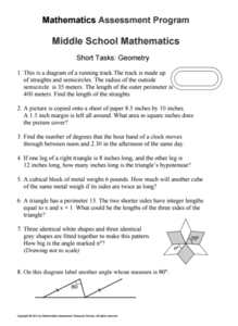
Help learners find joy in facing mathematical challenges. The questions posed on this worksheet encourage young mathematicians to utilize skills learned throughout a geometry unit, and to apply themselves and persevere through problem...
Curated OER
Measurement 3: Rulers
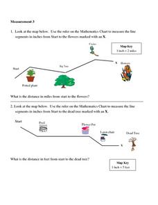
In this measurement worksheet, students measure the linear distance, in inches, between stated objects. Next, they determine the actual distance, in miles.
Curated OER
Maps Not Drawn to Scale
In this maps worksheet, students redraw a map to make it more accurate and drawn to scale in the space given. Students draw 1 map and answer 2 questions.
Curated OER
Measuring Distance
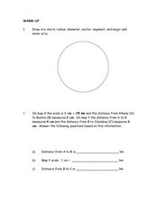
In this measurement worksheet, students practice drawing 7 specific geometrical lines in a circle. Students problem solve 1 word problem with 3 measurements involving distance.
Curated OER
Maps/ Scales and Conversions
In this math activity, students look for the actual values for the measurements of distance. The answers are found on page three.
Mathematics Assessment Project
Photographs
Picture your pupils using this assessment task. Class members must first determine the measurements of smaller copies of photographs placed next to the original. They then determine the dimensions of the entire sheet of photographs.
Curated OER
Problem-Solving Decisions: Reasonable Answers
In this problem solving worksheet, students answer 6 questions pertaining to a story problem about a tabletop scale model of the Nile River.
Noyce Foundation
Photographs
Scaling needs to be picture perfect. Pupils use proportional reasoning to find the missing dimension of a photo. Class members determine the sizes of paper needed for two configurations of pictures in the short assessment task.
Mathematics Assessment Project
Linear Graphs
A line is a line is a line. As a middle school assessment task, learners first identify graphs of given linear equations. They then identify the equations that represent real-world situations.
Curated OER
Comparing Ratios
In this comparing ratios worksheet, students solve and complete 3 different problems using the screens shown. First, they write a ratio that compares the shaded part to unshaded part illustrated. Then, students use the same grid to...
Curated OER
Real World Investigation- Math and Geography- Elevation Changes
In this math and geography real world investigation, 6th graders plan a driving trip to a city that is located several states away from their home while recording the elevations of three cities that are included in the trip. They use...
Other popular searches
- Maps Scale Drawing
- Drawing Maps to Scale
- Maps and Scale Drawings
- Maps/scale Drawing Lessons
- Drawing Scale Maps Geography


