Curated OER
Geography of the Study of the Spanish-speaking People of Texas
Young scholars identify the physical features, demographic characteristics, and history of the four Texas towns featured in Russell Lee's photo essay, "The Spanish-Speaking People of Texas." They conduct Internet research, and create a...
Curated OER
Manduca
Students study the definition of a "global society". They take this knowledge and speculate about the positive and negative ramifications of living in a global society.
Curated OER
"Where in the World is my School?"
Students learn new vocabulary and discuss what GPS is and does. They locate their school using the equipment.
Curated OER
The Year You Were Born
Students research a variety of events that occurred during the year they were born. They conduct Internet research, conduct interviews, and organize their research information into a report using HyperStudio.
Curated OER
Lake Tahoe Then and Now
Students investigate the differences in Lake Tahoe from the past to the present. In this geography lesson, students read the book Washoe Seasons of Life and identify the descriptions of the land and lake. Students create a Venn diagram...
Curated OER
Life During the Civil War for Women and Civilians
Students follow an overview of the American Civil War from a film, the text and/or teacher direct instruction. They create a timeline with a large map of the U.S. in the 1860's available for student reference as they do the spider activity.
Curated OER
Who Are the Aliens in Our Inland Seas?
Students work in teams to research specific landforms in Great Lakes Watershed, compile information into data table, and write legend explaining landform for children's book. Students then research area surrounding landform, compile...
Curated OER
Ancient Rome
Students complete pre reading, writing, during reading, and interdisciplinary activities for the book Ancient Rome. In this reading lesson plan, students complete journal entries, go over vocabulary, answer short answer questions, have...
Curated OER
Mother's Day Trip
Help your class develop their public speaking skills. They write original scripts for informative infomercials, plays, or poetry. They work to present their information with purpose.
Curated OER
What I Did On My Summer Vacation
Students use the internet to research the location of their summer vacation trip. Given the demographics, they plot the location on a world map. They create a brochure using the information they collected. Using PowerPoint, they develop...
Curated OER
States in the USA Quiz
In this online interactive geography quiz instructional activity, students respond to 50 identification questions about the states in the United States of America. Students have 4 minutes to complete the quiz.
Curated OER
Settling Nroth America: Improvisation and Playwriting
Students map the classroom by marking the movement of the first Americans' migration from Alaska down into North America. To improve their skills in map-reading and sense of direction, students identify physical features of the map and...
Curated OER
Mesoamerica
Young scholars demonstrate knowledge of early Middle American civilizations. They study Mesoamerican i religions, governments, and achievements. They identify geographies of North and South America.
Curated OER
Follow That Ship!
Students in this exercise are introduced to the distinct ways of measuring distance (nautical miles) and speed (knots) at sea, as well as the concepts of latitude and longitude for establishing location.
Roy Rosenzweig Center for History and New Media
Differences Among Colonial Regions
Classes look at and analyze primary source images to explore the differences between the colonial regions during the Revolutionary era. They break into groups to tackle each region and then present their findings to the class. A final...
Curated OER
Mills of New Hampshire
Students locate mill sites on a New Hampshire map. They describe who worked in the mills and their working conditions. They examine the environmental impact of the mills and work together to find out more information about mills.
Curated OER
Countries of South America
Students focus on the geography of the countries of South America. Using a map, they identify the European countries who claimed the South American countries and research the influences they had on South America. To end the lesson,...
Curated OER
What Happens When Sea Level Rises or Falls
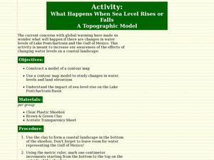
Students examine the impact of sea level on land formations. In this geography and map lesson, students construct a contour map model illustrating how much of the clay "coastline" is covered as water is added. Metric measurement is...
Curated OER
My World Wide Tour of Spanish Speaking Countries
Students organize a two week travel plan through Spanish speaking countries all over the world. plan their flight schedules, accommodations, and tours of cultural events. Students compute the total cost of their trip.
Curated OER
Watersheds, Watersheds Everywhere
Students identify the watershed in which their school is located. They use maps to locate their homes and school. They define and use the correct vocabulary.
Curated OER
Country Flags Quiz
For this online interactive country flag quiz worksheet, students examine the 20 pictured country flags and try to name all of the countries represented in 4 minutes.
Curated OER
State Nicknames Quiz
In this online interactive geography quiz worksheet, students examine the chart that includes the names of 49 states. Students identify the nicknames of the states in 6 minutes.
Curated OER
What is the Population Distribution of Cartoon Characters Living On the Pages of Your Newspaper?
Students read various cartoons in their local newspaper and calculate the population demographics, spatial distribution and grouping of the characters. Using this information, they create a population distribution map and share them with...
Curated OER
Geological Forces and Topography
Students discuss and research the Earth's geological processes. In this geology activity, students study maps of Utah and the United States to learn about geological features. Students then complete the research cards for each area of...

