Curated OER
What a Relief Map
Students create a map using cookie dough. In this geography lesson, students research the physical features of a country, draw a diagram and design and create a map out of cookie dough.
Curated OER
Canadian Conoe Trip
Sixth graders research Canadian geography - the land and the bodies of water. They then plan an imaginary canoe trip through six major water bodies in Canada. They conclude the unit of study with a creative story.
Curated OER
Postcards from Somewhere
Young scholars correspond with e-pals about their community. In this cross curriculum geography, technology, and literacy lesson, students complete a postcard webquest about their home location including local photographs. Young scholars...
Curated OER
Oh, the Places You'll Go!
Students read about and discuss the fifty-three recommended travel destinations for 2008 from the Travel section of The New York Times. They list three places they would each like to visit, read and discuss the news article, and create...
Curated OER
The Nile: A Gift to Egypt
Sixth graders discover the Egyptian culture. In this Nile River lesson, 6th graders examine why the river is so important to Egypt.Students study the religions, geography and the people of Egypt. Students create an exhibit where...
National First Ladies' Library
Brrrr! Expeditions to the North and South Poles
Students examine the first successful explorations of the North and South Poles, through a study of the four men who accomplished them. They present the fruits of their research on posters, or with PowerPoint presentations.
Curated OER
Map Keys
In this geography worksheet, students identify who a cartographer is and what they do specifically. They study an outline map of a fictitious island and then, respond to the three questions that follow. Finally, students add three more...
Curated OER
The Mother Culture of Mexico: The Olmecs
Sixth graders study the Olmec civilization. They develop a map of Mexico and a map of the area of the Olmec civilization. They research Olmec art, religion, and architecture. They construct Olmec symbols including giant heads, altars,...
Curated OER
Capturing the Reader With Vivid Images
Students examine how the author tries to capture the reader's imagination immediately, through imagery--and hold on to it. They locate Ukraine on a world map and understand Lenin's role in the establishment of Russian communism and the...
Curated OER
Lake Tahoe Then and Now
Young scholars investigate the differences in Lake Tahoe from the past to the present. In this geography lesson plan, students read the book Washoe Seasons of Life and identify the descriptions of the land and lake. Young scholars create...
Curated OER
Site and Situation: Right Place at the Right Time
Young scholars put their geography skills to work. In this geography skills lesson, students research maps and other primary and secondary sources to simulate the site selection process for the Pennsylvania Railroad Shops post World War...
Curated OER
The Children of World War II
Students examine the lives of children during WWII. In this WWII lesson, students investigate the effects of the war on children, what life was like on and off the battlefield and how the geography influenced decisions. Students also...
Curated OER
Asia's Global Influence
Middle schoolers explore Hong Kong. In this geography skills lesson, students watch "Asia's Global Influence," and then research the culture, landmarks, and geographic features of Hong Kong. Middle schoolers use their research findings...
Curated OER
Global Intelligence
Students discuss the war in Afghanistan and the conditions surrounding the hunt for Osama bin Laden after reading the article "Bin Laden and Omar: Far Harder to Find" from The New York Times. After the class discussion, students...
Curated OER
Putting the World in Perspective
Students work in small groups to: make a mental map of the world by tearing paper shapes of the seven continents and locating them on a flat surface in their relative positions, compare their finished mental map to a reference world map,...
Curated OER
Where We Live
Students forecast future population growth of the U.S. Virgin Islands. In this U.S. Census lesson plan, students explain the factors that influence population density on the U.S. Virgin Islands, including geography and economic activity.
Curated OER
Hide and Seek with Geocaching
Students locate objects using a Global Positioning System. In this global geography lesson, students explore latitude and longitude using a GPS in order to locate objects.
Curated OER
The Equator
Learners investigate cultures located along the equator. In this geography skills lesson, students research the geography, history, culture, and tourism of Ecuador, Indonesia, Kenya, Brazil, and Singapore. Learners write an article based...
Curated OER
Mapping South America
Middle schoolers explore South America. In this South American lesson, students use their geography skills to create population, terrain, biomes/vegetation, and major exports maps. Middle schoolers present their finished maps to their...
Curated OER
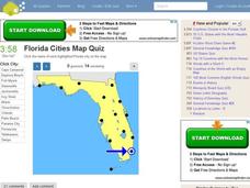
Florida Cities Map Quiz
In this online interactive geography instructional activity, students examine a map of Florida and identify the 12 noted cities on the map using a pull down menu within 3 minutes.
Curated OER
States and Capitals, Mountains and Rivers
Young scholars identify geographical locations in the midwestern United States. In this geography activity, students identify 12 states and capitals and geographical features in the region by using U.S. maps. Young scholars use blank...
Curated OER
Regions Change
Students examine how geography can have an impact on change in a region. They discuss what their local area might be like in 50 years, and in pairs, select a situation and write a short story to describe how it changed from one thing to...
Curated OER
Sacred Sites
Learners read about the one-year anniversary of the bombing of the Mosque of the Golden Dome, or Askariya Shrine, in Iraq. They explore a number of other sites of religious significance to create designs for a geography Web site on holy...
Curated OER
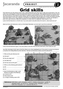
Grid Skills
In this geography worksheet, students use grid references on a map to locate places in the pictures given. They also identify another advantage of using a grid map, which they have an overhead view of the content to prevent any features...
Other popular searches
- World Geography Studies
- Geography Studies the Sea
- Geography Studies Rocks
- Elementary Geography Studies
- Geography Studies Cd Rom
- Social Studies Geography
- Social Studies Us Geography
- Social Studies and Geography
- Social Studies Maps Geography


