BrainPOP
World History Lesson Plan: Uncovering Essential Questions
Have you ever noticed a news story revolves around an essential question? Scholars research methods of reporting historical events. Working in groups, they use an interactive module to gather information on a historical topic, uncovering...
Reporters Without Borders
2017 World Press Freedom Index
Freedom of the press was seen as a right so important that the Founding Fathers listed it as part of the first amendment to the United States Constitution. Americans pride themselves on this freedom, but just how free are American...
Curated OER
Studying Mind Maps Created at Other Schools
Students explore Africa and mind maps created by students from other schools. They discuss Africa and the number of countries, diversity of language, cultures, races, religions, and lifestyles and in groups study a mind map from another...
Education World
Edible Resource Maps!
Young scholars discuss resource maps and examine examples from library resources. Working in groups, they create edible resource maps by drawing examples, such as popcorn on the border of Iowa and Nebraska. Then they use cookies in the...
Curated OER
Earth from Space Maps
Students use photo images from space to create a large map of the United States or the world, find where they live and label other places they know. They are exposed to a Web resource that allows them to view photo images of Earth taken...
Curated OER
Greeks Around the World: A Case Study on Greek Diaspora
Students gain an understanding of the concept of Diaspora relating to Greeks. They use guided discovery to apply the geographic inquiry model to an examination of the reasons for Greek Diaspora.
Curated OER
Geomnemonics: Facilitating the Teaching of Social Studies Content with Geography Skills
Students explore how to draw a world map by hand and how to locate countries.
Curated OER
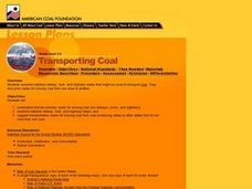
Transporting Coal
Some really interesting worksheets on Amtrak's national routes, and the major river systems of the United States accompany this lesson on the transportation of coal throught the country. This is an exceptionally well-designed lesson that...
Curated OER
Introducing Topographic Maps: Guiding Students from Concrete Models to Graphic Representations
Students interpret topographic maps and infer human activity as it is influenced by the landscape.
Library of Congress
Investigating the Building Blocks of Our Community’s Past, Present, and Future
As Ken Jennings said, "There's just something hypnotic about maps." Certainly, the longer you look at them the more you can learn. In this project-based learning lesson, individuals study both historic and present-day maps of...
Curated OER
Designing a Hiking Trail
Put your students' map skills to the test with this engaging cross-curricular project. Given the task of developing new hiking trails for their local community, young cartographers must map out beginner and intermediate...
Edgate
Why Map a Map?
After brainstorming reasons why Native Americans mapped their lands, your young critical thinkers will work together to review their ideas and determine the definition of a map. With today's extensive use of mapping technology and GPS...
Curated OER
Exploring Maps: Lesson 2 Guide: Navigation
Students explore and examine how maps have been used in navigation. They research how travelers collected observations to keep track of their positions and plotted information on maps. Each student then makes a Mercator projection...
Theodore Roosevelt Association
Roosevelt's Legacy: Conservation
The legacy of Theodore Roosevelt carries through modern American politics, economics, foreign policy, and society. But his proudest and most profound efforts were in the world of conservation, and in preserving the natural beauty of...
Echoes & Reflections
Contemporary Antisemitism
Despite the recognized atrocities of the Holocaust, anti-semitism continues. The 11th and final installment of the Teaching the Holocaust series explores the long-term effects of the Holocaust on modern anti-semitism, asking pupils to...
John F. Kennedy Presidential Library & Museum
Red States/Blue States: Mapping the Presidential Election
Young historians investigate how voting patterns have changed by comparing the outcome of the 1960 election to the outcome of the recent election. A creative final assessment has participants making a news show wherein they provide...
Curated OER
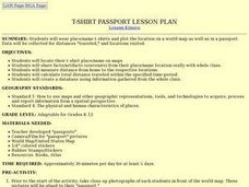
T-shirt Passport Lesson Plan
Students locate their t-shirt place/name on maps, then share facts/artifacts (souvenirs) from their place/name location orally with whole class. They create a database using information gathered from the whole class.
Curated OER
Mapping Your State's Role in the Vietnam War
Learners recognize reasons to celebrate Memorial Day. Students create a map of victims of the VIetnam War. Using the internet, learners research information about soldiers from their state who were killd in action in Vietnam. Students...
Curated OER
Nepalese Drum on a Stick
Students create a two sided percussion instrument designed to look like a damaru drum from Nepal. They locate Nepal on a map and conduct research on Nepal and the damaru. Students then create a damaru drum using a small plastic container...
Curated OER
My Top Interdisciplinary Social Studies Lesson Plans
Here are some top social studies lesson plans and activities which present concepts in a memorable fashion.
Curated OER
Using Old Maps as Tools to Explore Our World
Students explore historical maps. In this primary source analysis lesson, students uncover the meanings in selected historical maps as they use them to enhance lessons on historical events. Samples for classroom use are provided in this...
Curated OER
What Do Maps Show?: Lesson 4 How to Read a Topographic Map
Learners examine the use of topographic maps as two dimensional representations that show elevations and slopes with contour lines. They read maps of the Salt Lake City, Utah area and complete the associated worksheets that show map...
Los Angeles Unified School District
River Systems
Scholars must react to the ecosystems of a river. They use inquiry-based learning along with maps and visuals to better understand the impact of rivers on everyday life. To finish, they create final written projects and presentations.
Scholastic
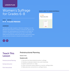
Women's Suffrage for Grades 6–8
Learners study the decisions and solutions involved in winning the right to vote. After reading background information on the fight for women's suffrage, including one woman's story, and its eventual success in the United States and...


