Curated OER
It's All Greek to Us
Students examine the various ways in which ancient Greek culture has influenced modern-day life. They study the context in which modern-day Greeks consider the 2004 Summer Olympics by reading and discussing the article "Where It All...
Curated OER
Chinese Lion Dance
Students celebrate the Chinese New Year and listen to the story behind the Chinese Lion Dance. In this Chinese New Year lesson, students research the geography and culture of China. Students create puppets, dance the Lion...
Curated OER
Life During the Civil War for Women and Civilians
Students follow an overview of the American Civil War from a film, the text and/or teacher direct instruction. They create a timeline with a large map of the U.S. in the 1860's available for student reference as they do the spider activity.
Curated OER
The Sweet Connection
Students use maps to find what crops are dominant in areas where honey bees are raised and discuss possible correlations. They mark the top ten honey- producing states on a US map.
Curated OER
Grocery Store Field Study
Learners visit a local grocery store (not a community market) to gather information about where some commonly eaten produce items come from. Once they have collected this information, locate the countries of origin on a map and research...
Curated OER
Soil: Food Mapping
Learners examine the concept of food mapping . In this agriculture lesson, students explore food and agriculture systems in the United States in the past and today. Learners complete food mapping activities.
Curated OER
Election Vocabulary Brainstorm
Students participate in numerous activities pertaining to elections. They study election vocabulary and generate questions about campaigns and elections. They paraphrase articles and generate a class vocabulary list.
Curated OER
The Ie Storm 1998: Maps and facts activity
Students investigate the St. Lawrence River Valley, ice Storm of 1998. In this middle school mathematics lesson, students interpret ice storm data from tables and maps. Students write about their own experiences of the ice...
Curated OER
Geography Lesson Plan
Students examine the history of the Aborigines. In this Australia lesson, students research selected websites and print materials regarding the lives of the Aborigines and create posters that showcase their findings.
Roy Rosenzweig Center for History and New Media
Differences Among Colonial Regions
Classes look at and analyze primary source images to explore the differences between the colonial regions during the Revolutionary era. They break into groups to tackle each region and then present their findings to the class. A final...
Curated OER
Where We Live
Students forecast future population growth of the U.S. Virgin Islands. In this U.S. Census lesson plan, students explain the factors that influence population density on the U.S. Virgin Islands, including geography and economic activity.
Curated OER
What in the World Is a Watershed?
Young scholars discover the role of a watershed. For this geography lesson, students are shown a diagram of a watershed and discuss the definition of a watershed. Young scholars demonstrate the role of a watershed by using an umbrella...
Curated OER
Seven Daughters and Seven Sons: the Middle East Through
Sixth graders read "Seven Daughters and Seven Sons" and examine aspects of Middle East culture and geography. They define vocabulary from the book and map locations described in the book.
Curated OER
Foreign Language: Travel Brochure
Students research either French or Spanish speaking countries. After compiling information covering the geography, people,government, economy, and culture, they produce travel brochures on their respective countries.
Curated OER
Where Does It Come from?
Students read articles about various agricultural products and create a map using the statistics in the article. In this agricultural statistics lesson, students look at the geography of the country and which products come from the...
Curated OER
Scavenger Hunt for Coins of the World--New Zealand, Japan and France!
Students explore the history, culture and currency of the countries they "visit" using the US Mint Coins of the World activity. Students find the answers to a Scavenger Hunt Questions handout for the country being studied. Students...
Curated OER
Plate Tectonics: Movin' and Shakin'
Students are introduced to the causes of plate movements and the hazards they present. They plot the location of 50 earthquakes and 50 volcanic eruptions on a map and explore the relationships between plate tectonics, earthquakes, and...
Curated OER
Making Prehistory
Students create mock fossil records based on current scientific theories about prehistory. By learning about what fossil records teach us about different prehistoric time periods, students gain a greater understanding of theories of...
Curated OER
Countries of South America
Students focus on the geography of the countries of South America. Using a map, they identify the European countries who claimed the South American countries and research the influences they had on South America. To end the lesson,...
Curated OER
Breaking News English: Iraq
In this Iraq worksheet, students read the article, answer true and false questions, complete synonym matching, complete phrase matching, complete a gap fill, answer short answer questions, answer discussion questions, write, and more...
Curated OER
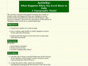
What Happens When Sea Level Rises or Falls
Students examine the impact of sea level on land formations. In this geography and map lesson, students construct a contour map model illustrating how much of the clay "coastline" is covered as water is added. Metric measurement is...
Curated OER
Can You Hear Me Now?
Students explore the industry involving communication and put communication devices into activities. For this communication lesson plan, students put items into chronological order, review primary sources, compare and contrast items, and...
Curated OER
Mesoamerica
Young scholars demonstrate knowledge of early Middle American civilizations. They study Mesoamerican i religions, governments, and achievements. They identify geographies of North and South America.
Curated OER
Fertile Crescent Map Project
Sixth graders develop a multimedia presentation of the Fertile Crescent that compares modern day geography, economics, government, and transportation resources. They work in groups to research their specific topic.
