Curated OER
Clouds and the Earth's Radiant Energy System
Wow! What a lesson plan! Six terrific activities are described in great detail, in this 31-page document! Learners will model and explain cloud formation, sketch and identify certain cloud types, calculate and compare incoming and...
Mr. Arnayro
California Missions Project
Looking for alternative options to the traditional California missions project? This is the resource for you!
Curated OER
Roman Holiday in Google Earth
Students plan an itinerary for an educational trip to Rome. In this research skills instructional activity, students use Google Earth to conduct research for their project in their travel teams. Students also set up blogs to share their...
Curated OER
In the Wake of Columbus
Students explore how the population decreased in native cultures.
Colorado State University
How Does the Earth Cool Itself Off?
Where does all the heat go when the sun goes down? An interesting lesson has learners explore this question by monitoring the infrared radiation emitted over time. They learn that hot spots cool more quickly that cooler spots.
Curated OER
Bears and Panthers Aplenty: Early Settlers Make a Home in Arkansas
Young historians research the Southwest Trail, which ran through Arkansas back in the 19th century. Pupils are divided into four groups. Each group researches a pioneer who blazed the Southwest Trail. Then, the group presents an oral or...
Curated OER
Texas Commemorative Maps: Honoring Our Past
To celebrate Texas, groups plan and create a commemorative map for a topic or theme in Texas history. The richly detailed plan and the approach could easily be adapted to any state. Samples are included.
Curated OER
Call to Arms: A Service Project
Sick of selling candy and washing cars? How about hosting a Digital Day or a Learning Lunch? The suggestions here make fund raising fun and rewarding. Raise money to preserve important maps and other primary source documents.
John F. Kennedy Presidential Library & Museum
Red States/Blue States: Mapping the Presidential Election
Young historians investigate how voting patterns have changed by comparing the outcome of the 1960 election to the outcome of the recent election. A creative final assessment has participants making a news show wherein they provide...
Curated OER
Investigating the Climate System WEATHER
Students research, interpret, and become able to explain general characteristics of weather in tropical regions. Students observe and compare tropical and mid-latitude weather patterns.
Curated OER
The Potential Consequences of Climate Variability and Change
Students analyze the impact of climate variability and change utilizing a broad span of topics over a wide range of grade levels. This three lesson plan unit is easily adapted for the various instructional levels listed.
Curated OER
Moon Mining
Go on a moon mining expedition from the safety of your classroom with this space exploration simulation. Using simple models of the moon's surface prepared ahead of time by the teacher, young scientists are challenged with locating and...
Energy for Keeps
The Energy Times
Extra! Extra! Read all about past and present energy use in a classroom-made historical newspaper. Useful as a cross-curricular assignment between science, history, and language arts, the project is sure to get young journalists...
Curated OER
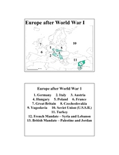
Europe after World War I
In this Europe after World War I map worksheet, learners note the 11 regions of the Europe labeled on the map.
Curated OER
China is Unique
Sixth graders study the culture of China by comparing it to that of the United States. They write all questions and notes in a journal. The students access the internet to obtain the information and internet sites are suggested in the...
Curated OER
Agriculture & Alaska's Economy
Students examine Alaska's agriculture numbers from previous years. They answer questions based on Alaska's production levels.
Curated OER
Scale Skills
In this mapping skills worksheet, learners read an excerpt that describes three different types of scales and how to calculate distance on a map. They respond to two short answer questions using the map provided on the sheet and to...
Curated OER
Where Does It Come From?
Learners explore where agricultural commodities used in snack foods are grown. They choose a snack food and locate the top five states that produce the food that the snack is made from.
Curated OER
Right on Time
The hour is nigh for your class to practice equivalency problems in the form of time-zone conversions. They write equations to describe elapsed time and apply problem solving strategies, including writing a plan, to solve the problems.
Curated OER
What Is El Niño?
Students access information at remote sites using telecommunications, identify impacts by reviewing past El Ni??o events, make and use scale drawings, maps, and maps symbols to find locations and describe relationships.
Curated OER
Sports and Exercise
Use prepositions to explain what the people in the picture are doing. For example, the man is swimming in the pool, and the woman is sitting on the edge of the pool. Learners write seven sentences.
Curated OER
Capitalization of Nouns
Which nouns are capitalized? Challenge young editors with these erroneous sentences, all of which require capitalization. After circling all the necessary capitals in 10 sentences, they rewrite two sentences (which are all in capital...
Curated OER
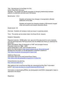
Development on the Edge of a City
Students explore and analyze examples of changing relationships between patterns of settlement and land use in the state of Minnesota. They view different avenues of transportation, cities, suburbs, city planners and suburbanization.
Curated OER
Enduring Cultures
Students research the art, dance or a game from the Pacific Northwest Coast Aborigines. In this Canadian Cultures lesson, students view a PowerPoint about the Inuits. Students choose a game , type of artwork or dance to...


