Curated OER
Introduction to the Barnegat Bay Estuary
Students research estuaries. In this estuaries lesson, students discuss the differences in a bay and an ocean. Students watch a PowerPoint of the properties of the estuaries and geography of Barnegat Bay. Students complete a worksheet...
Curated OER
Walking that Line
Students attempt to describe and use longitude and latitude. They will identify different countries, their neighbors, and borders around the world. Included in the lesson the students identify natural features that control the borders of...
Curated OER
What's on Your Plate?
Students travel the world. For this global studies lesson, students research selected countries and investigate their cultural traditions.
Curated OER
Sports and Exercise
Use prepositions to explain what the people in the picture are doing. For example, the man is swimming in the pool, and the woman is sitting on the edge of the pool. Learners write seven sentences.
Curated OER
Surprise at Pearl Harbor
Young scholars review the concept of courage and relate it to their daily life. As a class, they are introduced to the events of December 7, 1941 at Pearl Harbor. Using a map, they locate Hawai'i and label the islands. They use the...
Curated OER
Comparing Three Religions: Islam, Judaism, and Christianity
Students work together in groups to research either Judaism, Christianity, or Islam. Once the research is complete, they share their information with the other groups in the class. They complete a worksheet on rituals and holidays in...
Curated OER
Qur'an: Sacred Scripture of Islam
Students discover the strong emphasis Islam puts on education. Using the Internet, they identify advancements in ethics, math and astronomy. They explain the importance of madrasahs, or traditional places of learning in Islam, and...
Curated OER
Grand Canyon History Lesson
Students explore the history of the Grand Canyon. In this Grand Canyon lesson, students read "Grand Canyon National Park" by David Peterson and respond to questions regarding the piece. Students also create their own fossil models that...
Curated OER
Getting Oriented
Students explore the geography, culture, and philosophy of Asia using all five senses and information about China and Japan. This lesson plan is detailed and may take several days of in-class activities to complete.
Curated OER
Deforestation
Students identify the different tropical rainforests in the world using a map. In this ecology lesson, students describe the different methods of deforestation. They create a memo and present it to class.
Curated OER
Alaska Trade
Students spend two days traveling throughout Alaska, trading as they go. They explore universal principles related to trade and commerce while studying about Alaska's geography and indigenous people. At the end of the lesson, students...
Curated OER
Olympic Games Snowboard Design
Students find travel destinations and information on countries around the world, and use their knowledge to create a snowboard design that represent the country they pick. They explore maps, weather, geography, languages, in their quest.
Curated OER
Current Weather Condition Site Selection
Young scholars work together to agree on the days "preferred weather conditions." They choose a city in the world they think will have the preferred current weather conditions.
Curated OER
The Secret Life of Money Part 1
Pupils explore money, how its value determined, and how mere slips of paper or coins, and in today's high-tech world electronic blips, represent the wealth of a nation.
Curated OER
Where to Live?
Students examine types of spatial data found in a GIS. In this geography instructional activity students use a GIS to facilitate analysis and decision making.
Curated OER
Temperature Graphing
Students analyze temperature variations throughout the world by using computer graphing of select major national and international cities. After analyzing their findings, students write a paragraph explaining their data.
Curated OER
Map-Making Basics
Students study maps. For this geography and art lesson, students create their own map of the classroom.
Curated OER
Australia
Sixth graders study the continent of Australia. In this Geography lesson plan, 6th graders create an Australian city using their knowledge of Australian cities. Students participate in a game about the continent.
Curated OER
South America Puzzle
In this geography worksheet, students complete a crossword puzzle related to the countries, capitals, bodies of water, and populations of South America. They use the 23 clues given to solve the puzzle.
Curated OER
Where to Live?
Learners decide where they want to live in US. In this geography instructional activity, students select their residential preferences. Using GIS, they determine the location that meets their preferences.
Geography 360°
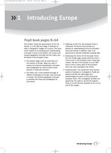
Introducing Europe
Provide your learners with a comprehensive introduction to Europe with this great set of worksheets. Map activities include matching European countries to their capitals and places on a political map, as well as...
Curated OER
Missing Masterpieces
Students investigate a fictitious crime involving stolen art masterpieces. They work collaboratively in teams to solve the fictitious crime. Students return the stolen paintings in a Microsoft PowerPoint "portfolio" to their owner. They...
Curated OER
Yaks, Yurts, and Yogurt: A Look at China's Autonomous Regions
Students are introduced to five Chinese geographical areas. They, in groups, research these areas and develop presentations including information on the physical characteristics, climate, elevation, agriculture and language.
Curated OER
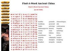
Find-A-Word Ancient China
For this social studies worksheet, students locate words relating to Ancient China in a word search. They may self correct their work by selecting the link at the bottom of the page.
Other popular searches
- World War I Map
- Mapping Penny's World
- Map of the World
- World Outline Maps
- Blank Maps of World
- World War 2 Map
- World War 1 Maps
- World War I Outline Map
- Map of World
- World Climate Map
- Blank World Outline Maps
- World Biomes Map

