Curated OER
The Geography of the United States
Full of bright maps and interesting information, this presentation details U.S. Geography. Slides include basic facts about size, regions, topography, and demographics, as well as fascinating trivia about the United States, including...
Curated OER
United States Geography: Crossword Puzzle
In this geography learning exercise, students use the 14 clues in order to fill in the crossword puzzle with the appropriate United States geography answers.
California Polytechnic State University
Australian Geography Unit
At the heart of this resource is a beautifully detailed PowerPoint presentation (provided in PDF form) on the overall physical geography of Australia, basic facts about the country, Aboriginal history, and Australia culture and lifestyle.
Curated OER
The United States and Canada: Climate and Vegetation
Display U.S. and Canadian climate and vegetation through this text-companion worksheet. Learners read about the geography of these regions, take notes, and answer 3 comprehension questions as they read the selection. A graphic organizer...
Curated OER
Hip Hop and Geography
Learners study the various geographic regions of the U.S. and discuss how popular music is influenced by cultural/regional factors. Groups choose East Coast, West Coast, Midwest, or South in rap/hip hop music and create a PowerPoint or...
Richmond Community Schools
Map Skills
Young geographers will need to use a variety of map skills to complete the tasks required on this worksheet. Examples of activities include using references to label a map of Mexico, identify Canadian territories and European countries,...
Institute for Geophysics
Understanding Maps of Earth
Here is your go-to student resource on primary geography concepts, including facts about the surface of the earth and its hemispheres, latitude and longitude, globes, types of maps, and identifying continents and oceans.
Curated OER
Puerto Rico: The 51st State?
Students research the history of Puerto Rico, its culture, and geography. In this Puerto Rico lesson, students find Puerto Rico on a map and find specific regions or cities. Students discuss Puerto Rico's statehood and listen to salsa...
Curated OER
Africa: Introduction and Study Guide
In this Africa worksheet, 7th graders answer 26 questions about the geography, economy and climate of the nations of Africa.
Curated OER
Understanding Latitude and Longitude
Teaching learners about latitude and longitude can get a little complicated. Present the concept by first representing it as a graph. Just like finding a location on a graph using the x and y-axis, learners will be able to locate items...
Curated OER
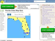
Florida Cities Map Quiz
In this online interactive geography worksheet, students examine a map of Florida and identify the 12 noted cities on the map using a pull down menu within 3 minutes.
Curated OER
Travel by Train: South American DVD Assignment
In this geography skills activity, students watch the National Geographic video "Travel by Train." Students then respond to 18 short answer questions about content in the video about South America.
Curated OER
Mapping Mistakes
Students examine early European maps and explore geographic errors. They also view maps of the geography of North America. Students discuss the obstacles faced by early explorers in mapping unexplored territory. They consider what the...
Curated OER
Maps that Teach
Young scholars study maps to locate the states and capital on the US map. Students locate continents, major world physical features and historical monuments. Young scholars locate the provinces and territories of Canada.
Curated OER
Landforms and Resources of the United States and Canada
For this North American geography worksheet, learners read about the physical features and resources of the United States and Canada. Students take notes and answer 3 short answer comprehension questions as they read the selection.
Curated OER
Seventh Grade Social Studies Quiz
For this Georgia social studies assessment worksheet, 7th graders respond to fifteen multiple choice questions based on seventh grade social studies skills.
Curated OER
Early Arkansas Geography
Seventh graders locate and describe historical Arkansas while using a historical map.
Curated OER
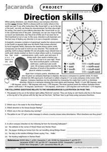
Direction Skills
In this geography worksheet, students read an excerpt on what directions tell someone. They respond to 6 short answer questions related to the neighborhood illustration found on the second page of the worksheet.
Curated OER
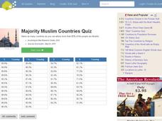
Majority Muslim Countries Quiz
In this online interactive geography quiz activity, students respond to 47 identification questions about Muslim cities. Students have 4 minutes to complete the quiz.
Curated OER
Africa 1500-present: The Big Picture
In this African history study guide worksheet, learners read a brief overview pertaining to the history of Africa from 1500 to the present.
Curated OER
Africa 1500-present: The Big Picture
In this African history study guide worksheet, students read a brief overview pertaining to the history of Africa from 1500 to the present and fill in the blanks with the appropriate words. Students also respond to 18 short answer...
Curated OER
History and Government of the United States
In this U.S. worksheet, learners take notes in a graphic organizer as they read several passages, then answer four comprehension questions.
Curated OER
Mapping the Past
Students study historical maps to view how the world evolved from medieval times through the Renaissance. They work in groups to examine the maps and present a report on one of the listed maps.


