Curated OER
Introduction to Symbols
Learners study the concept of picture symbols as a way to express ideas without using words. In this picture symbol instructional activity, students place symbols on a U.S. map according to meaning. Learners then review various...
Curated OER
Introduction to the Globe
Students investigate how to use a globe. In this map skills lesson, students define what a globe is and locate the various continents on the globe. Students are also asked to locate the four oceans on the globe.
Curated OER
Name That Continent
Students practice locating the seven continents, four hemispheres, and four oceans using a large world map and a review song. They also import a world map to the Kid Pix computer program then type in proper labels on the map. There are...
Curated OER
Where Do Canadians Live?
Students investigate Canadian people by researching the geography of the country. For this world geography lesson, students identify locations within Canada with large populations based on their access to waterways. Students...
Curated OER
Lesson Nine: Size and Scale
Students investigate scale as it is related to maps. In this map instructional activity, students read Jack and the Beanstalk by Carol North. Students then compare the setting in the story to a landscape picture map to help them study...
Curated OER
Where is Flat Stanley?
Students create a story map of the basic elements and significant events of the book Flat Stanley. Students brainstorm places they would like to visit if they had been flattened and then, write about an imagined experience. Students...
Curated OER
The First Thanksgiving: The Pilgrim’s Journey
Students discuss history. In this pilgrims lesson, students discover what life was like for people coming over to the New World on the Mayflower. They participate in class discussions as the teacher navigates through a Scholastic website...
Curated OER
Favorite Foods
Students explore human health by completing food choice worksheets. For this world hunger lesson, students discuss the importance of eating three daily meals and how to feed the underprivileged through charities and soup kitchens....
Curated OER
Discovering the World Virtually
Learners experience world adventures through the internet. In this technology lesson, students use a suggested internet site and explore each expedition. Learners can virtually travel such lands as China.
Curated OER
Minnesota-China Connections: Mental Maps
Students examine the concept of mental mapping. They draw a map of their school, before and after touring the space they draw. Then they draw mental maps of China and Minnesota, before and after seeing actual maps of the areas.
Curated OER
Geography of Our Environment
Students explore geographical elements. In this geographical elements lesson, students create a map showing the geographical elements in their area. Students take pictures of these elements to glue to their map and present it to the class.
Curated OER
Rulers For a Day
Students design and create foil coins with images that symbolize students' imaginary leadership in the ancient world. They model their coins on those made for Alexander the Great. They discuss what made him an important historical figure.
Curated OER
Equator, North Pole, and South Pole
Students identify the Equator, North Pole, and South Pole on the globe. In this map skills lesson, students use a globe marker to locate specific locations on the globe. Students find where they live in relation to the Equator.
Curated OER
Using the Four Main Directions in the Classroom
Students use the four main directions to locate features in the classroom. In this direction instructional activity, students review the 4 main directions using a world map. Students use a magnetic compass to locate the north wall in...
Curated OER
The Branding of America (And Your State)
Students investigate about the origins of some major U.S. brands. They explore local products that stimulate the economy. Students create a map showing where those products originate. Students discover the products that their local area...
Classics for Kids
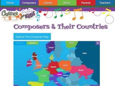
Composers and Their Countries
How many of the world's greatest composers were born in Austria? Or Germany? Or the United States? An interactive map provides young musicians with information about prominent composers in the last few centuries, as well as the periods...
Curated OER
French and Family
Where is France? Interest young learners in exploring France, French language, and French culture. They identify similarities and differences between French and American families, speak the French words for family members, analyze maps,...
Curated OER
Different Strokes For Different Folktales
Young readers use graphic organizers, such as Venn diagrams and story maps, to analyze a variety of folktales and the elements of a story. They use writing, sequencing activities, and creative art to identify the morals learned from a...
Indian Land Tenure Foundation
Respect for Land
Youngsters examine how people show respect and care for the land. Specifically, learners see how the Native Americans truly did care for and respect the land, and still do so to this day! They also explore how they themselves can care...
Curated OER
Molly Pitcher -- "Out of Many, One"
Young scholars research, brainstorm and analyze the events that lead up to the Revolutionary War. They critique a piece of artwork depicting a scene from the Revolutionary War. Each major battle is plotted on a map to show a visual...
Museum of Disability
Looking Out for Sarah
Perry the dog is Sarah's best friend and her guide to the visual world. Young readers learn about guide dogs and communication with Looking Out for Sarah by Glenna Lang, through a series of discussion questions and activities.
Edmentum
Roald Dahl Day
Who's your favorite Roald Dahl character? What book by Roald Dahl is the most exciting for you? Explore the wacky world of Matilda, The BFG, The Twits, The Witches, James and the Giant Peach, and more with a helpful resource pack for...
National Nanotechnology Infrastructure Network
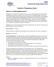
What’s In Your Neighborhood?
Chart your way to an understanding of nanoscale. Using a Google map, learners estimate a radius around their location of 1,000 and 1,000,000 meters. Predicting what 1,000,000,000 meters would look like takes them off the charts!...
Teaching Tolerance
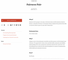
Fairness Fair
How can we create a more fair world? Chances are, class members have some ideas! After reading a text about fairness, individuals create skits around the ideas of fairness. Extend the learning and make their presentations a...
Other popular searches
- World War Ii Map
- World War I Map
- World War 2 Map
- World War I Outline Map
- World Climate Map
- World Biomes Map
- World Outline Map
- Blank Map of the World
- World Political Map
- Ancient World Greece Map
- World Time Zone Map
- Deciduous Forests Map World


