Curated OER
Title: Rivers as Borders
Students are introduced to the concept of borders. They read maps and identify rivers that separate different countries and states. They examine how or why a landform such as a river border might be the reason for different cultures.
Curated OER
Solving the Puzzle
Students create a map showing the United States borders at a specific period in history and produce three questions to be answered by examining the map. They also write a productive paragraph explaining who, what, when, where, how/why a...
Curated OER
Setting Boundaries
Students investigate the determination of the boundaries of various countries. They work in small groups to research a country's political history and past boundary issues and territorial disputes.
Curated OER
No magic borders
Middle schoolers discuss what they have heard about pollution. They explore the purposes and limitations of political boundaries and borders and identify some of the causes and effects of pollution.
Curated OER
A Wall for Peace?
Young scholars give examples that demonstrate how people are connected to each other and the environment. They idnetify current or historic conflicts and explain how those conflicts are or were influenced by geography. Students explore...
Curated OER
Hungary: The Landscape
Learners work in small groups to create a topographic map of Hungary. The map will include labeled line drawing of the bordering countries. Hungary should be three dimensional, made of salt and flour clay. The mountains, plains and...
Curated OER
Italy: The Landscape
Students work in small groups to create a topographic map of Italy. They must include labeled line drawings of bordering countries and bodies of water. Students use salt and flour clay to make Italy three dimensional, showing the many...
Curated OER
Malta: The Landscape
Students work in small groups to create a topographic map of Malta. They must include labeled line drawings of bordering countries and bodies of water. Students use salt and flour clay to make Malta three dimensional, showing the nearest...
Curated OER
The Big Circle
Students explore geography by participating in a mapping activity. In this concentric ring instructional activity, students utilize a poster board, string and markers to identify their current location within the entire world. Students...
Curated OER
Surveying the Land
Students explore the different kinds of maps and the purpose of each. In this Geography lesson, students work in small groups to create a map which includes the use of a map key.
Curated OER
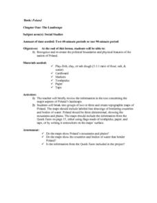
The Landscape of Poland
Students recognize and re-create the political boundaries and physical features of the nation of Poland. They create three dimensional topographic maps of Poland. In addition, they compose two journal entries written in two different...
Curated OER
Greece: The Landscape
Young scholars work in small groups to create a topographic map of Greece. They must include labeled line drawings of bordering countries and bodies of water. Students use salt and flour clay to make Greece three dimensional, showing the...
Curated OER
States with Attitude, Latitude and Longitude Dude
Sixth graders identify states whose boundaries are formed by lines of latitude and longitude or natural borders such as rivers. They trace a map of the U.S., and fill in borders, rivers and lines of latitude and longitude.
Curated OER
Papier Mache Globe
Students use newspapers and balloons to create a paper mache globe. They define areas of land and sea with geen and blue tempera paint, then define borders with markers.
Curated OER
Geography/Current Events Project
Using the Balkan region as an example, fourth graders review the five themes of geography as a class. They identify the physical and human characteristics of a region before labeling the countries and landforms on a map. They then...
Curated OER
Flamenco And Its Origins
Students discuss the role Islamic culture had on the development of Flamenco music in this General Music lesson for the middle-level classroom. Resource links are provided. The lesson emphasizes the creation of group posters.
Curated OER
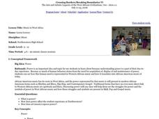
Music in West Africa
Students explore power and the symbols of power in West African music. They discuss the music of West Africa and compare it to African American music of today. In addition, they investigate musical instruments of Africa, identify the...
Curated OER
Power of Symbols in West African Art
Students examine and analyze symbols used in the Asante community of Ghana and look at the history of power struggles in West Africa. They discover how to express meaning and power as they create their own symbols and short stories...
Curated OER
Puck Meets Leonardo
Students create a puppet of Puck from the story read aloud. Then they identify how they can use the inventions of Leonardo da Vinci to help Puck complete his task. Students also observe the inventions of Leonardo from books and online...
Curated OER
Shakespeare and the Concepts of the Renaissance
Ninth graders familiarize themselves with the English Renaissance period and recognize the symbolism in Act V of "The Merchant of Venice" and analyze how it relates to the Italian Renaissance Themes. They produce an extended response...
Curated OER
Mapping South America
Students explore South America. In this South American lesson, students use their geography skills to create population, terrain, biomes/vegetation, and major exports maps. Students present their finished maps to their classmates and...
Curated OER
Treasure Hunt Region
Students are introduced to new geography related vocabulary words. In groups, they focus on a different region of the school and develop a new name for it. They create a treasure map for another group to use in the region of the school...
Curated OER
United Kingdom
Students investigate the geographical features of the United Kingdom. They create a clay, playdoh, or salt and flour map of the region. The maps should be labeled with landmarks and bodies of water. They can also draw maps on paper for...


