Curated OER
Maps and the Pictures in Our Heads
Geographers of all ages examine different types of maps. They draw maps of their environment, utilizing both three-dimensional and picture maps. They interpret map information, noting how it can sometimes be misleading. Some good...
Curated OER
Where Am I: How to Read a Map
Third graders develop an understanding of maps. They explore what a map is, who uses maps, and how to use maps. Students investigate the compas rose. They create a compose rose which illustrates the cardinal directions. Students practice...
Curated OER
Map Projections: The Grapefruit Activity
Students partcipate in activities in which they examine different map projections. They discover the positives and negatives of each type. They use grapefruits to help them with the different types of map projections.
Curated OER
Create A Map!
Students examine two- and three-dimensional shapes, and discuss map skills and attributes. They plan and create their own school campus maps using pre-cut building site shapes.
Curated OER
Solving the Puzzle
Students create a map showing the United States borders at a specific period in history and produce three questions to be answered by examining the map. They also write a productive paragraph explaining who, what, when, where, how/why a...
Curated OER
Mapmaking
Students examine the craft of cartography and how the Lewis and Clark expedition created and used maps. They analyze maps, read a handout, create a map, participate in a mini expedition and map out a route based on travel directions,...
Curated OER
Creating a Map
Third graders examine the process of creating an accurate map, and create a map of their playground. They identify what objects are on their playground, and discuss what is found on a map. Students then draw a map of their playground...
Curated OER
What Color is the Ocean?
Young scholars view satellite pictures of the ocean, and discuss the presence of phytoplankton and the colors of the ocean. Students compare/contrast ocean satellite images with maps and globes, then color world maps to replicate the...
Curated OER
Exploring the World's Geography
Students discuss the seven continents of Earth and the diverse geography. After discussion, they create their own paper-mache globes which properly display all seven continents, the equator, and the prime meridian. They conduct research...
Curated OER
Our Class Is On the Map
Second graders review map keys, symbols, and the purpose of maps, then students design a poster size map of their classroom.
Curated OER
Geography and Culture in South Carolina
Young scholars explore South Carolina. In this cultural heritage instructional activity, students investigate the topography of South Carolina using maps. Young scholars are engaged in identifying the different regions of the state and...
Curated OER
Water
Students complete activities to examine the properties of water. In this water science lesson, students read a book about water's forms and study a map or globe of the Earth to investigate water. Students discuss living things that need...
Curated OER
A Contouring We Go
Students examine the built environment and infrastructures of their community by constructing contour equipment, using the equipment, and comparing their results to current topographical maps of the same area
Curated OER
Where Should We Put a Store?
Students analyze population data. They convert population data into simple density maps to help make decisions about their world. They select the best location for a school store based on population density. They present their maps...
Curated OER
Maps
First graders look at their classroom or school setting. They use positional word to describe where things are located in the school. Students discuss a map and why they are important. They read the story "Taylor's New School" and...
Curated OER
Making a Globe
Students examine the mercator projection or nautical chart and observe how global maps do not have the same distance as flat maps. They design handmade globes using the meridians and equator as guides to draw in the land. They paint and...
Curated OER
The Clever Monkey Rides Again
Students read and explore a West African folktale. In this folktale lesson, students read the book The Clever Monkey Rides Again and examine West African proverbs. There are several related multi-subject extensions on this lesson which...
Curated OER
Interactive Atlas
Second graders examine the different ways people move from place to place in a neighborhood. Using the interactive online atlas MapQuest, they identify the various ways people move around their own neighborhood by creating a map and...
Curated OER
Build the Tallest Building
Young scholars examine the design and construction of skyscrapers. They use the internet to research information about different types of skyscrapers. They create their own building and defend it to the class.
Curated OER
Aboriginal Peoples And The Universals of Culture
Sixth graders research specific features of a province or territory of Canada. In this Canadian history lesson, 6th graders identify aboriginal culture areas on a map, identify cultural features represented in their region, and...
Curated OER
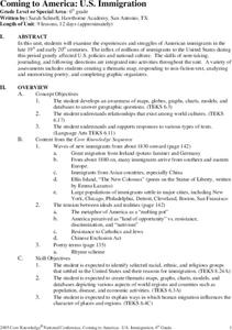
Coming to America: U.S. Immigration
Students study immigration in the late 19th and early 20th century. In this immigration lesson plan, students participate in activities including creating maps, responding to non fiction text, memorizing and analyzing poetry, and...
Curated OER
Empire State-Building
Students explore how empires around the globe have impacted the world in which they have existed. They analyze whether or not the United States is an imperialist nation and create their own empires based on their understanding of empires...
Curated OER
Once Upon A Time...
Students discuss elements of fairy tales, examine selected piece of Robert Harris' art, and compose fairy tales based on what they see and imagine. Students then view homes in Harris' artwork collection, create home in which they would...
Curated OER
Earthquakes: Getting Ready For The Big One
Students devise a plan to prepare a city for an earthquake. For this lesson on earthquakes, students differentiate between the different types of earthquakes, examine the impact they can have on a city, and write a proposal on how to...


