Curated OER
Solving the Puzzle
Students create a map showing the United States borders at a specific period in history and produce three questions to be answered by examining the map. They also write a productive paragraph explaining who, what, when, where, how/why a...
Curated OER
Four Famous Faces
Each one of our quarters is embellished with a famous face or image representing the state it came from. This lesson uses South Dakota's state quarter to get kids thinking about monetary value, what the president of the United States...
Curated OER
By George, I Think We Have It: Bicentennial quarter reverse
Voting is one of the major reasons the US adopted public education. Educate your class populace, they will analyze the images on a bicentennial quarter and think about the contributions George Washington made to the United States. They...
Curated OER
States/capitals
Students identify the geographic locations of each state of the United States. Working cooperatively, they put togehter a giant puzzle of the United States using their individual pieces.
Curated OER
Maps
Maps, globes, and computer software aid young explorers as they locate state capitols, major cities, geographic features, and attractions for states they are researching. They then use desktop publishing software to create a map to share...
Curated OER
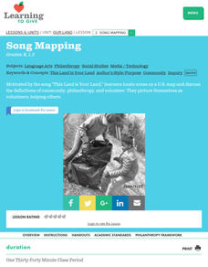
Our Land Lesson 2: Song Mapping
Young scholars study the meaning of philanthropy as giving of time. talent, and treasures. They sing This Land Is Your Land while locating five of the places on a map of the United States showing that relief office are everywhere. They...
Curated OER
U.S. Puzzle Map Bulletin Board
Students create cutouts of each state. They research different states noting their similarities and differences. They describe each state's location in relation to the state's surrounding them.
Curated OER
North Carolina Salt Dough Map Social Studies Project
In this lesson plan, North Carolina Salt Dough Map, 4th graders create a salt dough map of North Carolina, Students use dough to form the shape of the state of North Carolina. Students label the three regions of North Carolina and all...
Curated OER
Boundaries and People
Students map watersheds to find their boundaries. In this watershed activity students map and then give their "watershed address." Students show the trail from stream, larger stream to oceans. Students describe the boundaries of the...
Curated OER
Rockin' Round New York State
Students discuss their favorite rock groups and bands. They create rock groups that will be touring New York State. Students research cities in New York, determine dates of concerts, create touring itineraries, and develop Inspiration...
Curated OER
Let the Music Play: Bicentennial quarter reverse
To better understand who George Washington was and why we celebrated the bicentennial, pupils read a story and complete a worksheet. They sing and talk about the song, "Yankee Doodle Dandy" as they march around the room.
Curated OER
Mapping School Grounds
Young scholars map and analyze the natural and cultural environment of the school grounds. In small groups, they sketch the natural and cultural features of each side of the school building, create a map, participate in a class...
Curated OER
Arkansas History Lesson Plan: Identifying Arkansas on a Map
Students investigate their hometown of Arkansas. In this U.S. Geography lesson, students identify Arkansas on a map and distinguish it form the other states. Students investigate the history, state line, and personal experiences that...
Curated OER
I Can Find that Where? - A Study of Landforms
First graders make landform maps of the United States. In this landform lessons, 1st graders participate in a discussion of local landforms and make a landform map of the United States. They follow the teacher's directions to add plains,...
Curated OER
The Southeast Region
Students write a song about the southeast region. In this southeast region lesson plan, students view pictures of landforms, hear music, look at maps of states, and more.
Curated OER
Edible Resource Maps
Third graders work in groups to create an edible resource map showing locations of at least five resources in the United States. Students research on the internet different regions and the resources that are found in those areas. They...
Curated OER
The Greatest Educational Change America Has Ever Seen
Young scholars connect the symbols from the design of the United States Mint Fifty State Quarters Program to our country's history in this five-lesson plan unit. The culture, unique heritage, and geography of the individual states are...
Curated OER
Technologies of the Civil War
Fifth graders discover new and interesting technologies of the Civil War. In this Civil War portfolio of lessons, 5th graders analyze primary resources, develop new vocabulary, investigate websites, and create a time line of new...
Curated OER
The Countries of Slave Trade
Young scholars create graphs, routes, and write an essay based on their research of the slave trade. In this slave trade lesson plan, students research the Middle Passage and how slave trade happened in the United States.
Curated OER
States with Attitude, Latitude and Longitude Dude
Sixth graders identify states whose boundaries are formed by lines of latitude and longitude or natural borders such as rivers. They trace a map of the U.S., and fill in borders, rivers and lines of latitude and longitude.
Curated OER
Popcorn Geography
Students use kernels to create a "Top Corn-Producing States" map or graph. They read and round off numbers. Students identify on a U.S. outline map the location of corn-growing states. They create a visual (map or graph) illustration...
Curated OER
Geomnemonics: Facilitating the Teaching of Social Studies Content with Geography Skills
Students explore how to draw a world map by hand and how to locate countries.
Curated OER
Unite These States
Students explore the historical events and people associated with the 13 colonies. The geographic locations of the 13 colonies and ultimately, of all 50 states are investigated.
Curated OER
Forms of Government Project
From the United Kingdom's constitutional monarchy to the dictatorship of North Korea, this is a very simple project that will help your class members gain a better understanding of different forms of government that exist around the...


