Curated OER
Mapping Roxaboxen
Fourth graders read Roxaboxen and draw a map of the Roxaboxen community. In this language arts and geography lesson, 4th graders use specifications given, adding features to the map as described in the book and creating a legend.
NOAA
Into the Deep
Take young scientists into the depths of the world's ocean with the second instructional activity of this three-part earth science series. After first drawing pictures representing how they imagine the bottom of the ocean to appear,...
Curated OER
Storm Clouds-- Fly over a Late Winter Storm onboard a NASA Earth Observing Satellite
Students study cloud data and weather maps to explore cloud activity. In this cloud data lesson students locate latitude and longitude coordinates and determine cloud cover percentages.
Curated OER
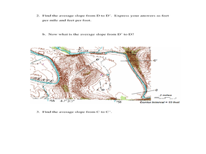
Slope and Topographic Maps
Students investigate slopes as they study topographic maps. In this algebra lesson, students discuss and apply the concept of slopes to graphing and analyzing data.
Curated OER
Where We Live
Learners forecast future population growth of the U.S. Virgin Islands. In this U.S. Census lesson plan, students explain the factors that influence population density on the U.S. Virgin Islands, including geography and economic activity.
Curated OER
Sunderland: Discovering Cities
Scholars investigate a local city (Sunderland) by participating in a discussion. They explore the different elements of the UK city by identifying the industrial and economic aspects. They also read an interview of two people speaking...
Curated OER
Meet You at the Midden: Map Game
Fourth graders use a sketch map to interpret map symbols in order to participate in a game. Using the game cards, they identify reasons why people modify their environment to meet their needs. They compare and contrast how people lived...
Curated OER
Reading Maps Critically
Young scholars discover that maps represent different values of the cultures who make them. Using the internet, they research the role of a cartographer and how their culture affects them. In groups, they are given examples of maps in...
Curated OER
Moving West with the Forts: Using an Interactive Map
Seventh graders practice reading maps and locating the forts stationed in Texas. Using the internet, they analyze westward movements from statehood to the Civil War. In groups, they complete a worksheet about the forts and share their...
Teach Engineering
Incoming Asteroid! What's the Problem?
Oh, no! An asteroid is on a collision course with Earth!. Class members must rise to the challenge of designing a shelter that will protect people from the impact and permit them to live in this shelter for one year. In this first lesson...
Curated OER
Dos mapas de Florida, el Caribe y parte de Sur America
What can maps tell us about the past? Find out with a Spanish lesson that incorporates geography. After examining maps individually, comparing two old maps of Spanish Florida and writing notes in the provided Venn diagram, pupils pair up...
NET Foundation for Television
1850-1874 The Kansas-Nebraska Act
How the Kansas-Nebraska Act created Bleeding Kansas is complicated—until scholars research and examine documents from the time. After completing activities that include mapping, photo, document analysis, and discussion, learners...
PHET
Earth’s Magnetic Field from Space
Feel the pull of science! The final installment of this 18-part series is an application of everything learned in the previous high school lessons. Scholars are given a magnetic field map and must propose an arrangement of magnets that...
George Watts Montessori
Upper Elementary Lessons for Classroom and Garden
Plant knowledge by doing to create long-lasting results. Creating a school garden gives young scholars the opportunity to study several science topics. By working through the unit of 16 lessons, pupils use their gardens to complete...
The New York Times
Kiev in Chaos: Teaching About the Crisis in Ukraine
Provide a historical context for the political unrest between Russia and Ukraine that began in late 2013. Learners review their prior knowledge and chronicle new understandings with a KWL chart, watch a video explaining the Ukrainian...
Curated OER
Mapping and Topgraphy- 8th Grade
Eighth graders practice interpreting a contour map as well as reading latitude and longitude in a team activity. Following a discussion on mapping terms, teams are given maps and estimate the distance between two points. Students...
Curated OER
Capitals, Oceans, And Border States
Students investigate geography by completing games with classmates. In this United States of America lesson, students examine a map of North America and identify the borders of Mexico and Canada as well as the Pacific and Atlantic....
Curated OER
Reading a Local and National Weather Map
Students practice reading a national and local weather map. Using this information, they work together to make predictions about the weather for the next few days. They discuss the use of symbols and maps as a class and discuss how...
Curated OER
From Hypothesis to Conclusion...Reading Maps to Understand Proofs
Tenth graders explore the concept of proof. In this proof lesson, 10th graders work in groups to collectively write proofs for directions to places on a map. Students give directions to specific places in big cities such as from the New...
Curated OER
Map It Out
Explore how illustrations add to a story. Young learners will look at picture books to see how the pictures tell the story. They create illustrations to go with a chosen story, and then flip the activity so they have to write a story to...
Curated OER
Arthur's Tooth
Students practice their reading comprehension by reading a story in their class. In this story map instructional activity, students read the Marc Brown book Arthur's Tooth and discuss the story, characters and setting. Students create a...
Curated OER
Lesson Ten: Direction
Students explore the concept of relative location. In this map lesson, students read I Hate English by Ellen Levine and consider how maps and globes help people to familiarize themselves with an area.
Curated OER
Changing Images of Childhood in America: Colonial, Federal and Modern England
Students compare and contrast maps of New Haven, Connecticut from today and the past. After taking a field trip, they draw sketches of the types of architecture and discuss how the buildings have changed over time. They read journal...
Curated OER
Watershed Investigations
Students explore the components of a watershed and the factors that affect it. They read a topographical map and use geometry to determine the area of a watershed. Students estimate the volume of a body of water and perform runoff...


