Curated OER
Mapping the Aegean Seafloor
Earth science learners create a two-dimensional topographic map of the floor of the Aegean Sea. They use it to then create a three-dimensional model of the ocean floor features. This comprehensive resource delivers strong background...
Curated OER
Ocean Floor Model
Young scholars construct a simulated model of the ocean floor in a shoe box. They determine that the floor of the ocean is composed of hills, plains, ridges, trenches, and sea mounts. They draw out a plan for their ocean floor which...
Curated OER
Ping!
Using "mystery bathymetry" shoeboxes, young explorers simulate sonar action to map out the topography of an un-viewable landscape. This classic activity helps physical oceanography learners understand how sonar works. It would be...
Alabama Learning Exchange (ALEX)
Sonar Mapping of the Ocean Floor
Eighth graders participate in an experiment that emulates a sonar signal bouncing off the ocean floor. They determine how the ocean floor is measured by the length of time it takes for the sonar signal to return. They work with a wooden...
Curated OER
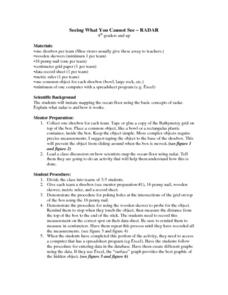
Seeing What You Cannot See--RADAR
Student imitate mapping the ocean floor using the basic concepts of radar. Then they explain what radar is and how it workds. All of their measurements are recorded on a data sheet. Then the data is entered into a spreadsheet program. A...
Polar Trec
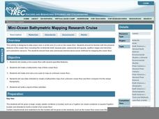
Mini-Ocean Bathymetric Mapping Research Cruise
Middle or high schoolers transform into oceanographers in a week-long simulation. To begin, each group follows directions to create a model of the ocean floor with specified features. Next, the groups prepare to set sail on a research...
Curated OER
Mapping The Ocean Floor
Young scholars explore and analyze the bottom structure of underwater habitats. They describe and explain what can't see through the collection and correlation of accurate data. Learners assess that technology is utilized as a tool for...
NOAA
Into the Deep
Take young scientists into the depths of the world's ocean with the second instructional activity of this three-part earth science series. After first drawing pictures representing how they imagine the bottom of the ocean to appear,...
Curated OER
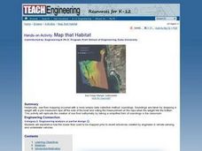
Map that Habitat
Students participate in an activity that replicates the creation of sea floor bathymetry by taking a simplified form of soundings in the classroom. They discuss sea floor mapping technologies, sonar, soundings, and remote sensing,...
Curated OER
Mid-Ocean Magnetism
Students investigate magnetic evidence that supports the theory of sea floor spreading.
Curated OER
Mapping the Canyon
High schoolers compare and contrast topographic maps and bathymetric maps. They investigate how bathymetric maps are made and how to interpret one.
Curated OER
Coral Bleaching in the Caribbean
Students practice analyzing images, maps and graphs from Internet-based educational resources. They explore the correlation between sea surface temperature and coral bleaching. Students comprehend that coral reefs are collections of tiny...
Curated OER
Seeing Sound & Sonar
Students make inferences based on different sounds that they hear. For this inferences lesson plan, students will hear sounds of different objects and describe the sounds based on what they hear. They will answer various questions about...
Curated OER
Mapping the Ocean Floor
Students study the bottom structure of underwater habitats and how they can be mapped.
Curated OER
Bathymetric Mapping
Young scholars draw contour lines based on NOAA soundings on a nautical chart. They color the contours and glue label tags for topographic features. They determine that the floor of the ocean is composed of hills, plains, ridges,...
Curated OER
Ocean Floor
Students identify ocean floor features. In this earth science lesson, students predict the object inside a close box to make them realize the difficulties scientists faced then. They label the different zones of the ocean floor after the...
Curated OER
Mapping the Blue Part
Eighth graders determine the location of specific features of the stimulated ocean floor. The features include the continental shelf, continental slope, an ocean trench, and a mid-oceaniz ridge.
Curated OER
Trade in the Indian Ocean: Should China End Zheng He's Treasure Voyages?
Students examine the amount of trade that occurs in the Indian Ocean. Using China as an example, they discuss the reasons why it ended its treasure voyages in the area and predict what would have happened if the voyages continued. They...
Curated OER
Sonar Mapping
Students use a shoe box to create a seafloor model and use cardboard for layering inside of the shoe box to simulate the ocean floor. They probe the ocean floor to simulate sonar echoes. Finally, students graph their data to get a...
NOAA
Sediments
Calcareous ooze ... what an interesting name! The 15th installment of a 23-part NOAA Enrichment in Marine sciences and Oceanography (NEMO) program focuses on sediments found on the ocean floor. After viewing the slideshow lecture,...
Curated OER
Oceanography
Fifth graders study the topography of the ocean floor. They determine its ever changing nature as they examine currents and trade winds. They write paragraph describing how the winds might affect land formations after the discussion of...
Curated OER
The Rocks Under Illinois
The goal of this fine geology lesson is to have learners create a map that shows how the rock layers are arranged far underground where they can't be seen. The ambitious lesson plan requires high schoolers to learn the law of...
Curated OER
Oceanography
Fourth graders define new vocabulary associated with oceanography. They locate and label the four oceans. They also identify features of the ocean floor.
Curated OER
Continents and Oceans on the Move
Students create an awareness of the vast percentage of water covering the earth. They relate similarities/differences between topographical maps and other maps of various time periods. Students examine how to use a topographical map.


