Curated OER
Math with Maps and Globes
Young scholars round out their math skills with these ‘round the world' ideas. In this math and geography lesson, students try out time zone sticks, a polar race, and tic-tac-globe to engage them in learning more about globes and the...
Curated OER
Globe Skills Lesson 3 Voyage to the New World
Students explore the globe. In this globe skills lesson, students use their knowledge of latitude and longitude to respond to questions regarding Christopher Columbus's maiden voyage to the Americas.
Curated OER
Globe Skills Lesson 10 Apollo 11
Students develop their globe skills. For this geography skills lesson, students use a globe and a softball to replicate distance between the earth and its moon.
Curated OER
Through the Forest and Home Again: Maps Help Us Find Our Ways
Students read Little Red Riding Hood, focusing on her path home to Grandma's house. In this language arts and geography lesson, students perform a reader's theater, re-creating the walk home and possible routes that could have been...
Curated OER
The Crash Scene
Fifth graders explore geography by participating in a mapping activity. In this engineering instructional activity, 5th graders identify the differences between latitude and longitude and practice locating precise points on a globe or...
California Academy of Science
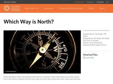
Which Way is North?
Who needs a compass to find cardinal directions? Just place a stick in the ground and record the movement of its shadow over the course of a day. Then, measure the shadow lengths in order to determine a north-south line. A simple...
Curated OER
Lesson Ten: Direction
Students explore the concept of relative location. In this map lesson, students read I Hate English by Ellen Levine and consider how maps and globes help people to familiarize themselves with an area.
Curated OER
Flat Earth Society
Students explore map distortion. In this geography lesson, students compare Mercator projection maps to globes in order to understand the strengths and weaknesses of projection maps.
University of California
Migration of Early Humans: Evidence and Interpretations
While much of prehistory is cloaked in mystery, ancient ancestors left evidence in DNA, languages, and materials from their time. Using photographs of items such as cave paintings and ancient tools, as well as maps of linguistic patterns...
Curated OER
Exploring an Atlas
Learners explore global geography by participating in an atlas activity. In this countries of the world instructional activity, students collaborate in small groups and analyze an atlas while researching continents, countries and...
Curated OER
Geography Puzzles
Learners study the continents of the world. In this Internet geography lesson, students connect to online mapping games. Learners collaborate in order to develop their understanding of world geography, including countries and capital...
Curated OER
Storm Clouds-- Fly over a Late Winter Storm onboard a NASA Earth Observing Satellite
Students study cloud data and weather maps to explore cloud activity. In this cloud data lesson plan students locate latitude and longitude coordinates and determine cloud cover percentages.
It's About Time
Taking a Ride on a Lithospheric Plate
Assist your pupils and broaden their horizons with several activities that determine the exact positioning of various communities over the globe. Pupils use data from the Global Positioning System to determine the position and rate of...
Curated OER
The Solstices
Compare surface temperatures when the solstice occurs in the different hemispheres. Young scientists draw conclusions from their investigation of data collected using spreadsheets and a globe.
Curated OER
GPS Sports Field Activity
Students practice using GPS receivers and explore how knowing the coordinates of two locations allows them to determine the distance between those two points. They use the theory that they already had knowledge of and apply it to a...
Curated OER
The Global Grapefruit - Representing a 3-Dimensional Globe on a 2-Dimensional Map
Students compare and contrast world maps and globes. They convert a 3-dimensional globe to a 2-dimensional map. They are introduced to the Mercator map projection. They observe map distortions of shape, area, distance, directions and angle.
Curated OER
Fractile vs. Equal
Students compare and contrast methods of categorizing data. In this data collection lesson, students complete worksheet activities that require them to note the differences between equal and fractile intervals. Students also discuss...
Curated OER
Water
Students complete activities to examine the properties of water. In this water science lesson, students read a book about water's forms and study a map or globe of the Earth to investigate water. Students discuss living things that need...
Curated OER
Thematic Unit on Cats
Students discover in which climates the cats of the world live in. They review the different climates of the world and use maps and globes to help them locate continents.
Curated OER
Fish Around the World
Students use a globe to answer questions such as which continent they live in and the country in which they live. They identify at least two bodies of water near their state and two foreign countries. In groups, they complete a...
It's About Time
Effects of Plate Tectonics
Explore our world from within as you lead young scientists on a thrilling adventure. Pupils examine the location of plate boundaries to determine earthquake and volcano distribution around the globe and explore the cause of hot spots in...
Curated OER
Build a Model Watershed
Collaborative earth science groups create a working model of a watershed. Once it has been developed, you come along and introduce a change in land use, impacting the quality of water throughout their watershed. Model making is an...
Curated OER
Where is Shirley the Elephant?
Young animal lovers engage in a lesson that's all about elephants. They access an elephant sanctuary website and read a story about Shirley the elephant. They perform a series of activities based upon that story, and also study about the...
Curated OER
SpellO': An Orienteering Lesson
Students participate in hands-on activities to practice orienting maps. Given activity cards, students accurately read maps and locate specific stations. Students collect information from the maps to spell a message when the activity...


